Inverted North Korea
Wednesday, 20th July 2005 by Alex Turnbull
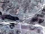
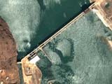
Check out this weird section of image that woowoowoo found in North Korea. He said:
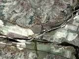
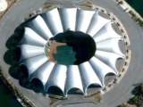
Somehow a whole chunk of data has inverted colours - taken into Photoshop and inverted, it looks much more correct.
In our first thumbnail you can see a section of the image as it appears on Google Maps, and our second image is the exact same image after the colours were inverted in Photoshop.
About the author
Alex has decided that his title will be Senior Vice President of Stuff.
I don’t think it’s inverted. Satellite cameras (or, say, mars rover cameras) don’t always use visible light; they often take pictures of non-visible spectra (for example, infrared, to see heat patterns), which are then mapped to visible colors so humans can view the non-visible spectra imagery.
Note that even after inverting the image, the colors don’t really quite line up with the presumably non-inverted imagery surrounding the “inverted” patch — the farms are much brighter. Inverting it just somehow makes it look somewhat more natural-looking to some people.
In the section in question, note that the rocky areas have much more color variation than in the other sections. My guess is that this image was looking for mineral deposits.
I suggested a link for a section of Korea a couple days ago. (Hasn’t shown up yet, but I’ll give it time.) If you zoom out and look to the south, you can see one section shows up at full detail, and in the south-eastern corner of this section, if you zoom in all the way, you’ll see a portion of the wall seperating North and South Korea. Not quite the Killing Fields, but close. Hard to tell without the map-detail, though.
Must be all the evil throwing the equipment off.
“I’m roanry … so roanry …”
I concede – not long after posting this suggestion, I realised that the shadows of buildings in the image were darker than surroundings, so it’s not inverted. On the other hand, it’s seriously screwed up.
I do think it’s visible light, but I suspect part of the image data has gone missing. If you take the image into photoshop, convert it to LAB colour and start mucking about with the ‘b’ channel, you see the image really start to take shape.
LAB colour is the most efficient for jpeg compression and the a and b channels get the stuffing knocked out of them in heavy compression, so I reckon a missing or corrupted b channel is the most likely suspect.
There’s a lot of this going on in Asia in general, some parts of the coast of China are also “inverted”, with blue fields and the like.
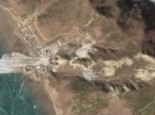
I have browsed a bit on North Korea and come up on an airfield. Does anyone know what type of (presumably old) planes those guys flight? View Placemark
it seems to be shot taken in winter.
Taken in winter and appears to be ice. At the right angle you can sort of see clouds reflected in the ice. This is probably the same as other places that have shots of water where things are reflected back to the camera.
BenQ: Not sure what kind of planes those are, but it must be training day. One of those two planes on the runway can’t seem to steer properly…
yay for Omar and Mike Parker.
Uh, the Killing Fields were in Cambodia. You mean the Demilitarized Zone.
Same inverted colors here : View Placemark,.404434&t=k&hl=en
Damn, I knew somebody would call me out on that Killing Fields reference. Anyhow, I’m pretty sure that’s the wall there. Mine fields are what I was thinking of, though I don’t know if you could identify a mine field from this distance.
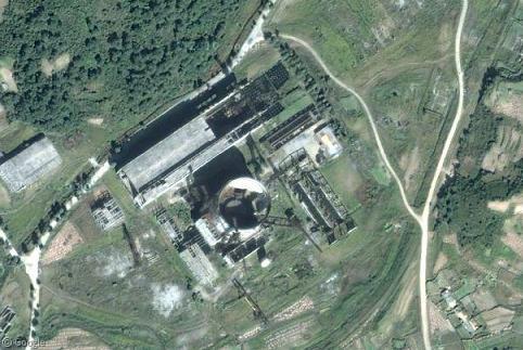
Since the North Korean Nuclear Facilities of Yongbyon are really nearby, I suppose the area is just completely polluted with plutonium and the images show nothing but the natural colors that should be expected under such conditions 😉