The Arrow Lakes
Tuesday, 2nd November 2010 by Kyle Kusch
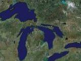
Originally two separate lakes, Upper Arrow Lake and Lower Arrow Lake were joined together in 1968 as part of a programme of construction that has seen 14 dams built on the Columbia River since 1937, converting almost the entire 2,000 km river into a set of reservoirs. There are another 62 dams on its various tributaries throughout the Pacific Northwest, ensuring that no river produces more electricity in North America than the Columbia.
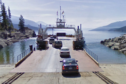
We start our journey down the Arrow Lakes by joining the Street View car as it boards the Upper Arrow Lake ferry at Shelter Bay.
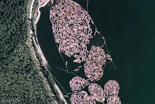
Just to the south of Shelter Bay, we can observe a huge log boom, a common site on lakes and rivers in forest-laden British Columbia.
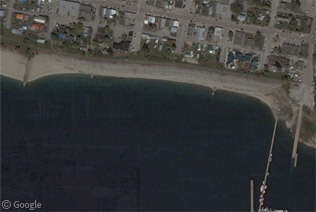
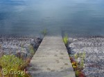
At the south end of Upper Arrow Lake is the bucolic village of Nakusp. Most know it for its hot springs and Japanese garden1, but it also lays claim to a unique concrete-encased waterfront designed to prevent erosion from the lake below, replete with stairs taking you right into the lake (don’t worry, vacationers; there’s a very sandy public beach to the west).
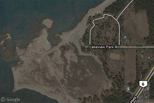
When the Arrow Lakes were converted into a massive reservoir in 1968, many small villages were flooded, and 2,000 residents were evicted. At low water during winter and spring, remnants of the former towns can still be seen. The village of Burton was relocated 1 km to the east, but the partially-flooded highway bed leading into the old townsite is visible just to the west of Lakeview Park Road.
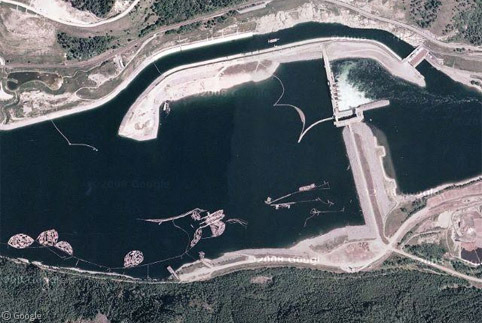
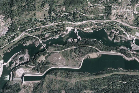
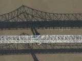
It was the Hugh Keenleyside Dam west of Castlegar which raised the level of the lakes. From above the dam, we can see the spillway, a small navigation lock in the middle of the dam, and more of those ubiquitous log booms.
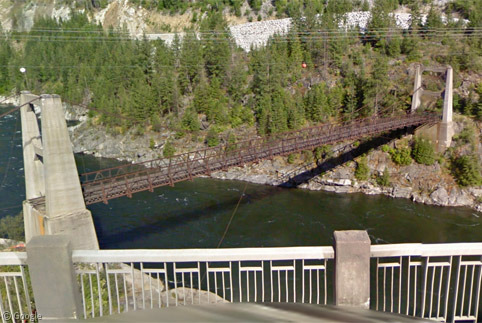
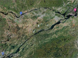
At Castlegar, the Kootenay River joins up with the Columbia to head off across the international boundary into Washington state. Our tour turns east up the Kootenay past the Brilliant Suspension Bridge National Historic Site. The bridge was built in 1913 for no pay by forty members of the local Doukhobor community. The Doukhobors were a group of 8,000 who emigrated from Russia to flee persecution for their communalist/pacifist lifestyle. Their descendants make up a large percentage of the local population to this day, and Russian remains a secondary language of instruction in schools. Right next to the bridge is the Brilliant Dam.
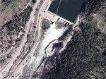
Twenty kilometres past Brilliant lies a complex of five dams in a 4.5km stretch. To the south of the river, the 15 metre deep Kootenay Canal was completed was completed in 1975. From the Street View camera, we can get a pretty good view of the Upper Bonnington Dam and its historic powerhouse, built in 1907 to provide electricity for the city of Nelson just to the east.
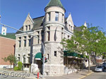
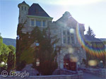
We end our trip through the West Kootenay in NOS73N… er, Nelson, which is home to over 350 designated Victorian-era heritage buildings. Unfortunately, the Street View car decided not to venture into the heart of the city, but it still provides us with a glimpse of two of Nelson’s most famous buildings: the old post office/customs house (now home to the city’s museum), and the imposing city hall.
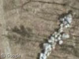
Of course, being in British Columbia, we can’t go without a sighting of the elusive pink Sasquatch:

-
Dedicated to Japanese-Canadian residents of the area forced into internment camps during World War II. ↩︎
About the author
Kyle is a jack-of-all-trades geographer and archivist in rural British Columbia and was formerly the proprietor of humble geography blog The Basement Geographer. He enjoys a good game of hockey and a good 30-km walk with a frozen beverage in hand.
Over 100 years ago, one of the main modes of transportation in this area were the paddlewheelers that travelled the Arrow and Kootenay lakes, although they were unable to travel up the Kootenay River to Nelson.
Here is an old picture of the SS Bonnington somewhere on the Arrow Lakes: http://www.crowsnest.bc.ca/a_00816.html and three paddlewheelers, including the Bonnington, at Nakusp in winter: http://www.crowsnest.bc.ca/a_00679.html
One of the greatest tragedies of building the High Arrow Dam (later renamed to Hugh Keenleyside dam after a politician) was the destruction of the last remaining paddlewheeler on the Arrow Lakes, the SS Minto: http://www.alhs-archives.com/articles/ssminto.html The picture of this great historical treasure burning in the middle of the Arrow Lakes is incredibly sad.
At least it’s sister ship, the SS Moyie, has been preserved in Kaslo on the Kootenay Lake: http://www.klhs.bc.ca/
Indeed, pooms; it is rather quite the tragedy (speaking as a Nakuspian, the destruction of the Minto is something we all lament). One of the last surviving vestiges of the SS Minto is the ship’s steam whistle , which is preserved at the Nakusp Visitor Centre and still blown every day at noon in summer (the paddlewheel below is from the SS Revelstoke).
The twin sister ship of the SS Bonnington, the SS Sicamous, is preserved at Penticton on Okanagan Lake. The Street View camera has a very good view of it here.
The top decks of the SS Nasookin were made into a house, just outside Nelson: View Placemark,,1,-8.63
Here is a writeup on the house: http://www.dougpyperphoto.com/gallery/pdf/Cottage_Magazine_Ship_To_Shore_2005.pdf
We used to go past this house all the time on the way to visit my grandparents, but I’ve never been inside.