Planes In Flight Mega-Post
Wednesday, 13th April 2005 by Alex Turnbull
Well it's my own fault really. Since I posted that I hadn't seen any planes in flight, we have been absolutely inundated with submissions proving that I was completely wrong. Glad to hear it, 'cos some of these are really cool.
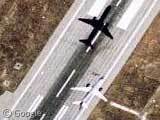
- Ryan (Cool shadow - look about 4 plane widths west)
- nowak (Can you find the shadow? I think its all the way over here)
- Arvo Huru (Anyone know what kind of plane that is?)
- Eric Thelin
- Brian Lalor
- Miker
- Chris (Pink plane. You sure its not parked though? I can't see a shadow anywhere!)
- Matt (From the comments - Three at once! Very cool but is it really three planes, or just one?)
- Geoff Sulcer (Tiny little one)
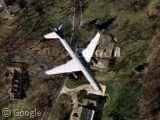
- Jason (This is the one in our first picture)
- Colin (This one is huge! Or perhaps just very high up...)
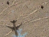
- Tobic (Another three planes?! One just off the top and another just off the bottom)
- Kent (Kent says this is a U2 spyplane!)
- josh k (Quite a few of the planes have this weird blue 'ghost' in addition to their shadows, perhaps its due to their speed...)
- caknuck (...or perhaps its a reflection?)
- Arvo Huru (Now that's fast!)
- Stilt (Apparently this is over Graceland)
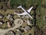
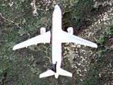
- Rod Levin (This is the one in our second picture)
- Tom (This is cool, its a razor sharp image. Can't find the shadow though.)
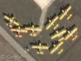
- DDA (And finally... toy-town planes!)
Couple of extra plane related ones, first from punk floyd, who says that this is a SR-71 Blackbird Reconnaissance plane parked on Beale AFB, and also from Allen Ormond, who fittingly points us towards the Wright Brothers National Memorial in Kitty Hawk, North Carolina. This is where the Wright Brothers made the first powered airplane flight.
Many thanks to everyone who submitted links but didn't get a mention, there were just far too many of you!
Anybody notice this tiny plane in the Suisun Bay Reserve Fleet post? View Placemark
I doubt the pink plane is parked… it’s in the middle of a grassy field! No airport near by, either. Possible that it’s some kind of statue or monument or something, but I doubt it.
As for the ghosting, I doubt that has anything to do with the speed… if it was caused by movement of the plane, then the ghost would likely be ahead or behind in the plane’s path… not off to the side. My money’s on some kind of parallax error (the satellite camera’s having focused on ground level, with the planes so high up above it).
And it can’t possibly be a reflection. Water’s surface is too turbulent (waves) to reflect such a good image like that. Also, do you really think the desert would reflect a blue image like that? Doesn’t make any sense.
I don’t think it can be explained away by any simple optics, it has to be some kind of processing error introduced by the satellites themselves.
That’s not an SR-71 — it’s an MD-21. Close, but not the same, just a lesser known variant.
Here — http://www.watership.net/nolan/albums/s100/md21.jpg — you can see the drone mounted, while in the Google shot, the drone is adjacent.
How do you guys find those planes? Do you just zoom in on an airfield/airport and scroll around it? OR is there a freak out there who wrote a script looking for a specific shape on google maps…?
i think, this is the shadow of chris’ plane: View Placemark
The one “over Graceland” is not flying over Graceland. It’s Elvis’ private jet called “Lisa Marie” and it sits right next to the smaller “Hound Dog 2” in the Graceland Visitor Center.
Planes flying high enough won’t cast a visible shadow. (The sun isn’t a point light source, so as you get farther from the ground, you start to “eclipse” less and less of it from any given point.)
The pink plane (Northwest Airlines) is definitely not parked…I work in the building to the north (which explains how I found the plane, too). It’s on approach to Detroit Metropolitan Airport. If you zoom out 5 levels, the airport is in the southwest corner of the image.
No, the pink plane is not parked. It’s inbound to DTW, which is a few miles to the west. The plane is in fact flying almost directly of Ford Motor Company World Headquaters in Dearborn, MI:
http://www.discoverdearborn.com/images/dearb_ford_lg.jpg
It’s not pink, either. I looks like a Northwest Airlines MD-80. Detroit is a Northwest hub.
I think the shadow is just crossing the highway about to pass over the Fairlane Mall, the big round blob on the west side of the highway.
View Placemark
This is the Space and Rocket Center here in Huntsville, AL. It has an SR-71 parked out front as well as a few rockets and the Pathfinder “space shuttle test craft” (my non-technical term…go to the museum if you want the facts).
Edwards Air Force Base
Two Blackbirds are clearly visible, parked in front of a hanger…
View Placemark
Avro Haru’s plane looks like a DC-9 type
Maybe the blue shadow is an oversaturation of the camera due to reflected light. All the planes that show it look to be mostly bare Aluminum at high sun angles.
I think the blue “ghosts” are the shadows of the low-flying planes, but they’ve been retouched (lightened) to let people see what’s underneath.
Another plane flying over a dam in southern CA.
View Placemark
Google Maps/Satellite – Weeee!
Short entry, and a bit of an off-character post for me, but weee! I’m having a bit of strange fun with Google Maps and the combined satellite imagry. I am falt-out impressed by the speed of the application, especially the seemless dragging of the ima…
Regarding the shot of three planes at once: I’d bet it is three separate planes, yes. The airport to the northwest of the plains is Logan International (BOS) in Boston, MA, and the planes are pretty clearly on approach. They run them in pretty close to each other — only about 40 or 45 seconds apart. (I used to live in South Boston, just SW of the airport, right under the approach to runway 4L. The planes are only about 700 feet up at that point, so it’s really pretty obvious when they go over.)
(Sigh.) I feel like a bit of an idiot. First, yes, that should be “planes”, not “plains” in my previous post. Second, I’m responding to the first of the three-planes-in-one-shot, submitted by Matt, where the planes are coming in over the water. In the second of the three-in-one shots, submitted by Tobic, they’re pretty clearly taking off from DFW. If you scroll down to the southern end of the runway, you’ll see a bunch of planes lined up waiting to get cleared for takeoff. Again, it’s entirely plausible that they’d be spaced that closely.
True, but if you look closely all 3 planes are identical, at least as far as is visible.
View Placemark View Placemark View Placemark
There’s also another shot in the same region that supports the time-lapse theory: View Placemark
Notice the semi-visible wake in front of the boat; it looks like the boat would have moved forward in the time between shots, and then the tiles were partly overlapped.
How do you guys find those planes? Do you just zoom in on an airfield/airport and scroll around it? OR is there a freak out there who wrote a script looking for a specific shape on google maps…?
I was taking a look at the Toronto Skydome and decided to check out the high-res portions of Lake Ontario surrounding it for planes and/or large boats.
Having flown over the same airspace and on (more or less) the same course 4 years ago was an added bonus.
As for Tobic’s pic, that stretch of highway is part of my daily commute. (I work in a building just off I-635, two photo plates to the right of the linked image.) As you drive that stretch of freeway, landing planes buzz you at an altitude of 100-150′. Any closer and you’d be able to see the passengers through the cabin windows.
But closer analysis of Tobic’s submission shows it is multiple images of the same plane. A second aircraft, a small private passenger plane, can be seen in the top right corner. If you scroll slightly up and right, you see the same craft again. this shot shows the two duplicate images of both aircraft. Note the roughly equidistant spacing, which would suggest a slight time delay as the satellite camer panned northwards. You can also continue to scroll northwards and track the shadow of the larger passenger jet as it flies over Lake Grapevine. The plane itself, however, is missing, meaning that the camera cropped it out (rotation of the Earth perhaps?)
Bugger. Lake Grapevine shot.
Sorry Abu Zavi, but that’s not an MD-21 in the picture there. The only one in existence is here:
View Placemark
Underneath the glass of that building, the Museum of Flight in Seattle.
MD-21 indicates that the has the D-21 drone mounted.
I concur with the time-lapse theory for the “planes” on approach to Logan. If you look at the shadows of the “three” planes, they all point in slightly different directions suggesting that the satellite took three sucessive images of the same plane as it was going over the horizon thus at slightly different angles. Remember that satellites go really fast! 😉 If it were three distinct planes taken at the same time, then the shadows would all align in the genrally same direction.
I found this small plane over Lake Tahoe.
View Placemark
I think this image from the same area doe snot support the “time lapse” plus with the on-orbit speed your perspective will be way diferent if it were three different images. Notice on this image there is no “ghost wake”
View Placemark
Short final for runway 34 at Calgary:
View Placemark
Jack – In fact your image helps to support the time-lapse theory since those ships would be traveling much slower than the airplane and thus was only captured in one frame whereas the plane was captured in three frames since it travels much faster. Further support to the time-lapse therory is that the satellite would be traveling overheard from west to east capturing the first image of the plane when it is the farthest out and thus the reason for the shadow at 3:00 o’clock. The two subsequent images of the plane as it approaches Logan would be captured as the satellite passed overhead and panned & scanned back to obtain other frames and thus the reason for the less oblique shadows at 2:30 PM and 2:00 PM.
I would think the height of the aircraft has more to do with the distance from the plane to the shadow not the angle of the imager. look out the window next time you are in a plane that is landing, the shadow distance is a function of the height. Plus even if the angle of the satellite changed, the angle of the sun as reflected on the plane would not. so the shadow would not move. on top of that it would appear that we are looking at the planes from three different angles, which we are not. they all look like they are taken from the same perspective. another thing is that yes the boats are slower, but that dosent get around the fact that IF three pictures are taken they would have moved so it would like like a smudge, a composite of the three boats.
If you go due north of the U2taking off from Beale…past the SR-71…there’s another U2 circling around to the northwest.
View Placemark
Look how close they get in this atlanta approach. One appears to be touching down and the other is right over the parking lot.
View Placemark
I believe the shadow to Tom’s plane is just to the right of the field over which the plane is flying. I think I see the left wing and tail shadows on the slightly winding, lighter-colored road at the right side of the field. I think the rest of the shadow is mostly in hidden by trees and other shadows. I had to zoom in all the way to find it and it took a long time. It looks like most the shadows of buildings and trees are pointing left, so I didn’t think to look to the right.
This is us missing a seaplane taking off by just a bit. View Placemark
This is about five miles southeast of a “giant sundial” 😉
A jet leaving Vancouver, BC:
View Placemark
In regards to the airplane ‘shadows’, I’m pretty sure this is what’s happening: In astronomy (and I’m assuming satallite images of earth), photography is often done in black and white. This allows for finer detail pictures, and when it’s transferring data back to earth, there is a lot less data to send (only grayscale instead of colour). Now the trick is that you take the picture 3 times: once with a red filter, once with a blue filter, and once with a green filter, and then you can recombine them to get a natural-colour photograph, or close enough. So, if these pictures are taken at slightly different times, and the airplane was high enough, the perspective would be off enough to get weird shadowing effects with different coloured planes. That’s my theory.
I think Joel is right. There are many satellite image systems that take two images, one “panchromatic” or black-and-white, and one in color. The panchromatic image is typically twice or four times higher resolution, and final products use the color from the color image combined with the intensity from the panchromatic image. It seems the two images are taken at slightly different times so the position of the plane relative to the satellite changes. If you look carefully at the ghost images, one is an intensity image with the color of the background and the other is a more blurry color image with the intensity of the background.
I also wanted to say that the ghosts are surely due to the motion of the satellite and not the plane. Satellites move at around 17,000 miles an hour (7500 meters/sec) and planes at about 600 miles an hour.
The SR-71 at RIC can be found at: View Placemark
Not as good of an image as the other. It’s a pity these awesome planes are just sitting there rotting.
Scott Said: April 13th, 2005 at 4:10 pm Planes flying high enough won’t cast a visible shadow. (The sun isn’t a point light source, so as you get farther from the ground, you start to “eclipse� less and less of it from any given point.)
Sorry dude… the sun is 93 million miles away and IS a point source at that distance. Shadows are not well defined when objects are high up due to atmospheric scattering of light. Without an atmosphere, all objects in the sky would cast shadows exactly their size. Simple trig calculations show this to be true.
An SR-71 can be seen at the March Air Force Base museum in Riverside, CA, along with a veriety of other planes, including a B-52.
View Placemark
Plane on final to LAX (on gray building), with Hollywood Park horse racing complex above and slightly to the left, as well as the Great Western Forum.
View Placemark
Dan said: “Sorry dude… the sun is 93 million miles away and IS a point source at that distance. Shadows are not well defined when objects are high up due to atmospheric scattering of light. Without an atmosphere, all objects in the sky would cast shadows exactly their size. Simple trig calculations show this to be true.”
Actually, he was correct. When you look at the sun, what do you see? A point? No, you see a circle of emitted light.
The light emitted from one edge of the sun’s disc is travelling at a slightly different angle than the light emitted from the opposite side of the disc. As an objects gains altitude, the rays from each side of the disc of the sun eventually completely overlap one another and the shadow completely disapears. This is why shadows cast by the sun have “soft” edges, as opposed to the hard edged shadows that you would get from a point source of light.
Also, the reason we can’t see the shadows is because some of these planes are likely flying at 40,000 feet altitude. From the perspective of the satellite (many hundreds of km), there is no obvious way to distinguish between an object at ground level, and an object at 40,000 feet. As a result, we can’t tell if a plane is high in the sky, or sitting in the middle of a field.
Here’s another one just taken off from Toronto’s Pearson Airport: View Placemark
Migon wrote: “I believe the shadow to Tom’s plane is just to the right of the field over which the plane is flying.”
It cannot be to the right of the aircraft. All the shadows fall to the west (left) of the objects. Note the angle of all the other shadows, such as those given off by trees. To me, it looks like 10 degrees north of west – roughly.
Take a straight-edge (ruler, piece of paper) and match the angle of a shadow. Then, keeping the same angle, put the right end of the straight-edge of the plane and trace along the path to find the shadow. I couldn’t find it, I think the background is too cluttered to get a good bead on it.
Found this one outside Harrisburg, PA near the Turnpike.
View Placemark
View Placemark
that’s the shadow of the pink plane, left to the highway
Found this one near Winslow, AZ:
View Placemark
Here’s one coming in to land at Los Angeles.
View Placemark
in the to the north of the U2 picture there are also 2 A-10s parked. and another U-2 parked to the south, as well as several planes i can’t identify (maybe t-38s?) parked in between.
Are you sure these are all satellite pictures? I suspect many of them are actually from aerial photography, or a mix of the two sources. If that is the case it would be interesting to know what altitude the photo aircraft typically flew at – it would make a big difference to the apparent size of any aircraft in flight that they caught…