UFO Updates
Wednesday, 18th May 2005 by James Turnbull
Thanks to everyone who commented on the original UFO find, although we're still not sure what they are, there's been some interesting developments.
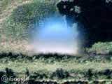
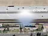
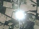
Ian Pottinger and jher were the first to find that there are in fact eight of these UFOs over Florida, at the following points
One - Two - Three - Four - Five - Six - Seven - Eight
and Tensus used keyhole to map the points showing that they make a very neat grid.
Yoshino and jher later noticed that the UFOs are not limited to Florida but can also be found over L.A.
One - Two - Three - Four - Five - Six - Seven - Eight - Nine - Ten - Eleven - Twelve - Thirteen
and Tensus again mapped the points, which appear in an almost straight line.
Things the UFOs are definitely not...
Space debris or another satellite?
Derek & Tensus discovered that the close-up images of Florida are taken by AerialsExpress.com at an altitude of 17,500 feet so are aerial photos and not satellite images.
Marks added to obscure famous peoples homes?
While there's no doubt the whitehouse photos were processed for security it is very unlikely these UFOs are intentional 'cover-ups' due to the neat grid layout.
Water towers?
The UFOs are just too big to be water towers (and there's no shadow).
Anomaly produced by the stitching software?
Shi Ju says
Definitely they’re NOT marks for picture stitching. In most stitching software (like for making panoramas) the algorithm comes down to finding sharp and contrasting details and aligning those spots with each other.
Things the UFOs still could be...
An alien spacecraft?
It's still possible!
A weather balloon?
Tm says
The "Grid" is centered around an airfield, common launch points for weather balloons.
Although Klem says
All currently used radiosonde devices (weather balloons) are latex, yellowish beige to transluscent
and Jello adds
The object in question here does not cast a ground effect, therefore does not exist in the air.
A 'lenticular' cloud?
Patrick was the first to float this idea and the images he posted do look similar to the UFOs, although it is unlikely clouds would form in neat grids.
Condensation on the lens?
Possibly the current forerunner for most likely explanation, Stuart said...
Condensation inside some sort of housing would be my guess. If the drop were directly on the lens it would be effectively invisible. Put it a few inches/feet away and have the camera shooting with a very deep depth of field (as you would with a small aperture) and it would look just like that anomaly.
Something else?
Possibly one of: Peppermint, baseball, Vogon ship, crop circle, planet, thumbtack, ballbearings, smoke, pond, swamp gas, golf ball, satellite, flying ninja, space junk or contact lens as others have suggested!

Also, why has it not occurred to anyone that Google maps could possibly become an issue of national security?
it is TOO easy to view the location, layout and buildings that are at Luke Air Force base in Arizona….
I am not sure how to paste a link from google maps…., but search on google maps for LUKE AIR FORCE BASE and select the link on the right that says Luke Air Force base, do not choose the mailing facilities.
A great example, although we all know about it already:
Do a search on google maps for the whitehouse. This terrifies me!
With technology comes great responsibility……..
View Placemark
this is the link to the correct image with the cloning evident.
this one was also doctored with cloning. The source spot for the cloned trees is diagonally down and to the right. I have cut and pasted in photoshop and the match is identical taking into account some vaiety due to jpeg compression artifacts.
sorry for the confusion
where can I find the higher resolution source images for this ??????
this is the link to the correct image with the cloning evident.
View Placemark
this one was also doctored with cloning.
View Placemark
The source spot for the cloned trees is diagonally down and to the right. I have cut and pasted in photoshop and the match is identical taking into account some vaiety due to jpeg compression artifacts.
sorry for the confusion
where can I find the higher resolution source images for this ??????
Knostalgic – Yes you are correct, the system seems to be using a lot of tiled images. The ocean is a tiled texture, which is not seamless, they probably have a generic forest texture as well.
I don’t know why, but I’ve tried posting certain pictures I’ve found while scanning the maps, and every time Google does not let it show up. I found some strange things, and I don’t know what they are. they are all around the Area 51 area.. some weird pentagram type symbols and stuff like that. and there’s this weird old abandoned airport with a plane on the runway that looks just like the earth.. almost invisible! some type of secret gov’t. stuff, I’m assuming. I don’t know why they don’t want me to post them, or want anyone to see them. anyway, if anyone is interested to this links for Google maps locations, please email me at [email protected] .. thanks!
Scott aka Asmodeus718
Back to wild conspiracy theories
Someone notices that an orb or two have been caught in the maps. First they order someone to digitally remove the orbs. But this proves to be too difficult and obvious cloning artifacts can be seen where they tried to cover them up. Next the order is given to copy and paste several more of these into the maps, and either by crafty deliberation or by the process involved, the orbs are pasted almost perfectly geometrically. This is all highly unlikely, but the scenario amuses me.
KNOST
http://www.drone-riots.furtopia.org/images/coolmoon3.jpg
Lens flares.
I’ll hazard a guess that they could be water droplets or little spheres of ice floating in front of the camera while it’s in orbit. They’re clear and the distortion of the image is similar to that of a sphere. The resolution of the camera is relatively high, so one of these spheres needs to only take up tens of pixels on a side at the magnification we’re seeing in the maps.
Those orb tails are little hairs or something that got on the lens covering and because of it some water formed around it. As you go on the orbs get more and more transparent like here: View Placemark this is because it is fading away, thats also why its not in all the pictures, it popped up and went away, the hairs/scratches stayed you can see them a lot of places
ASMODEUS718: those strange marks you found in the alaska photos are called “fiducial marks”. They are used to figure out the camera geometry from the photo in a process called “interior orientation” The camera is designed to add those marks to every photo. They are not used to “stitch” together images.
siema ziomale!!! Zjechana ta stronka i tyle a takie kity to nie wiem komu wciskacie. Rżnijcie się UFO-le!!! w takie bajki tylko amerykanie wierzą. CHWDP! narqa ziomale
I really agree with toones =)
where is Goom spouting more crud about conspiracys I mean really, once you saw that there were so many it sure should have been obvious this wasnt little greeen men Do you all realize how silly your comments seem? And you really wonder why Google never responded???
LOL
If you had bothered to read the thread, you would know I never thought they were UFOs, and you would have saved yourself from looking like an ass.
For those who are a bit slow on the uptake, there is this thing called “sarcasm” that not everybody gets. That makes it more useful for mocking idiots, though, so it’s not so bad.
Hint: references to things like foil beanies and such are almost always markers left for the slower folks in the audience, kind of giving away the fact that there is sarcasm present, without completely dumbing things down for the lowest common denominator. I do hope this helps.
SO CAL PILOT
Although blurred, the blobs are obviously round to most people’s eyesight and without any resemblance whatsoever to the distinctive form of an airplane, blurred or otherwise. Most of us seem to be agreed that they are also transparent or translucent, refracting light from the terrain underneath into the camera or scanner, which airplanes are certainly not. You also seem to have missed the fact that it has been discovered that the blobs are associated with repeating identical blemishes in the photographs, which suggests, at least, that they are artifacts of some kind rather than “real” objects. And, finally, you can’t just ignore the fact that there are identical (in size, shape and apparent sphericity), objects in the Florida aerial photographs.
Recon Pilot
You are, indeed, quite correct that I am by no means an expert in the business of aerial surveying. The trouble is that that those in this discussion who claim to be seem to have conflicting views, such as, in this case, between yourself and redneck_pixel_farmer who said,”The UFOs or, ‘drops of condensation’ you are seeing are in fact, small bits of dust and crap that the operator couldn’t remove from the scanner. If they occur in geometric grids, as one reader has pointed out, that only makes me more sure, as ROLLS are scanned automatically at a time.” [Emphasis added by me.] So which of you experts is right?
In fact, the evidence doesn’t support redneck_pixel_farmer’s simple theory (there is only a vague suggestion of a grid in Florida, with huge unexplainable gaps, and none at all in LA), and it could only support yours if you are suggesting that the scanning work was done in a completely chaotic way with odd photographs from Florida and LA being scanned out of region, out of sequence and out of alignment, and all before this “drop” evaporated (I imagine that these scanners could run pretty hot, but that is only a guess, since I am not an expert).
Actually, if there are any experts in aerial surveying out there, there is some information that would be very useful in this discussion. First, do aerial survey planes usually fly along circles of latitude or circles of longitude (i.e., N-S or E-W)? Do they fly along arbitrary circles or those of the Earth latitude and longitude coordinate grid? When they are surveying cities in maximum detail (and, therefore, at low altitude), what is the angular separation between runs, what is the angular extent of the resulting photographs and what is the angular extent of the tiles that are eventually cropped from them? With these facts it might be possible, for example, to establish if two or more blobs appear in the same photograph or tile (which would sink the scanner theory).
When I did a Google search on the “Zeiss RMK TOP 15” aerial photo camera, I ended up reading most of an article from ’96 or so, describing an operation in the southwestern US, where the camera and even the plane were “GPS guided” with elaborate telemetry from at least one ground station in order to compensate for the “dithering” the military was using at the time. This eliminated having to wait for the correction data from the military in two weeks or whatever it was. So it seems that the plane flew on a tight, well defined and carefully planned straight line, which presumably would be aligned with the geographical cardinal points. Otherwise, there would be more variables to deal with. I got the impression that the plane flew the course with no more than trivial deviation. Exactly what “trivial” would be in that context, I will not hazard a guess, but the flight path could, it seems to me, account for the precise alignments seen in the photos. Of course, that does not prove that the “orbs” are some artifact of the aerial photo process any more than it proves they are the product of sloppy scanning.
Some time ago I made a map of the LA blobs, which makes it easy to see the pattern (or lack of one) in their distribution, but I have only just learned how to use Flkr to make it available to everyone else. It might be useful if everyone with a theory (including the drop on the scanner enthuisiasts) had a look at it to see if the theory still holds water when confronted with the data. The map is here:
http://www.flickr.com/photos/40115884@N00/15620326/
[Note: this is not the same as Tensun’s Keyhole map of the same data, which, because of it’s small scale, gives a false impression of regularity to the blobs’ distribution.]
Thanks, Goomerator. Nice to know that someone else is pedantic enough to stick it out to the bitter end (i.e., probably when the moderators close this page) in the search for truth. As for “the precise alignments seen in the photos”, however, have a look at my map of the LA blobs. Either the pilot of the survey plane (if the blobs are a drip on the camera lens) or the scanner operator (if the blobs are a scanning artifact) was drunk, I reckon.
He he!
Yup, you got a point there. A bad hangover wouldn’t quite account for the “precision” apparent in that map. Nice work.
It’s starting to look like Google is just waiting for us all to get bored and wander off. Plenty of other cool stuff to look at on the photos, too. I have noticed a lot of additions to the high rez collection in just the past week. I live in an area with lots of great mountain bike trails, and there have been several improvements in the photos of my general area. Still can’t see my house, though.
Someone mentioned earlier seeing Hi-Res photos on other continent’s besides North America…..I have seen a few down in Mexico but no other countries. Does anyone know if this is true? Can someone plese post a link to someplace other than North America?
I’m surprised no one has suggested that they might be an AWACS plane, up high (40,000′?) with its big radar dome.
http://www.af.mil/factsheets/factsheet.asp?fsID=98
Steve DeGroof’s post suggests that it could be an object at around that height and diameter.
What we see in the pictures are orbs. Orbs are surveillance devices that come from a larger mother ship. These orbs are part of the ongoing genetic experiment that extraterrestrials have been performing on humankind since the dawning of civilization.
THE INTERGALACTIC FEDERATION IS COMING IN PEACE…
These images are references points use for coordinating/aligning source images from Overhead Image Providers.
The images arrive as a series of overlapped photos, taken from different angles. By placing these watermarks on the images, sets of images can be aligned.
Normally, these marks are removed in a later stage, where the edges of the images over lap. However, in some circumstances, the source images leave little overlap, forcing these images to appear on the final page.
Part of an Intergalactic-breeding Program between humankind and extraterrestrial biological entities.
Jim, that’s a plausible explanation, at least on the face of it. How about some links? References of some sort? How do you know this? Thanks.
Pygar, your flickr map has grossly different horizontal and vertical scales. The vertical scale spans about 2500 feet, whereas the horizontal scale spans 35 miles. I think a horizontal drift of a few hundred feet by a plane or a satellite as it travels several dozen miles is pretty reasonable, so I don’t think your map destroys the theory that the orbs are something on the scanner/camera that shows up in sequential shots.
Here’s your map with the scales defined and straight lines fit through the 2 groups of data. The scanner/camera obviously made 2 passes.
http://home.supernet.com/~jacksmountain/images/orb14.jpg
The deviation from the straight red line averages 99 feet, with a max deviation of 281 feet. The average deviation from the blue line is 215 feet with a maximum deviation of 504 feet. That is pretty close to a straight line in both cases. Easily explained IMHO by side drift, whether the photos were aerial or satellite.
I live in a suburb of Los Angeles & have contacts throughout several civilian & military agencies as well as the FAA in this area. I can tell you this. As far as they are concerned & to the best of my knowledge:
There are no UFOs, balloons (of any type), lenticular clouds, giant water drops, strange cloud phenomenon ,or any other craft you might imagine, purposely hovering in the skies above Los Angeles. Especially those that are just hanging around with nothing better to do than have their photographs taken. The FAA will be the first to tell you the skies are a busy place. Especially above Los Angeles (in fact the entire west coast for that matter) Most of what goes on up there is not mysterious comings & goings & it is the FAA’s job to see to it that there aren’t UFOs, balloons, lenticular clouds & such interfering with military & civilian aircraft. Admittedly there is always a fraction that cannot be explained & will never be explained because it does not re-occur often enough to be studied by professional researchers under strict laboratory conditions & sometimes ADMITTEDLY because of National Security concerns their is a veil of secrecy concerning top secret military aircraft. In the case of the latter; rest assured they would not be openly flying over civilian airspace in broad daylight. There are plenty of places they can operate away from prying eyes. The simplest answer is almost always the truest answer. Unfortunately “simple” is not as romantic as “Revenge of the Sith” or “War of the Worlds” We are probably seeing the effects of an already well known & well understood process & in the time we have spent discussing it, naming it, and chasing it down with our hunting dogs. Not one of us has come any closer to capturing it! I can tell you at least one thing for sure, positively, absolutely- IT GENERATES! …..and that always translates into MONEY ,PUBLICITY & the continuation of a circular argument that probably won’t be settled anytime soon. Right now at this very minute there is probably someone who knows exactly what you are seeing but he does not have the time nor the resources to provide us with proof that this “phenomenon” is not phenomenal at all! It may even be in his best interest to say nothing at all!
Ask yourself this:
Did I solve some great mystery today? Did it make the world a better place? Or did I waste my time furthering someone elses agenda by giving them publicity & making them money at every click of my mouse.
“Not everything you see is what it appears to be. Sometimes the truth wears the clothing of a lie.”
Agent X – Project Deep Black
Perhaps one of those spots covers something that Google has been persuaded is their ‘patriotic duty’ to obscure. And the rest of those spots are misdirection so you wouldn’t even know which spot is the one covering up something/someone important.
I typed in “area 51” in google maps just for kicks and scrolled around near the race track, some other area 51 I guess, and lookie what I found… View Placemark
I guess that’s not a race track, but it looked like one.
DigitalOldschool, scroll to the top of this thread. That orb is number 13 in the list of LA UFOs specified at the very beginning of this thread.
The Goverment has prepared a statement , and thus follows. The object is to distant from the ground so its blurs. the object also has strange discolorations which cause it to seem blue and gray on diffrent sides. If it was condensation it would be frozen solid to the lens, due to the cold imptiness called space. this imager in fact is only the misinterpretation of the statillite itself. due to the mass amounts of info and imageing these satallites have to putout they do have image blots. The engineers at NASA refer to this so called phynominon as a “Casatic Hole”. thank you
maybe its a Marketing stunt by Google?
did you consider that maybe it IS frozen solid to the lens — which would handlily explain why it almost always looks the same and why it never seems to move or change shape?
Google has enhanced these pics way too much to tell if it’s real or not.
Once again, the photos in question were taken from one or more airplanes, at about 17,500 feet. Google uses the word satellite rather loosely. Zoom out several clicks, and you will see a satellite image. The transition is easy to spot if you look for it.
So, after reading through this whole bloody thread (college is out and I’m obviously bored or something) I’m still at a loss for any certainties, but the repeating goobers all over the place seem to be a pretty good indication that it’s some sloppy human mistake- which is a whole lot easier in the Occam’s Razor perspective than a deliberate promotion for something or alien spacecraft or government crap. But whatever. Have fun.
So…if aliens are so darn intelligent, why is it that they appear on our satellites? Seems to me that anything smart enough to build ships like that, is smart enough to use some sort of cloak or to avoid being caught on camera.
Dummies! The aliens are following the sattelite as a joke.
Because they want us to see them.
The Extraterrestrials are making their presence known, little by little.
They cannot land on the front lawn of the White House because humans are much too primitive and savage to have direct contact. Humans would react by attacking. Reason for which a close encounter of the third kind is not likely. EBE’s cloak their existence in our mythology. They are the angels from the Bible, the gnomes and dwarves of the Middle Ages, the little green men of the 50’s and the aliens of today. The phenomenon has always existed, what changes is humanity’s concept of that phenomenon.
Before contact can be made with galactic civilizations that are far more advanced than we are, Humans must first learn to live in peace with one another.
THE INTERGALACTIC FEDEATION IS HERE IN PEACE
That is correct.
The Intergalactic Federation is coming in Peace.
A I N G A I N G A I N G A I N G A (Repeat in Meditation)
Could it be a shadow from something above the plane taking the pictures?
Check out the shadow this airplane creates…
View Placemark
Pygar & At0miC,
The following are examples of how refraction around low, slow flying private aircraft can appear as a disc or blob from the altitudes of the camera platforms. Additionally the size, speed and distance variation will account for the anomalies between any given examples. The reason they are the same in Florida as the are here in Southern California: Cessnas and Pipers are the same in Florida as the are here in Southern California.
http://www.ascotti.org/photo/weather.htm http://www.echeng.com/journal/index.php?p=878 http://www.dlcphotography.net/CR2/1D2_00937.htm http://hyperphysics.phy-astr.gsu.edu/hbase/atmos/glory.html#c1
Its clearly a monkey with a gun. All it wants is a banana!
View Placemark
Check this out… what do you think that is?
I think that’s number seven.
I work in photofinishing and I’d have to say these are artifacts from the scanner. They look exactly like some of the crap that we get out of our machine. Especially due to the fact that the dust around them is consistant in every frame where they show. No matter HOW clean you keep your lab, even if it is in a clean room, you are sometimes going to get crap on your scanning lense. These photos are from absolutely gigantic negatives that are very detailed, and even the smallest crap will look like crazy stuff. Heck, even when I am doing 35mm stuff, a hair or a scratch on the neg can turn out looking crazy.
Furthermore, there are software products that try to remove dust and scratches during the printing or scanning of negs. Sometimes they produce absolutely insane looking things. I’ve processed a few rolls that the algorythmn (sp?) misinterperated lines and dots on a wall as dust. All of them turned out looking like weird gradients.
Again I’d put all of my money on dust, and possibly a glitch in a dust/scratch removal algorhythmn.
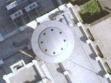
The object depicted on the google map in Mangonia Park (not Magnolia, as written) – in West Palm Beach, Florida is the exact location of a defunct, silver domed auditorium. I live in West Palm and my husband windsurfs on a lake almost adjacent to the auditorium.