UFO Updates
Wednesday, 18th May 2005 by James Turnbull
Thanks to everyone who commented on the original UFO find, although we're still not sure what they are, there's been some interesting developments.
Ian Pottinger and jher were the first to find that there are in fact eight of these UFOs over Florida, at the following points
One - Two - Three - Four - Five - Six - Seven - Eight
and Tensus used keyhole to map the points showing that they make a very neat grid.
Yoshino and jher later noticed that the UFOs are not limited to Florida but can also be found over L.A.
One - Two - Three - Four - Five - Six - Seven - Eight - Nine - Ten - Eleven - Twelve - Thirteen
and Tensus again mapped the points, which appear in an almost straight line.
Things the UFOs are definitely not...
Space debris or another satellite?
Derek & Tensus discovered that the close-up images of Florida are taken by AerialsExpress.com at an altitude of 17,500 feet so are aerial photos and not satellite images.
Marks added to obscure famous peoples homes?
While there's no doubt the whitehouse photos were processed for security it is very unlikely these UFOs are intentional 'cover-ups' due to the neat grid layout.
Water towers?
The UFOs are just too big to be water towers (and there's no shadow).
Anomaly produced by the stitching software?
Shi Ju says
Definitely they’re NOT marks for picture stitching. In most stitching software (like for making panoramas) the algorithm comes down to finding sharp and contrasting details and aligning those spots with each other.
Things the UFOs still could be...
An alien spacecraft?
It's still possible!
A weather balloon?
Tm says
The "Grid" is centered around an airfield, common launch points for weather balloons.
Although Klem says
All currently used radiosonde devices (weather balloons) are latex, yellowish beige to transluscent
and Jello adds
The object in question here does not cast a ground effect, therefore does not exist in the air.
A 'lenticular' cloud?
Patrick was the first to float this idea and the images he posted do look similar to the UFOs, although it is unlikely clouds would form in neat grids.
Condensation on the lens?
Possibly the current forerunner for most likely explanation, Stuart said...
Condensation inside some sort of housing would be my guess. If the drop were directly on the lens it would be effectively invisible. Put it a few inches/feet away and have the camera shooting with a very deep depth of field (as you would with a small aperture) and it would look just like that anomaly.
Something else?
Possibly one of: Peppermint, baseball, Vogon ship, crop circle, planet, thumbtack, ballbearings, smoke, pond, swamp gas, golf ball, satellite, flying ninja, space junk or contact lens as others have suggested!
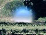
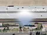
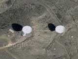

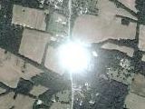
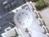
I can’t believe nobody has noticed the resemblance to the Pepsi logo. It’s obviously a viral marketing technique by PepsiCo. Oh sure, it doesn’t look EXACTLY by the Pepsi logo, because that would be too obvious. But here you are, staring at this circular, two-toned image, talking about it, staring at it, discussing it ad infinitum. You say “condensation,” Pepsi says “condenSODAtion.”
Congratulations: You’re cleverly being inducted into the Pepsi Generation. The more this comes up, the more Pepsi wins.
Soon, all will drink Pepsi. Pepsi is visible from space. Pepsi is a naturally occuring phenomenon. Pepsi was probably inevitable by the laws of evolution. First comes single-celled organisms, then plants, then Pepsi, which clearly is what gave our evolutionary ancestors the energy or dare I say “pep” to leap out of the sea and trundle about on land. Pepsi and the Great Wall of China are the only two man-made items visible from space except it turns out that not even the Great Wall is visible from space, really, so how can you doubt the immutable truth, light, and way that is Pepsi?
Coca-Cola is only a theory that should be considered alongside other theories, such as that of the obvious domination of Pepsi.
Argue and worry no further: Submit. Submit to Pepsi.
I’m according with Robin, when part of the Google’s Copyright is under the UFO, it is clairly lighter than normal (see View Placemark or View Placemark )
why are they always in the centrer of the image? It must have to do something with the lens
Eric, two thumbs up! Rolling on the floor laughing! That was a good one. Keep posting, we love it.
Its nice how the posts are “MIA” ??
Since it forms a good ole grid.. I’d say its the symmetrical unbusted bubbles from the bubble wrap that the earth was first wrapped in!!
clearly, clues left by the illuminati and free masons which points to the secret treasure of the ages.
annnd
you have to traverse all the dollar bills and euros for the other clues.
It’s the so called dead or blind spot every parabolic optical device has. The cameras they use on satelites and in many airplanes don’t use gelly or glass lens like normal video and television cameras do. They use a parabolic mirror to adjust the focal length, which actually has to compensate strong fluctuations, talking about the actual distance of the camery to the objects on the ground. The blind spot is the camera in the center of the parabolic mirror. The mirror faces the earth and the camera faces the mirror. Normally the machine would make two pictures of the same area, the second just after the blind spot has moved a bit, and then automatically mix them to one picture without the blind spot. I have no idea why they didn’t do that here.
has anyone zoomed out? and noticed that you can’t see it then, which implies to me that it is close to the ground, and not in space at all. so that woudl rule out spot on the lense, lense flare, space debris, and pretty much anything outside of the atmosphere. i am going with it being a weather ballon, or something like that. 🙂
No, nobody has zoomed out. Nobody has suggested the possibility that it might be a weather balloon, either.
Perhaps you could enlighten us as to why an object at such a distance from the lens would appear out of focus. Or why some of the objects appear almost transparent, or shaded differently from objects on the ground, or why they appear in geometric grids over heavily populated areas.
The dots appear in the center of the images because the people who found them centered them in the window before clicking on “Link to this page” in the upper right hand corner. Try it. It’s easy. Or just click here:
View Placemark
I highly recommend at least skimming the thread before giving us the benefit of yet another opinion, informed or otherwise. In among all the nonsense, there is a lot of information in this thread.
http://www.ebaumsworld.com/ufoguy.html
Also.
:B… vanish
I’m going to go with the opinion of Tophe above: “it’s the dead or blind spot every parabolic optical device has”
But it sure is fun to see that the kooks are alive and well.
Yeah, good, safe answer. Comfortable. It does little to explain these, and some others, but it’s safe.
View Placemark
View Placemark
I see Tophe couldn’t be troubled to give a single checkable reference, or even a reference of any sort beyond his pronouncements. I am not willing to take his word that the images discussed here were made with a parabolic lens. But hey, it’s a comfortable place to leave the question.
Could they be holes that the software could not replace with image data from another section of film? . Look closely you can see “shadows” of writing or other marks near them too, perhaps from the edge of the film.
Has a airplane been seen, shouldn’t we see more airplanes in the skies, if we were able to see all types of UFO’s
Also I know in Florida they have several baloons with cameras in them to catch drug smuglers, flying low, I know this b/c they are attached to a rope from the ground going thousands of feet in the air, and I’m a pilot and have to watch for these if Im down there.
Tophe
It has already been established that these are aerial and not satellite photographs, and the camera used to take them was almost certainly a Zeiss RMK Top 15. I am not an expert on aerial photography, but in all of the literature available on this camera on the Web there is no mention of a parabolic mirror arrangement being involved, only of the characteristics of its lens (if I understand your theory correctly, you appear to be saying that the mirror takes the place of a lens). Moreover, pictures of the camera (the film drum is on the top, so how can the camera be slung beneath a parabolic mirror?) and descriptions of its operations also seem to contradict your theory.
[After completing a writing job for a deadline that kept me too busy to do so, I had decided that it wasn’t worth contributing any more to a discussion that will almost certainly never reach any satisfactory conclusion, but I just can’t resist puncturing overconfidently proposed theories.]
Mountain Jack
I have just read up to your comments about my latitude map (I am catching up from the bottom up). In answer: first, I don’t think that I could have made it any clearer that I had DELIBERATELY compressed the longitudinal dimension by a factor of 16 to allow easier comparison of the latitudes of all of the blobs, which I thought was the most important variable assuming E-W or W-E flights of the survey plane. Secondly, while it had also occurred to me that the blobs could be distributed along more than one survey flight corridor, I am not nearly as tolerant as you appear to be about your calculated deviations from straight flight paths. For one thing, aerial survey planes are supposed to be guided by a combination of GPS and Inertial Navigation Systems with automatic yaw control to compensate for the effect of drifting due to wind, and I have read that they don’t fly at all if the wind is to strong for the system to cope with. I have also read that the aerial camera’s vertical axis can be kept to a pre-planned path along the ground with an accuracy of 3 or 4 centimeters (504 feet maximum deviation, did you say?). Then there are your lines of best fit – your proposed ideal flight paths from which you measure your deviations – which are nowhere near parallel to a circle of latitude; in fact, one end of your red line is more than 15″ of latitude (say 1500 ft) North of the other. Are these diagonal flight paths, over a W-E and N-S gridded city and for a photo-mosaic which is undoubtedly gridded W-E and N-S, deliberately obtuse?
Also, perhaps you haven’t noticed that these are not vertical, but oblique aerial photographs (i.e., you can always see the south sides of trees and tall buildings, never the north – more evidence, incidentally, that these are not satellite images). So, if the plane and camera go off track, it is not a question of simply sliding the photograph around to try to get it to fit with its neighbours, because in an oblique photograph the terrain will appear to be nearer or further (depending on the direction of drift) away than it should be relative to the mosaic as a whole (significant deviations in altitude would have the same effect if the camera were pointed vertically down).
In short, accuracy obviously matters in aerial surveying, and I don’t think that your calculated deviations can be considered negligable in this regard. You might also, finally, be interested in some relevant work that I did on the relationship between the blobs and the tiles of the mosaic here:
http://www.flickr.com/photos/pygar/
It’s over San Francisco right.
That was a home run hit Mr. Barry ( steroid ) Bonds.
Pygar, thanks for your comments. I had about given up on this thread for substantive posts, but you have given it new life. BTW, there are some interesting posts on this subject in a JREF forum thread, particularly by posters Thomas and Timothy.
http://forums.randi.org/showthread.php?s=9cd6d1c8b01d6b8d7851a43abe0331b8&threadid=56971&perpage=40&pagenumber=2
I’m not an expert on aerial photography, but the Google maps contain a lot of information from which we can draw conclusions. There appears to be at least 3 levels of “tiling.” First, there is tiling of the aerial photographs. It appears that the aerial photos were not shot in a continuous manner, but are a series of sequential shots that are later scanned and spliced together. For example, Look at this map of downtown Alexandria, VA:
View Placemark
We can clearly see that the left part of the picture is a separate photo frame from the right part, because the buildings appear to lean in opposite directions, indicating that the left part of the picture was photographed from the West, whereas the right part of the picture was photographed from the East. And yet, the two parts are spliced together pretty well. Further illustration of photographic tiling can be seen if you zoom this map out about 5 steps. Reflections of the sun in the Potomac River can be seen every 0.025 degrees or so, both latitudinally and longitudinally, and the splicing appears to be pretty rough.
The second level of tiling ocurrs when the photos are digitally scanned. This level of tiling may not be the same as the aerial tiling, and may not be done on an exact E-W or N-S line. For example, the “commas” that I mention in my JREF post are pretty clearly artifacts introduced when the photos were scanned, as are the “pigtails” in other photos. In fact, the commas and pigtails are not exactly aligned at a specific latitude, indicating that the scanning process is not exact, even if the photographic tiling is much more precise. The spacing of the commas, orbs, and pigtails in the CA photos is aroung 0.048 degrees longitude, whereas the spacing in the FL blobs is 0.055 degrees longitude. This suggests that the scanning covered two photographic tiles, assuming that the FL and CA photographic tiles are of similar dimension as the DC tiles.
The third level of tiling is what is inherent in the Google maps presentation of the data, which you discuss in your flickr comments.
As you can tell from my JREF posts, I now suspect that the blobs are digital markers deliberately placed on the scanned images to mark areas that need cleanup. The ones we see are cleanup markers that were missed by the cleanup crew.
Here is a strange feature just a little ways north of Number 2 up there in the Florida group. It looks to me like something is literally being Covered Up. 🙂 Anyone from the area know what this building is? I know there are lots of white or silver roofs in the area, but look closely at this “cut out” shape and the lack of evidence of walls around it, cut off shadows and/or trees, etc, before coming back here to call me more names, please.
View Placemark
Kook, I think that’s just a building with a reflective roof. Compare Google’s aerial photo with the one at terraserver of the same area:
http://terraserver-usa.com/image.aspx?T=1&S=10&Z=17&X=2961&Y=14809&W=2
Look at the image, see what you think. There’s a building there that has the same shape as the “cut out.” I see lots of extremely reflective roofs, ponds, rivers, etc. in the Google images.
If anyone is interested, here’s a comparison of two aerial and one satellite views of the same location, Magnolia Gardens, FL where the first blob was found. The Keyhole satellite shot is clearly the best. Terraserver suffers from being black&white.
http://terraserver-usa.com/image.aspx?T=1&S=10&Z=17&X=2960&Y=14794&W=3
http://img.photobucket.com/albums/v81/Veto1024/keyhole.jpg
View Placemark
Mountain Jack:
Thanks for the Terraserver link. I thought of going over there, but I don’t have much patience with the rather clunky interface there. Yeah, probably just an optical delusion, but I have been on many roofs, and found that one’s collection of features to be odd. Lack of features, I should say. The roof is not flat, it has a ridge and is made of two planes, with the “porch” being a third. Probably just overexposed its tiny spot on the film. I didn’t have any conspiracy theory, either, just thought it might have been concealing some rude grafitti or something. This whole puzzle is interesting if for no other reason than learning about the process. For example, I learned recently that the Zeiss RMK TOP 15 aerial mapping camera has a feature, presumably an optional extra, that causes the film to shift ever so slightly during the exposure, in order to compensate for the plane’s forward motion. !! That function is of course regulated by the computer that runs the camera. Yikes!
The fact that the blobs occur in regular rectangular or straight-line patterns is strong evidence that they resulted from an imperfection in or near the recording camera (which keeps taking pictures in a precise grid-like manner).
How could UFOs/clouds/air balloons exhibit this pattern? Note that the pictures are not all taken at the same time, but one after the other. So to get a regular straight line pattern, you would need either a bunch of UFOs that have landed in this pattern (why would they?) and stayed on ground long enough for the photo-taking plane to pass them (why did nobody report these landed UFOs?), or you’d need a single UFO that moves precisely parallel to and with precisely the same speed as the recording plane, again highly unlikely. The UFO explanation of the rectangular pattern poses even more problems.
The smeared edges of the blobs also point to optical phenomena, not physical objects.
It’s a trap! A TRAP! WE ARE ALL DOOMED! ::puts on tinfoil hat::
If you would all check out Dallas DFW airport you can see the western runway image on the north end (top side) where consecutive shots of a jet taking off to the north over a large lake. This means that the aerial photos were timed so those silver orbs may be a kind of alignment mark to connect images. You can see this effect over most major airports. You have to almost zoom all the way in to even see the jets believe it or not because they’re still difficult to see. I looked for jet shadows on the ground or lakes first unless a plane is taking off the runway. You can determine by the shadows the sun angle then find the jet airliner in the sky. Sometimes there’s only a shadow of the plane but nothing in the sky. That means the photos were overlaid in these cases to make the plane (or clouds) disappear. Check out large power plants or nuclear power plants were the steam clouds are sometimes overlaid.
Bunk bunk bunk~! I’ll believe it when I see it!
Bah. It’s just a white-paint roof with full-on Florida sun and got overexposed.
It is a silver orb. I saw 2. First in 2002 and one in 2003. The first one was on the way home fgrom work, I looked at the horizon ahead and up about 500′ was a silver perfectly round silver orb that was approx. 10′ in diameter. I stared at the orb for 6-7 seconds then I had to glace back at the road for a moment and then sure enough it was gone. The second one I saw I was on I70 eastbound in Indianapolis and I saw the same looking object dart out of a jet trail for about 5seconds and traveled east at mabye 70 MPH and then it just zipped back into the jet trail. This object was under it’s own power. And moved with purpose and intent.
I would like to say,If it walks like a duck looks like a duck, quakes like a duck, it more than likely is a duck, sorry for the pun but gees anything can be explained away with probabilities.
Wow alot of people commented on this.
This site:
http://www.ufocasebook.com/nasapaintbrush.html
Has this which is sorta similar:
“D.T.: Yes Elaine, that’s true. During the Apollo mission I worked at NASA throughout those Apollo missions and I did leave NASA at the time the space shuttles began. I worked in building eight in the photo lab. I had a secret clearance so I thought I could go anywhere in the building. And I did go into one area that was a restricted area. In this area they developed pictures taken from satellites and also all of the missions, the Apollo missions, flight missions. I went in and I was talking to one of the photographers and developers and he was putting together a mosaic which is a lot of photos, smaller photos into a larger photo pattern. And while I was in there I was trying to learn new methods and new things about the whole organization and I was looking at the pictures and he directed my attention to one area, he said, Look at that. I looked and there was a round oval shaped, well it was very white circular shape of a dot and I, it was black & white photography, so I asked him if that was a spot on the emulsion and he said, well I can’t tell you but spots on the emulsion do not leave round circles of shadows.
E.D.: So there was a shadow on the ground?
D.T.: Right, a round shadow! And I noticed that there were pine trees, now I don’t know where this area was or what, you, pretty close to the ground what I saw but I didn’t see outline of the continent. But I did notice that there was shadow under this white dot and I also noticed that the trees were casting the shadows in the same direction as this shadow of the circle of this aerial phenomena because it was higher than the trees but not too much higher than the trees but it was close to the ground and it was spherical but slightly elongated, not very much but slightly. I then said, is it a UFO? And he said, Well I can’t tell you. And then I asked him, what are you going to do with this piece of information? And he said, well we have to airbrush these things out before we sell these photographs to the public. So I realized at that point that there is a procedure setup to take care of this type of information from the public.”
View Placemark
Your point?
Gakona, Alaska – could this be HAARP ?
View Placemark
Whats a HAARP?
http://en.wikipedia.org/wiki/Haarp
I think it’s a google viral marketing campaign and it will turn out to be part of some kind of puzzle! 😉
When Google pays for the satelite service the “UFO’s” will be removed.
I found this over my hometown in Brooklyn. I know for a fact that this is not some water tower or any other structure. There are just homes there.
I was surprised to find this on the Google satellite image.
here is the link:
View Placemark
found this over my hometown. I know there’s nothing there but homes.
But this is strange View Placemark
Poeple are complaining that we are saying they are UFOS just because we cannot identify them. Welll….. a UFO is an Unidentified Flying Object. That is exactly what is is. lol.
something different, are you talking about a round object with a black center and a pointer at the bottom? That looks like some sort of a marker at 2050 ocean pkwy, kind of like this one
http://maps.google.com/maps?q=2050+ocean+pkwy,+brooklyn,+ny&spn=0.007660,0.005354&t=k&hl=en
Not sure why they would have a left-over marker in the image, but Google maps is a beta product. Maybe the final will be cleaned up.
Machine translation!!! (I do not speak English, I am French):
Final proof that these objects are not related on the landscape but well to the system which scan them later on: One can note that on the series of image 7, 9,10,11,12 and 13 one finds same dust and that this dust is at the same place compared to the “UFO”. Coordinated: X1 = – 290 pixel Y1=-135 pixel and X2=+285 pixel Y2= -110 pixel on the basis of the center of the “UFO”. This correlation shows undoubtedly that this object and related on the system which scan these images and not to the landscape.
This is not even an unidentified object. It is clearly: A. Attached to the ariel camera: The plane would make a flight from west to east then loop back and make a flight from east to west, the anomaly is likely close to the edge or the lens.
B. Or it is on the scanner. Same premise, the plane sweeps west->east then east-west. the image rotation would be done on the computer so again the anomalies would appear near a stitch so they would be close together and upside down.
QED: Not a ‘UFO’ (Extraterrestriall or Terrestrial)
NOTE: It is not the people who won’t say this is a UFO that are the ones denying the truth, its you people who want to desparatly to believe that the ariel photos caught a UFO. You are refusing to believe the truth.
I wish I would have found this sooner because it was obvious from the start. It was amusing watching you guys wish it was a UFO though, thanks for the laughs!
The original “UFO” in Florida is definitely NOT from the photo itself. Upon close examination, you will notice that the lighting for the artifact is from the southwest, yet the shadows cast by the trees and structures are all lit from the southeast.
When you input slightly different coordinates for the map, say from just southwest the pointer shadows the artifact lining up the shadows/lighting perfectly with those of the artifact in question, as does the balloon until you close it. This would indicate that the artifact is a remnant of the rendering interface, not the photograph. As the Sherlock Holmes in the 21st Century cartoon says, “Eyes and brains.”
David Patrick’s point is further evidenced at View Placemark
So David Patrick is pointing out that there are some round things with shadows on them in other Google images?
Astounding! Real round objects!
Interestingly, you would think at the site below where someone in another post spotted a plane would cast a shadow but it didn’t. Maybe the rough terrain in a mountainous zone was enough to disperse the shadow?
View Placemark
I think it has something to do with ‘Australian Avenue’ dont you! I also bend spoons in my spare time on the sheep station.