UFO
Thursday, 12th May 2005 by Alex Turnbull
Tensuns says:
I have no idea what this is. I can’t find anything similar on any google map referenced sites. It doesn’t show up on terraserver and I live nearby so I know there are no towers in that area. It has the same shadow as ground objects and when you zoom out it appears to be too small to be something really close to the satellite.
Well we're completely stumped. Any clues anyone?
Update: See the UFO Update entry.
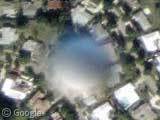
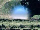
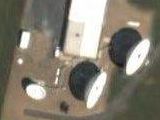
A ‘rational’ explanation would be that it is a wheather balloon, at say, 20 miles altitude, and thus out of focus and fuzzy. However, if the satellite was at over a thousand miles altitude a balloon at that altitude should be in as sharp focus as the houses on the ground. If it’s a genuine UFO, the blurry region around it could result from some form of time or space distortion affecting the paths of photons in the background. See http://starflight1.freeyellow.com/page3.html
Dave
seems to me that one of the first questions to ask would be whether these are the same object at different time intervals, or whether it’s a bunch of different objects. looks like there’s quite a variety. if we were to assume a water droplet on a lens, that would make sense, ’cause it would change shape if the camera moved. but, would a water droplet really be that weird silvery blue color? i’d think it’d be slightly more transparent.
if you saturate the hell out of it in ps, you can see that the ‘blue’ extends out pretty far (no pic, sorry); it’s more of a blob than a spheroid. it’s best to do this with the montage of all the diskies. also, inverting ’em seems to suggest that their density is variable. a variable density would explain why some of ’em look spheroid and some look like discs. i’d bet that if one went to the intervals where there should be ufos but aren’t, and really saturated the heck out of ’em, you’d find some trace blue elements
of course, the ‘droplet on the lens’ theory is pretty much moot considering there’re identical buggers in l.a. and florida. there’s no way a droplet would stay on a camera lens while crossing a continent . . . .
here’s a ufo sighting from la that looks creepily like our lil’ friends:
http://www.laufo.com/silverdisc.html
This could be an instance of ET marking something that he wants us to look at. Is there some nuclear military weapons sitting nearby?
ET is waiting for this big dumb idiot herd to awaken to the threat of these nuclear weapons, that the criminal classes have planned all along to use on us. If James Carville were to describe it, he might say, “its the nuclear weapons stupid!”
This nuclear threat to us explains the politics of ET. http://politicsofet.com
Why would UFO’s be so afraid of we insignificant humans? If we went to another populated planet, we would do so to communicate with other worlds, no? I don’t believe it till I see it!! It’s all bunk!
For all of you that missed it THESE WERE TAKEN FROM AN AIRPLANE, NOT A SATTELITE.
Amazing finds in LA. Later I’ll try to determine if the relative distances are the same as the ones in Florida.
Unfortunately it seems that there is no meta data for the LA images. Which means that we don’t yet know if they came from the same company (Although they don’t seem to show up on AerialsExpress.com’s web viewer).
(Hey Derek, you still out there? Any tricks up your sleeve for finding that info?)
First off, these are not satellite photos. While some of Google Maps “satellite” imagery is indeed from satellite, these photos along with most others in the denser urban areas are aerial photos taken from an airplane. As previously noted, most are taken at an altitude of 15k-20k ft (well short of the previously mentioned 20mi height of a weather balloon).
Additionally, these photos are not from Google. In terms of data, Google’s product is nothing new. Microsoft had it’s TerraServer since the mid-to-late 90’s and the United States Geological Survey (USGS) has been cataloging Aerial photos for decades. The USGS even offers the same data, and then some on it’s website http://seamless.usgs.gov. On that site you can overlay further imagery from other aerial photo survey’s, various satellite imagery, topographical renderings, streets, etc. To be sure, Google does seem to have the best interface to this data, and they definitely have done a great job “mapping” a street map rendering of the entire US to this aerial photo data.
In terms of the lens defect theory, these photos are taken with highly specialized equipment. If you find the same anomalies on the USGS site and inspect the metadata for the aerial photo layer, you’ll see that Aerials Express of Tempe Arizona is the source for both the Florida and California images (which was previously mentioned). They also list the equipment used to take these photos:
Number of Tiles 139 Sq Miles 1,442 Scale 1:30000 Flight Date January – March 2003 Datum NAD 83 Projection UTM 11 Units Meters Pixel Size 0.65 Meter Format Geotiff Rectification Method Orthorectify using Ground Control Points DEM 30-meter DEMS (Level 1, Level 2) Contol Image USGS DOQs Camera Type Zeiss Top 15 Focal Length 153 mm Film Type 9″ Color Roll Film Scanning 21 Microns Sampling Method Cubic Convolution
This site shows a picture of this camera (from a different aerial photo company) along with it calibration records: http://www.kam-az.com/cameras.htm
I have a longer comment awaiting moderation. Yes, the source is still Aerials Express. If you browse the USGS site, they list two orthoimagery sources for that area. The later of the two contain the points.
Con el paso tiempo creo que veremos cosas aún más sorprendentes… Todo esto es a cuenta-gotas, pues aún no estamos preparados para enfrentar la existencia de vida y tecnologÃa “super-avanzada”…
En fin… yo procuro tener mi mente abierta aunque un tanto esceptica, pero sin cerrarme ante esa posibilidad…
…:::: Nada® 2005 ::::…
ich verstehe nicht!
I think it might be a weather type baloon used to launch a reflective sphere used in radar calibration and test. Possibly from Jonathan Dickinson Instrumentation Facility (JDIF) located just north of the county line near Jupiter Inlet.
Think scalar weapons. Do a google search.
I’m pretty sure this came from scanned aerial images (non-digital photographs), and the “spheres” are most likely the heads of pushpins they are using to register the images to coordinates (or just attaching to a board).
Looks like one of my testicles when I got kicked at 15..there it is..50 miles up…
SURE………..i know what it is. These orbs have been flying around this area for a while. In fact, I took some pics of these strange circular objects early this January. Photos were taken during a comet pass. What came up on the pics once downloaded in a computer were strange to say the least. Tried to tell some people about this………….but all have been quite sceptical.
Is this a test?
That’s not a moon… that’s a space station.
This looks like another one in the same general LA area as jher’s first 13. But it’s fainter than any of the others I’ve seen
View Placemark
View Placemark
There have been many photographs of “orbs” next to “chemtrail” formations since about 1998. This US/Canadian joint military exercise involves monitoring global weather problems (have you had any good weather lately? – globally speaking) by dropping aluminum oxides and barium salts into the upper atmosphere at about 35,000 feet altitude. The large “X” patterns we see below are there as an aid to tracking the upper jet stream activity, which they do by utilizing satelite photos (among other things). The rest of the story gets pretty strange, trust me on that one. However, my point in this instance is this: “Orbs” appear in public citizen photographs of these “chemtrails” as well as what you’ve seen here today. I find that connection very interesting. Perhaps it’s a drop of aluminum oxide of the jet’s lense that we’re seeing here as well.
PS: Contrail: Condensation trail (water vapour). Depending on tempurature and altitude, a normal contrail lasts only 5 to 25 seconds, like the wake behind a boat, or your own breath on a cold winter’s morning. Chemtrail: Joint US/Canadian military exercise involving the administration of aluminum oxides and barium salts to seed the atmosphere for weather modification and global jet stream monitoring. Weather modification: The use of scallar waves and HAARP research projects (HIPAS, Arecebo, etc) in conjunction with reactive particulate matter in the upper atmosphere to generate moisture gathering, moisture absorbtion and timed release of precipitation – also linked to Star Wars ground based weapons systems. Star Wars: (Hopefully you know all about that by now)
Weather wars suck. cough, sneeze, glancing upwards
What are these orbs? Could be nothing really at all – but judging by today’s standard of “officialdom” and their tendancy to lie about their very existance (who doesn’t have photos of Area 51 by now?), I wouldn’t trust a single one as far as any one of us could write our own names in the snow.
It s the same as this one picked up by a ground-based photographer:
http://www.rense.com/general65/sim.htm
It must be the top of the Marshmellow Man’s head?
It is anna nicoles left boob.
All of you that say it is a weather balloon, you aren’t too bright. And those who say satellites don’t take pictures of this resolution, dumber. Several of these image reports reach my desk weekly. I can assure you 100% these are not balloons and yes we can take pictures like this from a satellite. We can read the date on a U.S. nickel sitting on the dashboard of a moving vehicle. Start studying before you make claims to know what you are talking about.
Wake up world! They really are here! We all need to look up more often!
Since Burt Reynolds lives 3 doors down, it’s obviously Dirk Diggler’s last ‘money shot’. In yo face, satellite!
This is defintely a UFO… but maybe not one containing aliens. As soon as you say UFO everyone thinks of E.T. or close encounters of the third kind… but let’s break it down.
U – Unidentified F – Flying O – Object
There. I’ve solved it. It is indeed a UFO. 🙂
I think it’s a really high fowel ball. But I could be mistaken.
it’s an alien probe gathering atmospheric data and surveying land terrain. contact is emminent in the coming months. they are vulnerable to chemtrails and constant spraying could delay the contact expected.
Looks like a condensation drop from the aircraft engine exhaust and not the god movie dot com.
THIS IS EXACTLY WHAT THE ALIENS WANT! WHY SHOULD THEY COVER THEIR TRAIL WHEN THE HUMANS WILL DO IT FOR THEM! WHY ARE THESE KIND OF PICTURES ALWAYS BLURRY? THOSE BASTARD ALIENS! STAB THEIR EYES!!
If it is high enough, with light refragtion, their will be no shadow.
It’s a high tech government operated surveillance orb, used for collecting information and spying on the behaviors of various schizophrenics in the West Palm Beach, FL area. I repeat, do not believe what they tell you to NOT believe in. It’s a vicious dirty lie, and an elaborate mind-trick.
I believe that this may be a surveillance balloon called an AeroSphere. I have seen them over Atlanta. You can find the specifications at:
http://www.proxygen.com/36/editorial.asp?aff_id=36&this_cat=Airships&action=page&obj_id=1454
You can also google AeroSphere and see what you get. Homeland Security at work!
Jeff
i think its space junk. most likely a ball barring/screw head. its out of focus because its too close to the lends. the camera is focusing on the ground detale, like far sightednes. if it was a ufo some one would have had to seen it and told the media about it.
Here’s a page (in LA area again) with two of the objects on it, with the light source looking different on them. But the image doesn’t look like it’s a composite – the shadows near both objects appear consistent.
View Placemark
Well, it is clearly out of focus. Anyone that has a focusable camera knows that, with a 50 millimeter lens on a 35 mm camera, when you set your focus at infinity, you can clearly see anything further than about 10 or 15 feet away.
The first question one has to ask is how close to the satellite does an object have to be to be out of focus? This information, when combined with the height of the satellite will give you an idea of how big the object is — if indeed it is an object and not an artifact.
If it is in orbit, it must be very near the orbit of the satellite or it would be dramatically blurred.
I’m unconvinced that this object has the same shadow pattern as objects in the sky.
I saw one of these form from a ringed shaped cloud just west of the Palm Beach Intl. airport . We were looking up towards the north at a thunderstorm forming and a rainbow was also in the foto that I had taken of the object. MAYBE THE ALIENS ARE LOOKING FOR A NICE HACIENDA DOWN HERE IN SUNNY FLORIDA, THEY PROBABLY HAVE A STAKE IN SOME REAL ESTATE AND ARE CHECKING OUT THEIR INVESTMENTS. KEEP WATCHING THE SKIES !
We’re all doomed…the end is near! Bow down to George Noory our Alien God!
Take a look at the white dot down to the left near the school. This Google map was most likely taken about 18-months ago as most others are taken. It appears someone at the school shot this aluminum covered object, maybe a weather sensor, up at the very moment the satellite took its GPS shot. This cannot be an alien or “UFO” since it appears it can be explained. Think about it, WHY would a foreign intellegence travel 100’s of light-years to get here, then say, Oh! we want to be a secret. It does not make sense. If you wish to have major impact, think about being a GREAT Steward of this planet, and stop worrying about what others could or would do. Coast to Coast is a great voice for the counter-culture.
On second thought coast to coast listeners are a bunch of FREAKS! They’re like those Trekky people. I wouldn’t be surprised if they’re talking about being “beamed up” tonight on Coast to Coast radio. Freaks!!!!!
Yup,A freak I am
I think what we are seeing is a polluted rain drop, or a polluted something?
Wait a minute, this could be just one little tiny piece of what the planes are spraying all over us every day, a little piece of cemtrail, we have them now. I sure wouldn’t want to take a bath in a tub full of this stuff…YUK!
when you scroll left and see the second orb :
is the second ufo the same one as in the first frame – has it moved west ?
or are both on the same frame.
?
Is there anybody (photographic expert?) who can comment on whether these “things” reflect or refract light? With one exception (and excluding the Google copyright lettering that has been layered onto some of them), the only variable quality in their appearance is their colour. This seems, to some extent, to “reflect” the prevalent colours of the terrain beneath them (for example, one of them over a waterway is a deep blue, while another over an open chalky area is white), but, of course, a reflective sphere photographed from above cannot reflect (into the camera) that which is below it. On the other hand, they certainly do not appear to be transparent, and if they are partly translucent, then the light absorbing material normally has a colour of its own that should be consistent, but does not appear to be here.
The exception is this one: View Placemark. Unlike all of the others found so far, this one is not entirely circular (or spherical), and could possibly be interpreted as two of them nearly completely superimposed or as one of them in motion.
Click on the next link, then zoom out to level 4 to see 3 objects in one frame.
To save anyone interested in addressing the above question from having to hunt for them, the references are:
“Blue” sphere: View Placemark
“White” sphere: View Placemark
If you look at all the various photos from LA and FL, each orb is reflecting light differently, according to the angle of the sun as shown by the shadows cast from the trees and buildings underneath. Furthermore, if this object is in the sky, it would make sense that the light reflecting off of it opposite the sun is BLUE light; that’s the color of the atmosphere. The side facing the sun is reflecting white light; it matches.
That tells us clearly that this is not a digital artifact from the image matching software. It also tells us that it is not a “water droplet” that formed on the lens; those camera’s are not your off the shelf Nikon hobby units. These are highly specialized, very expensive pieces of hardware that are thoroughly inspected before each run – they have to be because it’s expensive to run a flight (remember – it’s a business).
These are satellite images. Not from planes, let me explain and illustrate. During approach line up, planes in Phoenix that land at Sky Harbor fly over the Phoenix Mountains in north Phoenix (Squaw Peak, Camelback Mtn.) In that pattern they are no lower than 6,000 feet. Here is a picture of a plane doing exactly that: View Placemark
Now, here is a photo of a plane just after take off: View Placemark
Compare the 2 images of one plane at about 6000 ft and the other at only 500ft. They are the same size. That would not happen if the image was captured from only 17k-ft. It would only happen from orbit.
Now, these images are showing up in perfect/and lightly random patterns. What could that mean considering the arguments I’ve presented concerning the nature of these objects?
Well, consider this: If these UFO’s were from ET origin, how can we place any expectation on what their flight patterns would look like to us? Seriously. In fact, wouldn’t something from “out of this world” behave in such a way that would defy common sense? It seems these images do.
PPPPPPPPPPPPPPPPlasma………………….orb
2 more in one frame.
Click on the next link, zoom out to level 3 to see another 2 objects in one frame. View Placemark
Captured here http://flickr.com/photos/47503838@N00/14454659/
lenticular clouds
After seeing UFO video at http://www.laufo.com/tableofcontent.html I say this thing is real. That video explains (no, man, it DOESN’T EXPLAIN it just SHOWS) how that orb changes it’s transparency, color and shape. Ain’t that what we see in our case?
As for this one:
View Placemark
I guess it was caught in the movement (note the shape of that thing, just like in above mentioned video)