Double Bridge Shadow
Thursday, 2nd June 2005 by Alex Turnbull
Here's a great double bridge shadow in New Orleans. Weirdly, Google Maps labels both bridges as the Greater New Orleans Bridge, and they also both appear to carry the same highway. Does traffic only go one way on each perhaps?
Thanks: Andrew Harris.
Update: Jeff Richardson shared this brilliant info with us in the comments:
This will seem counter-intuitive, but the area on the left is called the "East Bank" and the area on the right is called the "West Bank." Because the Mississippi river zigs and zags so much, there are areas on the East Bank that are actually west of the West Bank. If you zoom out enough you'll see that this has to do with the fact that the river runs more or less West to East near New Orleans, even though the river obviously runs North to South across the country. Also, this is caused by the river's S shape, which is the reason that New Orleans is called the Crescent City.
Thanks Jeff 😀
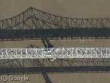
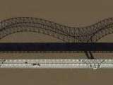
Follow the flow of traffic to the neighboring highways. You’ll see each bridge carries cars going one way.
There are 2 Bridges for the same road. Its called the Cresent City Connection. One goes West Bound, the other East. It was just a single bridge at 1 time. With traffic being a nightmare, they built another. So, there are 2 bridges for the same road.
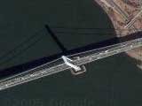
Similar to the Howard Franklin Bridge that carries I-275 over Tampa Bay.
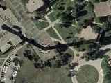
Another example is near Scottsboro, AL and carries route 35 over lake Guntersville. Unfortunately, Google has fairly low-resolution pictures of this region. You can still make out that there are two bridges though.
A long time ago, there was just one old bridge with two way traffic on it. Then they built a new, and much bigger, bridge and split the traffic between the two bridges. The plan was to eventually build two of the big new bridges and demolish the old bridge. However, to my knowledge, the old bridge is still functioning and will be for some time to come.
Incidently, the Bellefonte Nuclear Plant is just a bit North along the lake.
Google Maps identifies the Northern bridge as the HOV (high-occupancy vehicle, AKA commuter) lanes of US-90, but what do I know… I live in California.
I sent in this link soon after this site started, and I wondered why it took so long to post it since the shadow is so cool, but now I see that I didn’t get credit for bringing this to your attention. I raise this not because I wanted attention, but instead because maybe you never received my message and there was an error with your site submission page. Hopefully you didn’t miss too many other cool ones!
Some other cool things to note about this picture:
(1) Just next to the bridge, on the left, you’ll see the HUGE New Orleans Convention Center. And there are plans to expand it even more.
(2) This will seem counter-intuitive, but the area on the left is called the “East Bank” and the area on the right is called the “West Bank.” Because the Mississippi river zigs and zags so much, there are areas on the East Bank that are actually west of the West Bank. If you zoom out enough you’ll see that this has to do with the fact that the river runs more or less West to East near New Orleans, even though the river obviously runs North to South across the country. Also, this is caused by the river’s S shape, which is the reason that New Orleans is called the Crescent City.
(3) Scroll up the picture a little bit and you’ll see Jackson Square, which has been the heart of New Orleans since the City was founded in 1718. On both sides of the square are the Pontalba Apartments which were built in teh 1850s. They are the oldest apartment buildings in the United States.
-Jeff
Scroll up and zoom out (way out), and you’ll see the worlds longest bridge – the Lake Pontchartrain Causeway. 23 miles in all.
View Placemark
It’s so long they give up on high res in the middle of it.
Derek, we’ve already got a separate post on the Lake Pontchartrain Causeway.
the hov lane is only one lane that changes directions based on time of day is is only open during rush hour and only to buses, police and people who pay extra and meet the hov reqs
Jeff, I double checked the submissions database, and we do have your submission, so apologies for not giving you the credit 🙂 When we post a site we always search the database for other people submitting the same thing.. Not quite sure how I missed you on this occasion, my bad.
Anyway, thank you for the extra info – I’m updating the post 😀
I’m such a n00b
the south bridge is 4 east bound lanes to the west bank.. the north bridge is 4 west bound lanes and 2 hov lanes that switch back and forth for rush hour.. in the morning it goes west bound into the city and requires a toll tag (pre-paid) and cost $.40 to cross which is the same as the normal toll tag lanes.. in the evening to goes east bound and is free to anyone with 2 people in the car.. normal cash toll is $1.00 for the bridge… here some offical info from the CCC website
The Mississippi River Bridge Authority began construction on the first bridge in November 1954. The Greater New Orleans (GNO) Bridge over the Mississippi River opened for traffic in April 1958.
Construction on the GNO Bridge No. 2 began in March 1981. Traffic first crossed over the GNO Bridge No. 2 in September 1988.
Both bridges have been in continuous operation since 1988 as a unitary bridge facility having a total of eight general traffic lanes plus two Transit / High Occupancy Vehicle (HOV) lanes. This configuration provides four lanes from the East Bank (New Orleans) of the river to the West Bank of the river, four lanes from the West Bank of the river to the East Bank of the river, and two reversible HOV lanes on the route US 90 Business. The Crescent City Connection ranks as the fifth most traveled toll bridge in the United States, with the annual traffic volume exceeding 63 million.
Following a 1989 public contest to select a name for the bridges, a Louisiana Legislative Act officially designated the bridges as the “Crescent City Connection.” The Department of Transportation and Development (DOTD) unit, providing the operation, maintenance and policing of the Crescent City Connection, was then designated as the “Crescent City Connection Division” of DOTD