Weird Writing
Wednesday, 8th June 2005 by James Turnbull
Somewhere in the middle of Utah we find this giant writing overlaying the photograph (make sure to zoom right in - it's very big). The text reads "40 NAIP03 01026-44" so appears to be a unique tag for that section of the map and has been warped by the process of stitching the image to the adjacent photos.
Again in Utah there is a similar site although this second example has been partially obscured by the image tile above.
Thanks: Tony & Steve
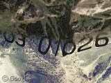
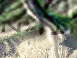
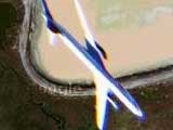
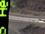
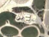
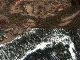
whats interesting about this is that the numbers appear to hug the terrain so there must be some form of 3D data being stored- which of course is the keyhole software – GoogleMaps2007 3D Edition Pro. Bring it on!
Or…They could be giant letters on the actual ground…hmm. But you can’t expect Google to proofread all the maps, how long would that take!?
There is another example just to the west at
View Placemark
and more such examples to be found at
View Placemark View Placemark
There’s also a very small black hole! And going west from the second writing there’s another one. I saw another one around there but lost the coordinates…
What the? I suggested something just like that…well, similar. All i want is to be appreasiated…(sob)
We’ve been tagged… Fcuk!
Well, googling a bit seems to lead to: http://www.apfo.usda.gov/NAIP.html which appears to be the pages for the US Department of Agriculter Aerial Photography Field Office’s National Agriculture Imagery Program (NAIP). Specifically the 2003 seems to be the 2003 set of images based on http://www.apfo.usda.gov/NAIP03%20Quarter%20Quad%20State%20Links.html
It’s probably just an identifier (like the “black holes” recently) on the original image that didn’t get replaced by other image data from other frames.
The texture is because the software that stiched the together probably takes into account a DEM (elevation model) so that things will stich properly based on their altitude. If you didn’t do that then two oblique images who have edges that need to be stitched will not line up properly
Since this is a defect in the image-stitching program, and not actual large type on the landscape, doesn’t this post belong more in “Weird” than in “Large Type”?
No, it has to be UFO’s Just like the orbs in Florida!!! There is no other explanation!!!!!
(Recycling from the “UFO” research) Keep in mind these images are purposely distorted to account for elevation changes and the angle the photo was taken at (or at least the angle of that portion of the original frame)
This article goes into some detail on the process.
http://www.esri.com/news/arcuser/1001/standup.html
Still an awesome find.
Good point Brandon – I’ve re-categorized the post.
There is a miltary base at this location…
Someone want to tell Google about all the stuff that people with an awful lot of time on their hands keep finding? 😉
Jason, I’m sure Google is watching.
/Big Brother? 😉
As someone pointed out, Keyhole integrates elevation (topo) data into its maps. This allows it to do a sort of mostly-3D view of an area (it only really stands out in canyons, though) using the Keyhole software.
01026 – 4440, clearly a long technical zipcode. 03 is for the year it was taken and Naip – is a city code it could only be for Naples – a city in Eastern utah, Check to see if it’s near any forests (Dinosaur National Forest) if so that’s true, this is what it’ for.
I cant help dat i fell from heaven it wasnt ma chocie, but yoo no.. the halo actally fits
hello there i like this web site there is not much more to say
recycling shuid happen or the world will be devasted with global warmin lol.
lil miss bennett ‘n’ lishman