More Scotch Tape
Monday, 25th July 2005 by Alex Turnbull
Remember our giant piece of Scotch Tape holding Canada together? Well our ever-helpful readers have since turned up several more pieces of this gargantuan sticky-tape...
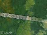
Firstly we have this enormous length of tape, which is actually holding Ghana and Ivory Coast together. Not high-resolution on this one, but at the eastern end the tape fades out rather prettily into some lovely clouds.
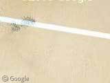
Next up is this semi-transparent tape stitching a large section of the Libyan desert together. Notice how all of these anomalies run at very similar angles across the images?
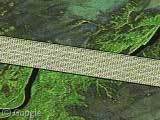
Finally we have this shoddy looking job in Russia, which appears to have required two pieces of tape to get the job done! I think their mistake was trying to tape water together...
Thanks: Dave, Winterfresh, Alxdr, mcb, blumentopf and MoonFella.


but seriously… what is it??
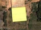
The last 1 kinda looks like a giant space snake decided to shed it’s skin on the satelite’s camera LOL
they are all roughly the same angle because they are perpendicular to the orbit of the Landsat satellite, which have an inclination of around 98 degrees. Landsat has a mirror that sweeps from side to side to image the ground under the orbit. The data from one or more of these swaths was obviously corrupted in these images, perhaps the swath wasn’t received properly at the ground station.
There are a variety of anomalies</a. that can occur in this kind of satellite imagery
Wow, it only took me like 10 submissions to finally have one accepted! 😛
thanx for the info pooms!
hullo,
i seem to see those above my head on a clear blue sky… could it be traces of aviation fuel in the high atmosphere ?
Nice catch as to them being at similar angles, and why. 🙂
A few more tape examples:
Saudi Arabia: View Placemark
Austrailia: View Placemark
Not certain if this one fits (shadow and all), but it’s at the correct angle. Over the Sudan: View Placemark
Original credit for these last few goes to various users over at Google Globetrotting (www.googleglobetrotting.com)
And one more just submitted over at GG. It’s darker than the others, being mostly over water, but is at the same general angle.
View Placemark
Oh. That last bit of tape is in Issyk Kul, Kyrgyzstan.
The other indication that these are the swath errors that I mentioned is that for some of them you can see a pattern of 16 lines within the “tape” if you zoom in to the maximum resolution. The Landsat satellite has 16 sensors that are exposed at a time when the mirror sweeps across. That last one is a good example, you can count 15 lines for sure, and given the alternating dark/white pattern you can assume that there is one more dark one that we can’t see, making up the 16.
Another one… Russia: View Placemark
There’s also some scotch tape with colored rectangles in Russia: View Placemark And there’s also a big scar all the way through Norway: View Placemark
I don’t think this explanation applies to the standard “scotch tape” artifacts…
But, the Kyrgyzstan instance: View Placemark
…looks very much like light reflected off the solar panels of a lower-altitude satellite. Since its body reflects relatively little light, it reads as black. Imagine a craft with a similar design to this: http://www.glonass-center.ru/satellite.jpg I don’t know how long or frequent the composite exposures are, but the trail is most likely an artifact of the foreground satellite’s own orbital motion.
What things about this: https://www.googlesightseeing.com/maps?p=&c=&t=k&hl=en&ll=55.047892,100.244064&z=12