Downtown Tokyo
Tuesday, 26th July 2005 by
I think this is downtown Tokyo. It almost looks like an isometric view because of the angle that the photo was taken at. You often can't tell the height of buildings when looking at them on Maps but this view illustrates just how tall these buildings really are.
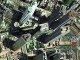
That’s Shinjuku. To the right, just past the seam between two images is Shinjuku station, the busiest rail station in Japan. The building just below and to the left of the triangular skyscraper in the middle of the image is the Tokyo Metropolitan Government Office (twin towers, 243 meters tall). There are restaurants at the top of that triangular tower, the centre of it is an atrium that goes most of the height of the tower! To the left of the triangular tower is the Century Hyatt, I stayed in a room there that faced west, over Shinjuku Central Park. Had a great view of Mt Fuji in the distance. Was surprised to see homeless people living in cardboard boxes in the park.
Here’s some info on the Shinjuku area: http://www.japan-guide.com/e/e3011.html
That’s Shinjuku, the hotel-and-nightlife area. I think downtown is farther east:
View Placemark
This is the Shinjuku Skyscraper District, according to Emporis.com. You can see the City Hall with it’s twin round towers towards the left of the photo. http://www.emporis.com/en/wm/bu/?id=104942
The building above it that resembles the Natwest Tower is the “Shinjuku Sumitomo Building”, and the one at the top with the green helipad is the “Shinjuku I-Land Tower” http://www.emporis.com/en/wm/bu/?id=105126 http://www.emporis.com/en/wm/bu/?id=104981
In the bottom left you can see the Opera City Tower, with the opera auditoria next to it: View Placemark http://www.emporis.com/en/wm/bu/?id=105067
There are lots more to identify. Sorry I can’t give a link to the page listing buildings in this district – Emporis don’t enable that on their public site at the moment 🙁
Yeah I was really surprised at the amount of homeless people in Shinjuku Central Park. But not just in the park. When you walk around the area at night you see lots of them sleeping on the steps of the stores. I’ve never seen that many homeless people in one area, and I live in New York!
I found it interesting that even the homeless still keep their shoes outside their cardboard boxes in a tidy neat fashion. Ive only stayed at the Keio Plaza and the Century Hyatt in Shinjuku, but the Century Hyatt definitely has more class then the Keio. Impressive
Bits of trivia: * Shinjuku Station is the world’s busiest rail station, with between 1.5 and 4 million passengers a day * The Shinjuku Park Hyatt was where Sofia Coppola’s ‘Lost in Translation’ was filmed.
By the way, another interesting one in Tokyo is Roppongi Hills: http://www.roppongihills.com/en/
The largest city redevelopment in Japan, it was completed a few years ago, with a 270m central tower containing business offices, a lookout gallery and an art museum.
Google maps seems to be a few years old, so you can see Roppongi Hills under construction: View Placemark
I think the angle of view makes this one of the best skyscraper shots in Google Maps. I have it as wallpaper on my desktop and when the shadows are adjusted in Photoshop it looks even more spectacular.
More information and fine photographs here: http://www.skyscraperpicture.com/TOKYO.htm and here: http://skyscraperphotos.com/
The ground view of Tokio City Hall is amazing.
Old buildings are OK but let’s hear it for the skyscrapers!
ooh I live about 4 drags of the screen (highest magnification) west of here.
Hey thats cool yongfook. I added it up, and at highest maginifcation I only live 335,346 drags east! We should hang out some time 🙂
It is good to see that Google Maps has now added maps of Japan to their service. Written in Japanese though…
I tried finding an address on it, but that didn’t work for me (using both English or Japanese).
Definitely one of the most enjoyable city shots I’ve seen so far, because of the angle. Is that a satellite thing, because Tokyo is so far from the equator, or are these more aerial photos?
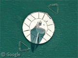
Speaking of Aerial, there’s a plane about to land at one of Tokyo’s many busy airports not far off:
View Placemark
I had always heard that Tokyo was crowded – but wow! How does anyone ever get around in this burg? I guess having a train station that handles 4 million passengers a day helps. 🙂
Otter
I think this is the plane link:
View Placemark
Oddly enough, there is a cargo ship almost directly underneath it!
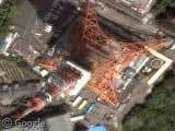
Does anyone know what this is?
View Placemark
It is located on the harbor just south of the city. Looks like there is some sort of mining going on just above it. I can’t figure it out.
Not mining, but storage. Looks like coal and.. iron? Maybe it’s a steel mill.
If you scroll to the east about 4 screens, you will find the Imperial Palace and Garden grounds. It’s a beautiful place to spend an afternoon wandering around… I enjoyed taking a stroll down memory lane by looking at the satellite photographs. Thank you!
The twin towers in the shot, bottom left, have viewing platforms in the top and the view is superb. This is the Shinjuku district and you can also see the ‘Empire State Vuilding’, a smaller copy of the New York ESB which is home to telecoms company NTT. Great shot. I love Tokyo and there’s quite a few pics on my website of some of my trips there.
I notice that tokyonodoko use similar picture in their flash presentations, trying to zoom down into tokyo suburbs. It very effective. someing about humans and see biuildings from on top. More so in Tokyo,