Haneda Airport, Tokyo
Wednesday, 3rd August 2005 by
This is a cracking shot of a plane coming into land at Haneda Airport (AKA Tokyo International Airport). By sheer passenger throughput, Haneda is the busiest airport in all of Asia and the fourth-busiest airport in the world, handling over 60 million passengers a year.
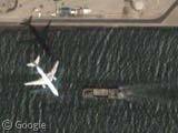
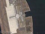
Looks like the Tokoname airport is just getting started when the area was shot.
linkie
Good find. Considering the hours I’ve spend panning around Tokyo and it’s wards I’m surprised I never found this.
Again, you can’t see it in Earth …
My house is a 20 minute drive from Haneda, but the definition of the photos in my area are kuso(shit in Japanese). Meh.
the google earth map is totally different (grass is greener) and the plane isn’t there! Why are the maps different?
All three runways have a red-orange thing going out into the water at one end. Does anyone know what that is?
Jarrod – My guess is, an extension of the landing lights.
Jarrod:
http://en.wikipedia.org/wiki/Instrument_Landing_System
Those light strips are not related to the ILS, but the ALS (approach light system). They help pilots line up with the runway when making their final approach in VFR conditions.
The ALS also works in conjunction with the VASI lighting system to help pilots find the proper glideslope and approach localizer when in the final moments of landing.
http://en.wikipedia.org/wiki/VASI
Here’s another, though not as clear as that one, on final approach to Atlanta’s airport.
View Placemark
the aiirport access is wicked cool — it looks like you drive into a tunnel, and surface in the middle of the airport. that is a neat idea.
the Haneda Airport link in this post is fragged.
Anyone else notice this extremely long tunnel that goes under the water near the airport?
This odd building sits in the middle of it, in the water that is. Any ideas what it is?
View Placemark
My guess is, that it’s some kind of ventilation system, maybe even emergency exit. There can be control centre together with the ventilation…
Thats really interesting that google earth has different maps than those on the internet. I suppose google earth’s images are older.
This long tunnel is “Tokyo Bay Aqualine”. http://www.nccnet.co.jp/english/introduction/tokyobay.html
One of the two artificial island is a ventilation system tower. https://www.googlesightseeing.com/2005/06/28/tokyo-bay-offshore-platform/ penta-ocean.co.jp/english/works/work_data02_08.html
The other (kisarazu artifitial island) is called “Umihotaru”.
the link that Gary Petersen posted scares me a little ( View Placemark ) you see the plane coming in on approach but if you look ahead just a bit you can see a plane sitting on the runway directly in front of the landing plane.
Isn’t that odd? I wonder if the plane approaching the runway isn’t higher up, as it doesn’t look all that well aligned with the runway centerline. It can’t be all that high up, though, as its shadow is pretty darn close to it. Weird.
Here’s another. This one, at Boston’s Logan International Airport, actually shows three planes, all on final to the same runway.
View Placemark
Scroll down and to the right and you’ll see two more planes.
Seems the view has changed and th eplane is not there anymore. But another high res view from an approaching plane can be found a few meters in the north: https://www.googlesightseeing.com/maps?p=&c=&t=k&hl=en&ll=35.578884,139.777658&z=19 you can even read the markings on the planes wing.