Strange Lines In Argentina
Friday, 19th August 2005 by
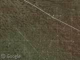
Does anyone know what on earth these strange lines are in Argentina? In places it looks like some kind of military bombing practive but then in other areas there are just geometric patterns. Very strange.
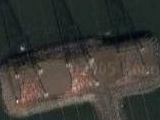
Update: So it looks like the grid pattern in the first image is the damage left from doing a seismic survey of the area, probably for oil. The strange network of lines in the second image is just the roads inbetween hundreds of oil wells.

Thanks: Patrick Martin & Dobermann35.


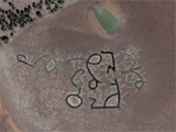
I am reasonably confident those are mines– at least, the latter ones are. Some sort of open mining in sporadic here-and-there clusters. Look at the high-detail section to the west, it’s more apparent there.
My interpretation is slightly different. There is some type of extractive process going on, but I would say it is oil/natural gas… The lines are service roads and possibly pipelines.
My thought was it was an oilfield and a search on the net found this shuttle photograph of the same region: http://eol.jsc.nasa.gov/debrief/STS108/landFiles/STS108-725-85.htm Note that it is labelled “Neuquen agriculture and oilfields.”
This view has a few more details and might give a useful insight.
Here are some grids of straight roads just to the west in hi res. I’m guessing they are access roads around mining leases or survey areas for exploration. Lets hope they don’t find anything or it might end up like this area away to the south, which shows an amazing mess of small open cut mines used to extract a particular type of gold deposit. Sure screws up the environment!
i live in argentina but have now clue of what those lines are.
View Placemark
Looks very very similar to:
View Placemark
What are they? Well, the latter are West Texas oil field pumps.
Yee haw. Looks like dem Argentines have struck black gold.
Those are pretty cool, I mean those must be some pretty big lines to be seen from that far out.
These are definitely related to oil and gas development. The USGS has maps of the Neuquen area in a pdf:
energy.cr.usgs.gov/WEcont/ regions/reg6/p6/tps/AU/au605511.pdf
The region in question has both oil and gas development. Blotches represent platforms or wells, radial patterns represent short pipelines to processessing facilities (water/gas/oil/condensate separation and/or pressurization?), and larger through-going white lines represent pipelines and pipeline parallel roads. The regional grid of NW-SE, NE-SW lines likely represents the path of large thumper trucks for a 3D seismic survey. The persistance and bright contrast of these “temporary tracks” might represent disruption of an ancient desert varnished surface formed in the rain shadow of the Andes.
More typical oil fields (lacking facilities for high pressure gas?) are found further west:
View Placemark,.287018&t=k&hl=en
These are starting to look similar to well developed fields in the western San Joaquin valley in California (following link) but will never have the same well density because of improvments in horizontal drilling techniques.
View Placemark,.143509&t=k&hl=en
I should clarify that the first image shows a grid for a N-S, E-W 3D-seismic-survey. The second image shows a similar grid rotated 45 degrees from this.
Here is an image with a labled seismic survey in Argentina: http://ww.satimagingcorp.com/gallery/landsat-well-recovery-2-lg.html
Here is an image of a planned high resolution seismic survey in the Neuquen area. The “source” thumper trucks follow straight lines regardless of terrain. In rough terrain they sometimes have to go out of their way to reach those straight lines. Explosives placed in shallow (50 foot) drill holes are used in very rough terrain. The drill rigs for this can be moved by helicopter.
http://ww.satimagingcorp.com/gallery/ikonos-argentina-lg.html
A detailed seismic survey will be the first action in ANWR if it is opened up.
Is there a DMZ file available for this?
There is a similar structure in down under, obviously some mining activity: View Placemark
Similar in Alberta Canada. Pipelines.
you are all wrong. Those are God’s lines of coke, waiting to be snorted.
The oil theory must be right, I heard on the BBC WS (The World Today 21 Aug 2005) that Argentina was forced to hold oil exports for some amount of time due to instability in the region. I knew Argentina had beautiful women and #1 export was beef but I had no idea they were a big oil producer. Maybe this is where that oil comes from after all (or not coming from right now)
First shot is seismics investigations profiles – it is used to deploy sensors on ground which are registering sesimics (acoustic) waves from explosion or special vibration vehicle
Secon shot is oil wells clusters
This picture is the same as could be observed in Western Siberia oil provinces in Russia
http://maps.google.com/maps?q=denver+city,+tx&spn=0.143381,0.240704&t=h&hl=en The second link looks just like the oil fields of West Texas around Denver City and Plains.
i lives here. It`s a petrol region. The lines are roads that conects the petrol pumps.
Looks very very similar to
View Placemark
Are oil field pumps at Mossoró, Rio Grande do Norte, Brazil
hahAhAHaHaHhAa TIENEN MIEDO !!! TENGAN MIEDO… LOS DUEÑOS DE LOS POZOS QUE AHI MUESTRAN, SON AL-QAEDA Y COMPAÑIA TEMAN YANKIS FEOS
bueno lo q se ve es realidad son pistas para ovnis sisi lo crean o no asi es a una amiga la secuestraron y la levaron ahi esto es una historia veridica, le pusieron sondas y todo eso
it may be late now, but I should say that the oil theory is true. The place we see is called Rincon de los Sauces. Is an oild field property of Repsol YPF (YPF was the national oil company until president Menem gave it to Repsol for a little money). Argentina is not an important country in oil busissness (not like Venezuela for example) but we have enough for the country. Anyway, we see who this spanish company takes the oil and sells it for a lot of money.. money that goes o Spain… unbelivable….
I apologie for my terrible english.
Bye
Northwest area of Neuquen Province is a very rich area in gas and oil. This picture shows old oilfields (the small squares) and the road/ways betweek them.
I am from Neuquén City.
Hi,
It’s an old “cigüeña” (english:stork) pumpjacks field.Oil companies use them for pump the oil or gas from the underground. Some “lines” are roads or pipelines.I worked 15 years ago in this zone, (Near Catreil Town, provincia de Río Negro) making a documentary for an energy company.
That’s where they take salt, ignorants, had to be yanquees
this is an oilfield.. look at the permian basin in west texas, and you will see simillar lines. you can even see tanks in thinks if you look closely enough.
two (maybe 3 ) words naz.ca.
Seems to be a big HAARP field