Joint Security Area
Friday, 30th September 2005 by Alex Turnbull
When North Korea, China and the United Nations Command (UNC) signed the 1953 armistice which effectively ended the Korean War, they did so in a village called P'anmunjÅ?m. After the cease-fire was signed, construction began on a site located about one kilometre east of the village, the Joint Security Area (JSA). The three blue buildings straddle the border between North and South korea, and were designed and built by the UN to allow delegates from North Korea to enter one end, and delegates from South Korea to enter through the other. All meetings between the two countries have taken place in the JSA since its completion.
History lesson over 😉 If you'd like a more complete lesson, try the Wikipedia pages on the Korean War and P'anmunjÅ?m.
Thanks to Andry.
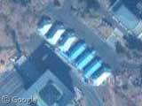
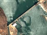
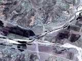
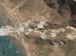
Nice find. For the level of strife and military tension still existing on that border, the border itself is almost invisible to the naked eye. I would have expected such a fortified border to be clearly visible.
It actually is in most other places. there’s such a build up of military arms next to the JSA though, that the landmines are really needed. if you follow the border at the west coast though, it’s clearly visible for quite a ways. there’s about 50 yards thick of land mines between two fences, so it’s not hard to miss.
Just wanted to point out that North Korea and South Korea are technically still at war. They are just exercising a negotiated cease fire. No peace treaty has ever been signed.
Andy! My name was ANDY! ANDRY WAS A TYPO! 😉
JSA is also a really good Korean movie. I recommend it.
i’ve been there! but i cant get the link to work
6 replies and not a single MAS*H reference yet. 🙁
For the most part, the border itself (called the Military Demarcation Line, or MDL) is almost invisible, even when you’re right on the ground. The MDL is marked with fairly small yellow and black signs every 200 meters. In some areas there are a few strands of barbed wire strung between the signposts, but much of the wire has rusted away since the end of the war. Likewise, many of the MDL signs have fallen (literally) into disrepair or are obscured by brush.
The Demilitarized Zone (DMZ) extends 2000 meters to the north and 2000 meters to the south of the MDL. (The DMZ turns to the south in the Panmunjom area, so the edges of the DMZ are actually to the west-by-northwest and east-by-southeast of the MDL there.) Landmines are banned inside the DMZ, and the total number of armed personnel inside the DMZ is limited by the armistice agreement, so the minefields and manned outposts along the DMZ are actually outside the 2000 meter distance from the MDL. These edges of the DMZ are fortified in a number of ways, such as the aforementioned minefields, but also consist of tall chainlink fences topped with concertina wire, and, in some locations, ditches and tank walls. These areas are actually quite easy to spot on Google’s satellite photos, such as this area along the southern border of the DMZ and this north-south tank wall on the North Korean side.
What’s also amazing is the amount of fortification that extends throughout the Northern portion of South Korea. I lived in a city that was less than 30 miles from the DMZ. All of the ridge lines had a system of trenches and bunkers. The road and rail bridges were built in such a way to easily destroy them with explosives. Also, there aren’t any large modern highways until you get south of Seoul. All in an effort to prevent the North from just steam rolling right on down the country.
Another way to distinguish the border between the two countries is to look at the amount of vegetation on the mountains and hills. In the North they have virtually exhausted all of their forests to be used for either heating or building and never bothered to replant new trees so the terrain looks relatively barren compared to just a little farther South.