Power lines
Thursday, 15th September 2005 by James Turnbull
Six huge towers hold power lines crossing the Saint Lawrence River, they're quite cool. If you follow the lines to the north you'll find another six not-so-huge towers as the lines have to cross another part of the river. Now who can be bothered following them all the way to the power plant? 😀


View Placemark
oops i meant View Placemark
Is that the powerplant, mark? Looks like vegetarian pasta to me.
Yes, Mark show us the Churchill Falls power plant in New Foundland. Almost all electricity produce there is transporte in Quebec by this really long power line.
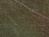
At first i thought the line heading off to the south west was an imaging anomaly but it soon becomes apparent is is the power lines – or more to the point the area cleared below the power lines. It is amazingly straight and doesnt seem to have any deviation to account for the topography or the natural environment. Some achievement!
I followed the lines north and arrived here: View Placemark
I followed the lines south and gave up after a couple of hundred miles! It sure is a Big Country.
Wow, those are some large power lines. They’re easy to follow once you get further inland… the construction people conveniently cut a huge swathe through the trees so that GoogleMappers could see more easily. It also seems apparently these power lines service a lot of speed demons. They pass right by a go-kart track here: View Placemark As well as a dirt bike track further down, here: View Placemark
I arrived at the same northward destination that Graham did (although the lines split up in a few locations), but it seems like the lines continue for many more miles… they re-emerge into high-res after awhile, so I’m still exploring.
Hydro-Québec TransÉnergie is a leader in transmission system design, operation and maintenance. It operates the most extensive transmission system in North America, with 32,539 km of lines, 18 interconnections allowing power interchange between Québec and the systems in Labrador, New Brunswick, Ontario and the U.S.Northeast, and more than 500 transmission substations.
see: http://www.hydroquebec.com/transenergie/en/reseau/pdf/carte_reseau.pdf
For the record, all other high-tension power line trails in temperate North America look like that when they run through a forested area:
In some areas like mine, some of the power line trails double as public walking/biking trails. No, I don’t know if there is an increase in cancer cases as a result. The BPA Trail south of Seattle is such a trail; it can be a little unnerving taking a leisurely walk under buzzing and crackling power lines, but it’s still a nice use of utility-owned space.
This power line showed here is one of many power lines coming out of Churchill falls, this is at Lévis(Qc) on the other side of the Saint-Lawrence. The island is L’ÃŽle D’Orléans and on the other side ofe the rive is Saint-Anne-De-Beaupré. Unfortunatly lighting doesn’t show it but the towers(of the same power line) at Saint-Anne are much more higher and impressive the those at lévis. But if you want impressive power-lines; you should go at Radisson(Qc), it is where the road stops up north(^^). And it is also where the ”Complexe La Grande” begins.( http://www.hydroquebec.com/sebj/fr/lagrande.html ) Here’s a little site explaining the complex, in french of course… but maybe is ithere something in english on google, try to find out, fact it this is the biggest power source in Quebec!
in french of course… here is the english link
http://www.hydroquebec.com/sebj/en/lagrande.html
and here is the link for HydroQuebec for those who would like to know more about this incredible power network.
http://www.hydroquebec.com/en/index.html
note that hydroquebec is a societé d’état
Aaaand here’s a link to Radisson, as mentioned above:
View Placemark
Here’s an overview of the Complexe La Grande:
View Placemark