Lake Michigan Water Pumping Station
Tuesday, 11th October 2005 by James Turnbull
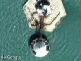
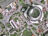
A couple of readers pointed out a cool-looking pumping station (in the thumbnail) and another not-so-cool one, both in Lake Michigan. Presumably they are both involved in pumping water towards the nearby city of Chicago; Lake Michigan is the largest freshwater lake in the US and supplies the drinking water for some 10 million people.
Strangely both pumping stations come with a free plane passing overhead. What's the chances?
Thanks: Jason, Stuart Reid, john, Phil, David Youse
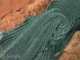
Here’s another pumping station somewhere between the two. No plane, but a mismatched image seam adds a bonus piece to the installation. View Placemark
Possibly the same plane? That must be a small plane based on the size of the image.
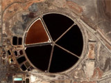
Did anyone else think he was looking at a golf hole in that picture? 🙂
Actually, the approach to O’Hare from the east is over Lake Michigan, so the chances are pretty good of spotting a plane in that area.
Google resulted in the following links which provide more information about these water intake “cribs”:
http://www.gapersblock.com/airbags/archives/the_lake_michigan_cribs/ http://www.unc.edu/~rowlett/lighthouse/photos/WilsonAveCrib.htm http://www.unc.edu/~rowlett/lighthouse/photos/4milecrib.htm http://www.unc.edu/~rowlett/lighthouse/photos/68thStCrib.htm http://www.lindahall.org/events_exhib/exhibit/exhibits/civil/lake_tunnel.shtml http://www.encyclopedia.chicagohistory.org/pages/300017.html#200310
Everyone is aware of how the maps changed a week or 2 ago (the local bar on the left instead of right and tighter integration with local search). But I just noticed this. Now it may be old news to some, but I was suprised when I saw it. If you search for an exact address or location (ie city and state) then the map now takes up the entire lower portion of the screen! No more bar on either the left or right side!
Example:
http://maps.google.com/maps?q=212+Elm+Street,+Somerville,+MA+02144&spn=0.005450,0.012771&t=k&hl=en
Anyway sorry if everyone knew that already, it was news to me!
Yes, those are cribs, and they are where we Chicagoans get our water. There are, in fact, three – the third is more centrally located on the city but is in the low-def area:
View Placemark
As for the plane, the odds do seem low. And it looks kinda like the same plane. And it’s a weird shape for something that small – it has the silhouette of a passenger get, but the cribs are only the size of a big house; for instance, the bridge between the intakes (the round part) and the artificial island (the hexagonal part) is only a single-person catwalk. And, if you look at the third crib (above) there’s a dot next to it – another plane?!
One of the cribs has a webcam that is updated every hour looking at the Chicago skyline. http://www.glerl.noaa.gov/metdata/chi/
Here is another one with some mis-alinment problem View Placemark
Nitpicky: Lake Superior is actually the largest freshwater lake – according to one quickly-googled website the water in it could fill all the other great lakes plus 3 Lake Eries.
where is lake erie loacted and pollution on lake erie