The White Sands National Monument & Missile Range
Wednesday, 12th April 2006 by Alex Turnbull
This is the utterly bizarre, and totally incredible White Sands National Monument in New Mexico, USA. The monument is the southernmost part of a 710 square kilometre (275-square mile) field of startlingly white sand dunes, which are composed of gypsum crystals which are water soluble, but as there's no sea outlet, all the dissolved gypsum from the surrounding mountains collects here instead.
You can picnic, sandboard, and take guided orientation and nature walks here, however I'm pretty sure the guides won't let you wander too far, as the monument is within the White Sands Missile Range. They actually close the monument to the public roughly twice a week to conduct tests! The most famous weapon tested at this range was the first ever detonation of an atomic bomb on July 16, 1945 - the infamous Trinity Test.
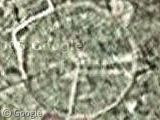
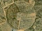
The brand-newly launched Yahoo Maps Beta has some stunning high-res images of the test site (and some very nifty features too). Compare the Google image with the Yahoo one:
We look forward to receiving a deluge of Yahoo Maps submissions!
Thanks to Allen Ormond, Shital Shah, Richard, Tim Gregory, Int13, Tyler, Richard Rowley, Kyle, Jeff, Mike, Earl, Alan, Steve Ransom, Rob Marshall, Bruno, Matt Musselman, Mr. Putty, an MP, woowoowoo, Percel and Matt



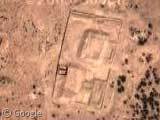
They let you walk around pretty much wherever you want. There is a fence at the edges of the public area (which is quite large; I’d estimate that it’s more than half of the total area of white sand). It’s easy to get lost if you aren’t on a marked trail (marked with reflective blaze orange plastic stakes every couple hundred feet or so) though, so if you don’t have enough water or a jacket (to protect your skin in case the wind picks up and you get sandblasted) it can be pretty rough.
Looking at the images more carefully and remembering the times I’ve been there, I think the public area is just under 1/4 the total are of white sand, but it’s still a really big area that you can’t totally explore in two days.
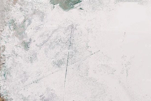
While I’m on a posting storm, people should zoom out some and move north to the big black stripe. That’s the Valley Of Fires National Monument. There was a slow volcano at the north end, and the lava slowly filled the valley. You can camp and hike around up here: View Placemark
Thanks for the post, and thanks to Jarrod for recommending Valley of Fires… two places I didn’t know anything about! I’m moving to New Mexico (Albuquerque) in a few weeks, and these are some sights I’ll definitely have to check out!
The link in the post for the Trinity Site is wrong (though the thumbnail is correct). The Trinity site is a smaller circle northeast of the circle the link shows you. Here is the correct link: http://maps.yahoo.com/beta/#maxp=location&trf=0&mvt=h&lon=-106.475833654404&lat=33.6772560484859&mag=2
Thanks for that Jarrod, now fixed. And btw, the valley of fires looks incredible… and even more incredible, no one has ever submitted it! I feel another post coming on 🙂
I grew up in El Paso (Texas) and we went to White Sands quite often when I was a kid. Closest thing we had to a beach, being about 700 miles from any ocean. Here’s a photo at ground level taken almost 40 years ago. Thanks for the memories.
If you guys are gonna take Yahoo submissions, are you going to take Virtual Earth/Live Local?
Matt, we’re happy to take submissions from WLL too 🙂
Oh, and while you’re in New Mexico don’t forget to visit the GINORMOUS military runway. Freakin’ huge.
View Placemark
Wow, that is Ginormous! Anybody know what that “runway” is called? And what on earth it is used for?
Here’s a couple other views of it…
Yahoo Maps: http://maps.yahoo.com/beta/#maxp=search&trf=0&mvt=s&lon=-106.573176383972&lat=33.1828902878847&mag=3
Windows Live Local: http://local.live.com/default.aspx?v=2&cp=33.185261~-106.573863&style=h&lvl=15
That runway might be the backup strip for the Space Shuttle to land on. There aren’t very many buildings nearby, so it’s probably not used very often (which would make sense).
A closer look is here: http://maps.yahoo.com/beta/#maxp=location&trf=0&mvt=h&lon=-106.573348045349&lat=33.1835727090714&mag=4 The Cape Canaveral landing strip is longer: http://maps.yahoo.com/beta/#maxp=location&trf=0&mvt=h&lon=-80.6949663162231&lat=28.6143259656751&mag=4 Since I can’t find another landing strip of reasonable size on the missile range, it probably is the backup shuttle landing strip (I know there is one somewhere on WSMR).
Apperantly this is the back up stip(s) for the shuttle (White Sands Space Harbor), at an increadible 35000ft long it dwarfs the previous stip. Looks to be about 3-4 times longer. Wow! http://maps.yahoo.com/beta/#maxp=search&trf=0&mvt=s&lon=-106.416664123535&lat=32.9428884300419&mag=4
Here’s some more info: http://www.wstf.nasa.gov/WSSH/Runways.htm
I still can’t seem to find any info on the other “strip.” http://maps.yahoo.com/beta/#maxp=search&trf=0&mvt=s&lon=-106.573176383972&lat=33.1828902878847&mag=3 Although, after looking at it again, I’m pretty sure it’s not even an aircraft runway at all. Not really sure what it is. Anybody else got any ideas?
It looks like a long water reservoir to me. It probably feeds the entire base with the drinking water necessary to survive out in the desert. There aren’t any lines painted on this “runway”, which would be against standard protocol, not to mention unsafe.
white sands also housed some Japanese-American interred Prisoners during WWII, a family friend’s father was there for a little while, though it wasn’t an offical relocation camp.
I love how we used the term “relocation camp”
I agree with Geoffrey. It just doesn’t look like a runway. There are buildings and stuff on both ends and I can find absolutely no typical markings. Compare it to other airfields – even Area 51 has more obious, regular marked runways. A water reservoir or something like that seems quite possible to me – although I don’t think they would allow such a huge surface of water to evaporate.
How true, Nigerache, how true.