Tehachapi Loop
Monday, 3rd July 2006 by Alex Turnbull
The Tehachapi Loop is a railway line through the Tehachapi Mountains in south central California, connecting the San Joaquin Valley to Los Angeles via the Antelope Valley. In its day it was hailed as one of the greatest engineering feats and is the world's busiest single-track railway line.
The particular loop shown is such a tight turn and the trains are so large that the engine at the front actually passes over the rest of the train. Prety cool. More pictures and information over on wikipedia.
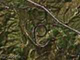
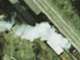
This looks much better on Yahoo Beta maps. You can even see a train going over itself on the loop.
http://maps.yahoo.com/beta/#maxp=location&q1=tehachapi%2C%20ca&trf=0&mvt=h&lon=-118.53659&lat=35.200333&mag=2
Wow! Nice one tt. Hopefully Google will license this increased resolution imagary soon.
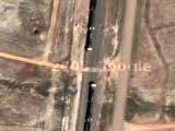
I used to run street-legal road rallies in the area. Just to the northwest of this loop, there is a spot where the trains did a ‘z’ over the main road. You could get caught behind the same train twice (especially since they move very very slowly going up that hill). Here you can see Yahoo Beta maps has caught a train blocking the road twice at the very spot I mentioned above.
http://maps.yahoo.com/beta/#maxp=location&q1=tehachapi%2C%20ca&trf=0&mvt=h&lon=-118.627367&lat=35.289829&mag=2
If you are ever in the area, the run up Caliente-Bodfish road to Lake Isabella is a joy to behold. If you have any sort of sports car on this road, your heart will sing! Follow this road in the link above to the north and east (right and up) and you’ll see what I mean. Once you get to Lake Isabella, chase the river back down to Bakersfield using 178 to the southwest (down and left). Incredible drive. Jaw dropping incredible drive. Scenery is alright, but the drive… ohhh, the drive!
wow, I magnified the picture, it is fantastic
The only spiral in the UK is on the Ffestiniog Railway, a preserved narrow-guage railway. (I’m posting Live Local as Google doesn’t have the images yet): http://local.live.com/default.aspx?v=2&cp=52.960152~-3.969372&style=h&lvl=17&scene=4146283
The Dduallt spiral was built by volunteers in the 70s to give the extra height needed to avoid a new hydroelectric scheme (the reservoir can be seen north of the spiral).
In British Columbia, Canada, there are twin Spiral Tunnels. The sat image isn’t high res, but is the link is
View Placemark
If you know what you are looking for, you can trace the cut in the trees where the rail line is.
There is a detailed topo map of the tunnels at
http://railways-atlas.tapor.ualberta.ca/cocoon/atlas/Maps-14-1-9/
as well, Wikipedia has info
http://en.wikipedia.org/wiki/Spiral_Tunnels
as well as a cool shot of a train entering and exiting one of the tunnels over itself.
http://en.wikipedia.org/wiki/Image:Power_exits_Lower_Spiral.jpg