China’s Scale Model
Sunday, 6th August 2006 by James Turnbull
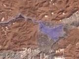
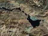
A while back KenGrok over at the Google Earth Community was browsing China's Huangyangtan region and discovered a scale model of Aksai Chin - a disputed terrain on the Chinese / Indian border.
Australian paper The Age did some proper journalism (by using a telephone rather than searching Google) and they discovered that the area isn't that much of a secret. In fact, the authorities were happy to admit that the scale model has been there eight or nine years and is used to train tank drivers.
With that we thought the story was dead, but it's all over the place again so it's about time (ie 2 weeks late) that Google Sightseeing got in on the action.
Here's the model.
And here's the area it represents.
Thanks: Rich, Viper007Bond, Belbo, Gary Shell, Gesh & tt.


Tank training? So do the tank drivers negotiate the terrain in teeny tiny scale model tanks? Not bloomin likely!
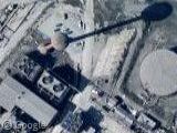
There does however seem to be a lot of vehicular activity in and around the complex.
This really fries my head – what ARE they doing???????
I think they might use it as a scale model for a camera to be displayed on a screen in a tank simulator, making it seem much more real than computer-generating the graphics. Similar stuff is sometimes done for flight simulators, moving a small camera through a cityscape. However, I’ve never heard of anything this big, and I don’t know how they’d move the camera. There may be an elaborate system of cables we can’t see.
Or maybe, just maybe, they’re developing some top-secret REALLY HUGE TANK for the next invasion… something “to scale” ya dig?
maybe…
there are 150 trucks parked by the location, do you think they need ~6000 people for just creating simulation?
The trucks are parked behind a series of buildings. Official looking ones to the south facing the entrance and barracks like ones behind them creating a square.
If I was looking at this without context, I would say it looks like a school.
6000 people sounds about right for a tank division.