Wake Island (Island Week)
Friday, 1st September 2006 by Alex Turnbull
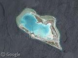
Located in the North Pacific Ocean, Wake Island was an island of great strategic importance during World War II, and over the last few days it's been in the news again, as is it was directly in the path of the oncoming Hurricane Ioke - the strongest hurricane ever recorded in the Central Pacific.
Fortunately all 188 people who live here were evacuated safely by plane before the hurricane arrived, but at around 6am yesterday (August 31st) the island's automated weather station seems to have stopped functioning just before the southwestern eyewall passed over the island.
Some of you PC gamers might well recognise this place, as it's a map in both Battlefield 1942 and Battlefield 2! So perhaps those people can tell us what this strange thing is, or if in fact this really is a bridge which has been partially washed away?
Thanks to Reek of Putrefaction, Roy and Lee Bennett.
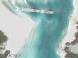

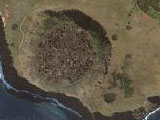
The Peale Bridge burned to the waterline a few years ago (2004?). It was wood, and someone left a cigarette on it.
You can see still see the posts in the Google photo. Not sure what that is to the north.
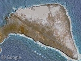
And that sight on Wilkes Island is probably the remains of Battery L, which originally consisted of two 5″ guns.
FWIW – the links to what Jed believes is the Peale Bridge needs to be fixed. It currently is the same link as the Battery L remains.
Ah, well spotted Lee, now fixed, cheers.
A bit off theme, but does any avaition expert know why a runway such as this was built in the direction it was – not parallel to the coast?
The runway was built that direction because it’s the only place on the island with a long enough platue for 9000 feet of strip. The island is appx 2 miles long and 1/2 mile wide
I’m not an aviation expert, but runways are built by taking the usual local wind patterns into account – planes can take off and land in shorter distances if they are pointing into the wind.
I’m not an aviation expert, but my grandfather was a SeaBee (Naval Construction Battalion) in WWII, and he told me about how they would build airstrips on islands such as this. While this is probably not the original runway material (they used metal mats that could be readily replaced after an attack), it is probably built over the first one. They would have laid it the direction they did for 2 possible reasons — 1. Take advantage of prevailing winds for takeoff (planes sometimes left with max loads of fuel and ammo for long-range missions, and there was no mid-air refueling those days) and 2. Lay the runway in such as way that the least amount of material would have to be moved in or out to level the field — that meant it was completed faster.
The SeaBee’s are really unsung heroes of the Pacific Campaign during WWII — they often went in while the battle was still being fought to start work on the airstrip and other facilities — shovel in one hand, rifle in the other.
Thanks – I guessed wind factor.
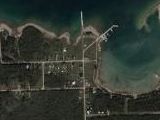
I think that you can see some evidence that the wind does blow parallel to the runway. First of all look at this pattern of sand: https://www.googlesightseeing.com/maps?p=&c=&t=h&hl=en&ll=19.288401,166.647255&z=18 It could be a snadslide, but my guess is the sand blew this way because there are no plants to hold on to it. Then there’s the way the water flows around this rock: https://www.googlesightseeing.com/maps?p=&c=&t=h&hl=en&ll=19.270369,166.657469&z=18 Finally, there’s the soft sand beaches on this side of the island, which we’re assuming to be in the brunt of the wind: https://www.googlesightseeing.com/maps?p=&c=&t=h&hl=en&ll=19.289616,166.653457&z=17 Compare those beaches to the side of the island that must be sheltered from the wind: https://www.googlesightseeing.com/maps?p=&c=&t=h&hl=en&ll=19.276451,166.641666&z=17 Wind erosion, d’you think?
Would anyone care to argue with me on these points, or maybe find more evidence?
I’m not an aviation expert 😉 , but I totally agree with the wind theory. It could also have been because of geological problems (terrain, elevation, …) or obstacles which could have been dangerous for flight operations. Note that the position and orientation of the runway has not changed since WW2.
Nice island, nevertheless! I would love to spend my holidays there.
The “strange thing” in the picture to the north of the burned-out bridge is an old concrete bridge dating back to the war. Possibly a Japanese contruction. It lies mostly under water now. The cool, dark spaces under the arches are a great refuge for fish on hot days.
Captain Jack is correct on being an old world 2 bridge. I spent a year on Wake in 64 & 65 at the USCG Loran Station. Explored every inch of that island.
The structure you see is the old concrete bridge build during WWII. I is a serious of arches with a concret bed. I was there in 2000 for 6 weeks and most of the bridge was under water. We used to snorkle through the arches and I did a lot of under water vidio of eagle rays and other fish.
The island is really 3 different islands seperated when the tide is in. The runway was build on Wake because it was the longest of the islands. Wilks Island is off the end of the runway. The island that the bridge went to is Peale Island.
Wake was a loran station in the 60’s and had a large military population and ever had a school for grades from 1 to 12. I was controled by the Army up until 2001 and then the administration was taken over by the Air Force.
Before the WWII it was a stop over for the Clipper’s making the trans Pacific flight from San Francisco to China. You can still see the concret ramps and the pillers for the docks. There was only one gun inplacement left from WWII on the island. Also, Wake has it’s own bowling Ally, considering it is 3000 miles west of Hawaii I thought that was cool.
with a little more research you may find that the smaller more erroded beaches are on the windward side of the island. The larger soft sand beaches are on the lee (non windy) side of the island
A couple links to sites with information about the damage inflicted on Wake Island after Super Typhoon Ioke hit, including some preliminary pictures taken from the air. The damage to the island was reported as “moderate” and far less than expected under the circumstances. The damaged structures appear to be repairable and a ship was set to sail to the island on Sep. 4th out of Hawaii to do a thorough assessment of Wake. The Hercules C-130 that flew over the island for the preliminary assessment could obvoiusly not land on the runway without a thorough inspection on the ground.
http://www.wptfan.com/article.php?story=20060904232955281 http://www.af.mil/news/story_media.asp?storyID=123026374
The concrete slab between Wake and Peale is a causeway that was built by the either the Americans or the Japanese during WW II. It had a flat surface so vehicles could cross from one island to the other. At some point it was bombed out by either the side. I lived on the island from 1965-1968 and as a small boy one of the rights of passage was to walk down the beach from Drifter’s Reef and swim to the causeway. It was quite challengeing when the tide was racing in or out and God only knows what would have happened had we been swept away. The other challenge was to jump off the wooden bridge which was about 20 ft off the water and swim to shore. True..thebridge did burn down in 2003 and the Air Force or Army was debating on rebuilding it soon. Don’t know what plans they have now.
They tell me a dog was left on the island when it was evacuated and it was found, much to the owner’s and his friend’s joy, still alive afterward.
I was there for a year with the Air Force 6/88 to 6/89 as a Civil Engineering QAE. I’m surprised the bridge had time to burn down, Wake had a very effective fire dept. We (The 8 Military) had a club house where the Pan Am clippers came out of the water to parke on their apron. It was nice for a while, but by the time my tour was up I was really ready to leave.
Can anyone who’s been to Wake tell/show me where the 98 Rock is located on the island?
The 98 rock is on Wilkes Island. From Wake Island go past the runway, around the man made harbor area, and just as you come to the fuel tank farm you will see on the right hand sign a sign which points you to the rock. It is on the harbor side of the island. Before hurricane Ioke the Thai people who live on the island used to maintain the 98 rock area. They has a rock trail that led down to the rock from the main road. Further down from the rock is a beautiful bird sanctuary where there were millions of birds before Ioke.
There were floating drydocks in WW2 my father was construction battalion befor there were ever Sea Bees. He was at Sampson NY for 12 weeks and helped build the base there. Now its a museum. Then to Great Lakes in Michigan for more training . He was sent to the west coast from there he was at Hollandia Mandus , Los Negros finally Dutch New Guinea. One lake he remembers is lake Sentani. But this lake is in northern British New Guinea. I am looking for photos of planes in trees. The runways were built so our planes as they ran out of fuel getting back to ship wouldnt crash into the ocean. Building the airstrips saved countless lives. Please search another web site it might help all of you. http://www.pacificwrecks.com Any info for me send to 1123 S. Main St Elmira, NY 14904 OR if your family served with a Tostanoski in the war. Thankyou
I worked on Wake Island from 1991 until about 2 weeks ago. Typhoon Ioke pretty much left the island a mess but all the historical sites are undamaged. The end of Peale from the Loran Station out to the point was completely underwater. The hill which the big gun sat on washed away exposing an octogon shaped base made of steel roughly 40′ in diameterand 10′ high. I have a disc with a hundred or so pics on it. I would gladly make copies and mail to you.
Dear Mr Lumia, I might be interested in the disk of Wake Island photos you mention. How can we get in touch?
Wow! It’s great to stumble onto a site like this and read comments about Wake Island from other people I lived on Wake as a child from 1960 to 1972 and know about every inch of that Island. As other people have mentioned that long thin strip you see in the photo is a concrete causeway that once linked Wake and Peale Island. It was built by the Japanese during their WWII occupation to transport tanks, vehicles, and materials between the two islands. Part of the structure was bombed by the Americans during their bombing “practices”. The Japanese could offer little defense since they were effectively cut off from receiving any supplies. On another note, I am the founder of the Wake Island Spirit which brings together former Wake Islanders. I’ve been organizing reunions since 1992 which have been well attended. There will be a reunion this year in Branson, MO for anyone interested in attending. You can contact me from either of the following websites:
http://groups.msn.com/WakeIslandSpirit http://www.wakeisland.ws
To Gary Lumia: I would be very interested in obtaining a copy of your Wake Island photos. They’d be of great interest to the Wake Island Spirit members. Mahalo!
I was a B-29 crew member in the early 50″s and twice stopped at Wake for fuel. Then, after college I went to work for Pan Am and they sent me to Wake In December 1964. I was there until Jan. 1966. Prior to WW II Pan Am ran Wake. The Pan Am manager was also the official Federal Government administrator for Wake. There had been a Navy rescue outfit at Wake but they left just before I arrived. Periodically they sent people up…I think from Iwo. When they were permanent there they operated a tiny radio station…WAKE. Because I had worked in radio and TV in college as well as at a commercial station I fired up the equipment and when I had time I would broadcast news and play records. If I recall correctly the bowling alley then was owned by a Chinese man and I think there was only one alley….maybe two. I have a lot of memories of Wake.
My father, Jerry Burris was the Commissary Mgr at Pan Am on Wake for three different time frames. We were all there in1960-1963. Al Ching was the owner of the bowling alley, and it has more than two lanes, actually six, as I remember. Lastly, the school went to 9th grade, after that you has to go off Island for school. I was the class president of the 9th grade graduating class, all 8 of us. Tony Burris
TO ALL: I AM RETIRED ARMY AND AM RESEARCHING M.I.A.’S ON WAKE FROM WORLD WAR II. ONE OF THE GREATEST MYSTERIES TO DATE IS THE POST WAR EXHUMATION PROCESS OF WAKE’S MILITARY AND CIVILIAN DEAD, AND THE LOCATION OF THEIR ORIGINAL BURIAL LOCATIONS. IS THERE ANYONE WHO LIVED, WORKED, OR SERVED ON WAKE AWARE OF WHERE THE BURIAL SITE(s) WERE?? THE NAVAL HISTORICAL CENTER, THE MARINE CORPS HISTORICAL CENTER, AND THE QUARTERMASTER SCHOOL ( GRAVES REGISTRATION) AT FORT LEE CAN SHED NO LIGHT ON THE SUBJECT. I AM REASONABLY SURE THAT THE REMAINS OF FOUR MARINES, AND TWO NAVY AIRMEN ARE STILL ON WAKE- UNKNOWN AND OVERLOOKED POST WAR. IF SOMEONE DOES KNOW, I ASK THAT THE INFORMATION BE SPECIFIC- AN EXAMPLE ONLY FOLLOWS: “WAKE ISLET, ON PEACOCK POINT, APPROXIMATELY 100 METERS FROM THE HIGH TIDE MARK ON THE EASTERN SHORE” – EXAMPLE ONLY. FINALLY, CAN ANYONE RECOLLECT WHEN THE BULK OF WAR DEBRIS WAS REMOVED, AND WHERE IT WAS REMOVED TO? EXAMPLE: BULLDOZED INTO THE SEA, BURIED, LIGHTERED OFF ISLAND AS SCRAP, ETC.? WHERE? WHEN? AND BY WHO? ANY OTHER POINTS OF INFORMATION, NO MATTER HOW SMALL, WOULD BE DEEPLY APPRECIATED. THANK YOU, RAY