Imagery Updates Sept 8th 2006
Friday, 8th September 2006 by James Turnbull
Google Earth Blog and Google Maps Mania are reporting new satellite imagery updates across many US towns available in Google Maps (but, at the moment, not in Google Earth). I won't bother repeating the lists of what is new, as without an official announcement new sections are still being discovered.
The new imagery seems to be mostly satellite photography from DigitalGlobe, who also supplied the bulk of the excellent satellite photographs for Off the Map (US) and Not in the Guide Book (UK) - both available early November.


James, there are a lot of high-res photos in the new US data which is from aerial photography as well.
Hmm, well it seems they updated my hometown (lot less blurry), but it appears the the satellite or aerial or whatever pictures were taken at about the same time. Early 2002 by the looks of the construction sites around town
Frank, ah you’re right, I think they’re mostly DG photos. Can’t turn down an opportunity to plug the book though 😉
Sheesh. When I first downloaded the demo/predecessor to Google Earth, Keyhole, my home was in high-res. So much so, my wife was able to tell me what the greenish coloring near the garage was (the kids had colored on the blacktop with chalk). The current images are very low res. Disappointing. Still. Wonder why they took a step backwards?
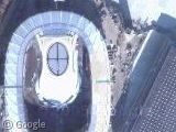
Went looking around, found a big oval (turns out its the track and feild track) at the high school. But, theres a whole buncha little dots leading up to the school…im confused View Placemark
It’s not just the United States, Europe is updated too.
I’ve had a quick look at The Netherlands and from what i’ve seen the whole country has high-res images now… compared to a few cities a couple of days ago.. woo hoo! 🙂
This is so exciting!!
The Netherlands is now available in high-res!
We seem to have quite a few deutch!
Sigh… My town was updated, but it looks like someone got in a plane, rolled 90 degrees, then took some shots with a disposable camera. Hehe, oh well, it’s still an improvement.
Wichita, Ks., my city, also got updated, now I can see the addition we put in to our driveway.
Aargh! What does it take to have the whole of Belgium in high-res? 🙁
“The Netherlands is now available in high-res!”
Not quite all of it! See:
View Placemark
Yeah, buildings like military installations, royal palaces, airbases, parliament etc.. have all been blurred.
Here’s another (larger) base to the north east on the coast:
https://www.googlesightseeing.com/maps?p=&c=&t=k&hl=en&ll=52.956291,4.796391&z=15
The images around the Sarasota, Florida area are definetily 3 years old as addition to our barn and riding corrals are no longer visivle, thes were built 2 1/2 to 3 years plus ago, and they were in the images two weeks ago.