Gateway of India, Mumbai
Thursday, 7th September 2006 by Alex Turnbull
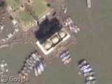
Mumbai's most famous monument, the Gateway of India was traditionally the first thing visitors arriving by boat would see of the city. The Gateway is 26 metres high and was built to commemorate the visit of King George V and Queen Mary (although the city was called Bombay back then), and fittingly, it was through the Gateway that the last British troops passed as they left India for good.
You can see there's lots of tourists milling around here, and you can also see the boats which might to take you to the famous caves of Elephanta Island - which were hewn from the living rock between the 9th and 13th centuries and contain many magnificent carvings.
There's also thousands of other cool things to look at around here (Mumbai has the highest population of any city in the world after all) - so why not take a wander and send us what you find!
Wikipedia: The Gateway of India and the Elephanta Caves. Thanks to Kim Singh, Rushikesh Jukar and Shreeraj Doshi.
Neat naval base just around the point to the north and east: https://www.googlesightseeing.com/maps?p=&c=&t=k&hl=en&ll=18.926098,72.841727&z=17
5 subs, a couple of carriers, a ship in drydock. Is it just me, or do those planes on the deck of the north carrier appear to WWII era fighters?
Does anyone know about this structure/island?
https://www.googlesightseeing.com/maps?p=1063&c=47670&t=k&hl=en&ll=18.926098,72.841727&z=17
Sorry wrong link.
https://www.googlesightseeing.com/maps?p=&c=&t=k&hl=en&ll=18.902318,72.827302&z=17
WRA – you mean these ones? They definitely look WWII era to me – well spotted!
No1Monkey, that link you posted is the same one as WRA’s – which island did you mean?
Ah – I was too slow writing that comment 🙂
Seems to be a fort, according to the Keyhole forum guys: http://bbs.keyhole.com/ubb/showthreaded.php/Number/149911
Docking space is obviously in quite high demand:
https://www.googlesightseeing.com/maps?p=&c=&t=k&hl=en&ll=18.959287,72.848625&z=18
What are these? Cell towers in the water?
https://www.googlesightseeing.com/maps?p=&c=&t=k&hl=en&ll=19.30727,72.883617&z=18
There are similar structures to the southwest and northeast, so I would guess that they are just towers for power or telephone lines to carry them across the river.
Google earth is great, sitting your office you can see around world. Thanks google earth.
Google earth is great,but some part of india can not seen like ratnagari (maharashtra state) tirupati (ap state) can any one help Thanks google earth.