Angkor Wat
Sunday, 29th October 2006 by James Turnbull
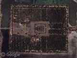
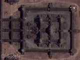
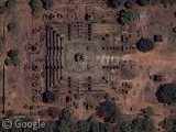
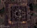
The Cambodian ruins of Angkor, the capital of the Khmer civilization, consists of 72 major temples and other buildings from the 9th to 15th Centuries in an area about 15 miles across. The dense forest around the ruins shows how the city was lost for centuries until a French explorer rediscovered Angkor in 1860.
The southernmost temple is Angkor Wat, the largest religious structure in the world, a giant temple surrounded by a 570 ft wide moat. The west-facing temple comprises of three levels with the uppermost level originally being open to only the priests and king.
Browse around for more of the spectacular temples, and drop by the comprehensive Wikipedia page.
Thanks: Joseph Pantoga, Dave, Juha Ylitalo, Freddie, Dekdoi Bondoi, Matt Ebb, mindflux, rahul, Rob, babs, visnu pitiyanuvath, Arrianus, Debi K, Edward S, Datamorgana, Glenn, Glenn, Tim, Mark, Phil, Stephanie, Edward, Ethan Fugate, Simone, Glenn, Scott Rhoades & Me!

Amazing! This place is huge!
Tons of close up pictures of Angkor Wat at this blog:
http://peejabroad.blogspot.com/2006/08/angkor-part-1-angkor-wat.html http://peejabroad.blogspot.com/2006/08/angkor-day-2-secret-of-ta-prohm.html http://peejabroad.blogspot.com/2006/08/angkor-day-3-care-and-feeding-of-stone.html
Amazing pictures. If you take a far view, you can see the huge rectangular pond built at the west of the main palace.
Yea I used to have to have to mow the grass and trim the tree there for 20 buck man did I get ripped off
There is one more temple. https://www.googlesightseeing.com/maps?p=&c=&t=k&hl=en&ll=13.44384,103.856045&z=18
This website shows the Google map for Angkor Wat map together with the city of Siem Reap and the Tonle Sap Lake.
Though what google provides is awesome, I do wish we’d get an updated image, with clearer view of Angkor Thom, instead of just a big square of brown.
i been there and its awsome