Underwater Explosion?
Tuesday, 1st May 2007 by James Turnbull
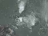
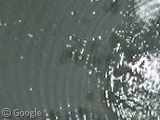
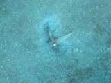
Could these be the waves from an underwater explosion? Found in a lagoon in Acapulco, the circular waves could be caused by any number of different events.
However, the waves are about 8m peak to peak, and still can be clearly seen 400m to the South East, implying that this is more than simply someone jumping in the water!
On the Google Earth forum it has been suggested this may be the result of a small earthquake, or perhaps an underwater explosion to remove reef rock below.
I think the explosion idea holds more weight, but it still seems unlikely. Is there anyone more qualified on such matters who can answer either way? Or at least someone out there with a wild conspiracy theory? 😉
Thanks: Panarimi

Cool! Meteorite?
Maybe its a giant throwing rocks into the sea.
My first thought was meteorite also.
Matthew
Did a wheel fall off the google plane as it was photographing the ocean?
I thought the title said “Underwear Explosion” at first…
Cool find though, despite lack of undies.
Maybe some random cartoon character was rowing a boat right there, and a helicopter passed by to drop an anvil on the boat?
There is actually another one to the North West, just north of the air field, but that one looks almost spiral rather than concentric.
Yeah This one is just weird https://www.googlesightseeing.com/maps?p=&c=&t=k&hl=en&ll=16.915529,-99.982646&z=18
Also OT but what is this in the water to the west? https://www.googlesightseeing.com/maps?p=&c=&t=k&hl=en&ll=17.075636,-100.392954&z=18 looks like its making a big trail
I’ve seen some water treatment plants which discharge processed (clean) water into nearby bodies of water via an underwater pipe. Perhaps there’s a pipe under the water there discharging stuff from a nearby treatment plant?
Maybe a gas eruption? I’ve seen those happen myself, albeit on a much smaller scale. Gas (mostly methane, actually) buildup can happen in coastal regions, when rotting stuff (underwater plants etc.) is covered by a layer of sand and clay by currents, making it gas-proof up to a certain pressure. At some point, this pressure is exceeded, and some of the gas erupts.
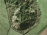
And close by, do these trees in the water spell something out? Google Maps
It’s a personal watercraft making circles in the inlet.
You can see the watercraft at about 7 o’clock from the center of the circle. It’s the end of a short wake that goes from about 4 o’clock to 7 o’clock.
The various overlapping waves ( 100 Yards North of circle center, and 200 yards ENE of circle center) show that the rider made several non-concentric circles and that this is just the newest of a batch.
You may notice that this circle is really a spiral indicating that the rider is going in clock-wise circles.
Boo! lael just ruined everyone’s fun 🙁
I was hoping for signs of intelligent life in the universe.
Dang, just a little late, yeah. Jet ski type spinning donuts, cookies, or whatever they’d be called in your local.
Re: Julian
Yes, it looks like those trees spell out DUVAC in the water. Maybe it is a company who owns the land? Good find!
Actually, I now think it says “DUMAC”, which stands for Ducks Unlimited de México: http://www.dumac.org
The thing Julian found seems even more interesting. I’m pretty sure it’s some kind of writing, but what? It reads like “DUMAC”…
@Malcolm: your find is interesting – I reckon it’s a feeding frenzy of birds. The brown stream seems to start right there and it and the birds steadily dissipate as it is swept along by a current. The birds are probably feeding on fish attracted by the ‘rich’ food source – possibly an underwater waste outfall. The currents in this area are amazing – there are little spirals of muddy water all over the place – like Mr Curly’s doodle pad.
I don’t know what they are, but they don’t look like waves or wake to me. The way they are not reflected by the sore, and the way they don’t wrap around stuff on shore as they pass, i think it’s just as likly an optical thing with the camera.
Have you recognized that weird looking coastline? There’s a strictly straight line of sandy beaches, followed by some houses or so and then there’s water again. Kinda weird, isn’t it? I used Google Earth to measure it: 72 miles of absolutely straight coastline, a great deal of it with that strange strip design (water, beach, town, beach, water – half a mile from coast to coast). Is that some kind of coastline-straightening experiment?
P.S.: Sorry if you haven’t understood anything – I’m German (Don’t mention the War!)…
Kinda looks like Europe doesn`t it?
You think it looks like Europe? Which Europe do you mean? The one between Asia and the Atlantic Ocean? No, I don’t really think so… I’ve been there quite a few times (I’m from Germany) and I’ve never seen such a coastline anywhere in Europe! So, let’s call it a Mexican style coastline (a thin stripe of straight land with a lot of nothing around it)! 😉
There is a secondary ring up high.The bottom right seems to have a face. as for conspiracy theories what about some of Teslar’s experiments or some HAARP type practising?Maybe somebody’s humongous OMMM?Does it happen often?Is it the way the land shape reacts to the water?The lapping on the shorelines does not look right.
You’ll be starting a new Crop Circles line on water next, you lot…
I think it just has something to do with the tide and the way the water flows…
One of the imagery satellites fell out of orbit. 😀