2006 Lebanon War
Tuesday, 5th June 2007 by James Turnbull
Update: Google Maps has now been updated with the latest images, so will look the same as Google Earth
During last year's war in Lebanon between Hezbollah and Israel, excellent Google Earth news site Ogle Earth mentioned that Google would "soon" be updating the images of Lebanon, but were keen to stress that this was not side-taking on the controversial conflict.
However, for some reason these images did not appear in Google Earth and Lebanon appeared as pre-conflict up until the most recent image update just a few days ago. Google Maps has not yet received the same image update, so until it does we can use the two sources to compare areas before and after.
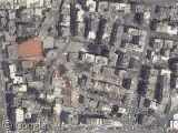
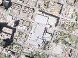
Central Beruit, Before:
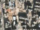
Central Beruit, After:
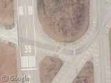
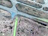
Runways at Beirut International Airport, Before:
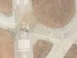
Runways at Beirut International Airport, After:
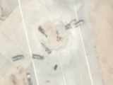
If you zoom in on the runways you'll also see that they're busying repairing bomb craters:
The full story of the conflict is, of course, on Wikipedia.


I keep telling myself ‘Why am I going to Israel?’ Not that continually seeing images like this is going to change my mind.
Its not like me to be serious but its interesting that the genesis of aerial photography can be traced back to military strategy and that images like this are exactly the reason why high level aerial photgraphy developed in the way it has. Images such as this bring home the effects of conflicts in places that most of us will never visit and are thankfully well away from. They may be just satellite images but they are thought provoking none the less.
🙁 there are also lots of destructions in bridges about 70% of lebanon bridges are ruins one of them is the highest in the middle east