Runway Roads
Monday, 19th November 2007 by James Turnbull
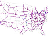
When the American Eisenhower interstate system was constructed it was a specific requirement that one in every five of the 46,837 miles of road had to be kept perfectly straight. The idea was that during times of war the roads could be used as emergency runways, negating the need for more airports.
Sadly, urban legend website Snopes debunks this as totally unsubstantiated codswallop.
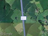
A similar story is told in the UK, and many believe that straight sections of the M1 Motorway near London were also planned as potential runways. These claims are also easily debunked by the presence of over-bridges and large concrete central reservations, neither of which are very helpful when attempting to land on the road.
The UK version of the myth also extends to most other motorways, some of which have more truth than others. A couple of the motorways were in fact built across and on top of former runways, such as the M8 and the M62, which replaced RAF Burtonwood. Today you can still see one of the former runways intersecting the motorway at 45 degrees1.
But still, being a former runway doesn't qualify these roads as being of any use as a runway today!
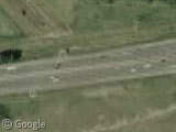
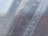
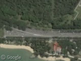
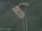
In China, we can see a runway-to-road conversion happening, as the original Baiyun International Airport is transformed from airport in the southern (older) imagery to highway in the northern (more up to date) images.
However, it seems China have no plans to use these roads as an emergency runway.
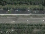
But all is not lost - Singapore's East Coast Parkway is finally what we're looking for: a road that was actually designed to operate as an emergency runway!
1.25 miles of the road near to Changi Airport was constructed in a nice straight line, with no camber and a central reservation made from easily-removable pot plants.
Thanks to Cookie monster, yym_c & others.
-
This is right beside last month's truck spillage which, if you've not been following the comments, is not zombie chickens but waste probably destined for landfill. ↩︎
I would have thought the nature of an emergency would not allow the removal of pot plants….
It isn’t totally unsubstantiated.
gripen_g50_roadb.jpg
http://en.wikipedia.org/wiki/Swedish_Air_Force “During the 1950s the air force started to build road bases after an idea taken from Germany. The bases were ordinary highways constructed in such a way that they could also serve as landing strips.”
@johan: I think you misunderstood me.
I wasn’t saying that the idea of roads-as-runways were unsubstantiated. They clearly do exist, as proved by the Singapore road and probably many other examples across the globe.
I was saying that the idea of the American highway system having 1 in every 5 mile of road as a runways was unsubstantiated nonsense.
According to Wikipedia there are a number of emergency airstrips build on highways in Germany and Swizerland during cold war times (1965 to 1980). See more details there: http://de.wikipedia.org/wiki/Autobahn-Notlandeplatz Guess there are similar strips in other countries, even if not every fifth mile.
For some reasons I haven’t seen the comments above mine earlier … Right, the article does not deny the existence of these kind of airstrips. With the USA exporting their military conflicts to locations all over the world and the big demand of aircraft transportation following a huge number of airports anyway, they do not need to have such a high number of motorway airfields. For UK this might be different. Anyhow, many straight motorways can be converted into an airfield with certain efforts, depending on to conditions. It may take weeks or months of course.
Do the potted plants fold downwards when an aircraft is inbound…..a bit like on Thunderbirds ?! 😀
One example of “road-as-runway” is here in Czech Republic. Google has only low-res map of the place: View Placemark
But you can check out a much sharper photo map at a local map site: http://www.mapy.cz/#x=139116288@y=133197952@z=13@mm=F
Normally it’s a standard two-lane road. You can see easily where the runway starts and where it ends, and there even are some taxi-ways present. Right beside the road/runway is a small operational airfield.
The runways the military needs aren’t the kind of thing you’d expect: a Hercules can land loaded and take off empty in 300 meters, I’ve seen them do it. Fighters not much more, or the Navy’d be calling its Tomcats Catfish. OK, they’ve got arrester wires to help, but the art of landing a plane is to bring it to an almost complete stall just past the end of the runway, bleeding its speed away using the flaps to stop it actually stalling until it’s almost in a hover, at which point gravity takes over and you drop the last foot or so and stop rolling almost as fast. Commercial jets just thump in by comparison with everybody else – you can tell the commercial pilots who fly gliders in their spare time, as they turn onto the first taxiway at taxi speed, as opposed to the white van drivers who take the turn into the last taxiway like they’re driving a Formula 1 car – the only surprising thing is there’s so few cartwheels as the outside wing digs in. If memory serves, there was one last year, tho’.
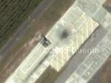
Motorway linking cities of Lahore and Islamabad (M2) in Pakistan has certain areas built and successfully tested (in 2005) to be used as runways in emergencies such as war, with one such example here. A straight bit of road with almost zero change in terrain and removable divider blocks.
On the same runway, just exiting Lahore you can also spot 3 helipads.
Before the M55 motorway, which links Preston and Blackpool, was opened to the public “the Ministry of Defence and British Aerospace were allowed to use the motorway, still lacking its final surface, near Weeton as a temporary base for a Jaguar GR1 aircraft. Taking off from nearby Warton airfield on 26th April 1975, the Jaguar landed on the motorway, loaded four cluster bombs and took off in a demonstration of the aircrafts ability to operate away from its normal environment.”*
Dont believe me? Here is a picture!
*From the website http://www.lancashire.gov.uk/environment/historichighways
On 12 Sep 2003 a small airplane landed on the portuguese highway A1 near Leiria, but I don’t think it makes it a “runway road” 😀
The pilot had a problem with the plane wich was overheating and losing power. He then started to fly over the A1 highway, the drivers started to slow down and with luck he had some space to land the small plane safelly. I have the links for Correio da Manhã and TSF about this emergency landing, but unfortunally they’re in portuguese. 🙁
Interstate freeways are not, nor ever have been, designed to serve as runways at any point in history.
Actually, many of the highways in Massachusetts have been constructed to withstand the impact of military aircraft. If the US is ever invaded during war the first thing the enemy would destroy would be our militarie’s ability to send out aircraft and other type equipment. Therefore, we have to be prepared to make use of our highways…especially the ones leading to the oceans edge….and nearby to military bases. Certain highways in Massachusetts have been build for this purpose. They do not have overhead signs or center margins, etc. The earth and substructure is also different from a “regular” highway. There has been great thought put into this.
Actually, the 405 freeway in Los Angeles was designed as a backup runway for LAX airport. As far as I know it’s only been used for this purpose once, as documented in the documentary “405” available at http://www.405themovie.com/Home.asp.
Matt
In Finland there are many strips of roads that double as runways for fighter planes (“road bases”), and are regularly used in the exercises. Airplanes designed for aircraft carriers are especially useful in these conditions as you can see in these images of Finnish Air Force F-18’s:
http://www.ilmavoimat.fi/index.php?id=79&kuva=galleria_hn4.jpg http://www.ilmavoimat.fi/index.php?id=79&kuva=galleria_hn1.jpg
In the mid-70s they actually did land a C-130 on the Autobahn between Stuttgart and Augsburg, just to prove they could do it. IIRC.
Though not a road itself, its interesting to point out that Gibralter’s Airport crosses a road.
@ Keith: That’s “Gibraltar”, not “Gibralter”, if you don’t mind. It actually won’t for much longer, cross a road that is, as we are having a shiny new air terminal and tunnel which will allow the traffic to pass at the eastern end of the runway.
Learn more and see the aforementioned road, Air terminal etc. atWiki, where else.
That particular Singapore expressway (cum aircraft runway) is more for military aircraft (fighters), not commercial aircraft (road is not wide enough).
And no, the potted plants do not fold into the road… I think they get carted away by forklift, or are bulldozed away.
A little splash of water to wash off the loose soil – there you go – a runway.
In Switzerland there were 10 actual uses of the Autobahn from 1970 to 1991. http://tinyurl.com/25tnmk (wikipedia) Here a movie from the first one in 1970 http://tinyurl.com/257rhb (swiss tv archive) That maneuver was located here: View Placemark (47.294901,7.751294) note the lack of green on the middle stripe for approx. 3 km. Some others took place here: View Placemark (46.858512,7.554705) (Münsingen, 1974, 1982) View Placemark (47.085036,9.363602) (Flums, 1977, 1985) View Placemark (46.216922,7.331702) (Sion, 1988) View Placemark (46.291666,8.990705) (Lodrino, 1991) Theoretically still operable is the newly built piece of highway near Payerne: View Placemark (46.842405,6.929151)
Actually, the 405 freeway in Los Angeles was designed as a backup runway for LAX airport.
Considering that the 405 is absolutely jammed with traffic almost 24 hours a day, this would be awkward. To say the least.
In the Republic of CUBA, there is such a runway road Google Maps with several sites to park and protect planes with mound of earth.
View Placemark
Little El Salvador, in Central America, has it’s own runway/road in the Panamerican Highway.
There are a couple of military bases nearby, so the stretch was designed for emergency take off and landing for military planes during war time.
The paint has faded over the years, but during our civil war it had runway markings.
https://www.googlesightseeing.com/maps?p=&c=&t=h&hl=en&ll=13.763062,-89.369531&z=17
hopes the link works
And this is what happens when you try to land on a highway that isn’t meant for it: http://mitglied.lycos.de/juergensch/erinnerung_an_den_absturz_eines_.htm http://www.airdisaster.com/cgi-bin/view_details.cgi?date=09061971®=D-ALAR&airline=Pan+International+Airlines They actually got the plane down in one piece despite both engines dying during take-off … and then they hit a bridge that ripped off the wings and the cockpit. I actually saw the while highway full of flashing blue lights that night … made a pretty big impression on a little kid.
View Placemark
This part of E75 in Slovakia is rumored to be an emergency landing strip and actually looks like one — it is straight, there are no overhead traffic signs and the center barrier can be easily removed. There is a small military air base nearby (View Placemark).
Not really a runway road but…
https://www.googlesightseeing.com/maps?p=&c=&t=k&hl=en&ll=55.754035,37.620353&z=17
this is probably one of the most famous non-runway, runways. Red Square in Moscow was famously used as a runway in 1987 by Mathias Rust
In Indianapolis, the I-465 interstate system had to have some revisions in the “90s
Seems that several of the overpass bridges were not quite to the military specification. It was explained that the bridges needed to be raised by 4 or 5 inches so that ICBM mobile missile vehicles could pass under them without doing any damage to the missiles. As far as I could find out, the US never had built any mobile ICBM systems, they had plans for them, but never built them.
We still raised the bridges though.
The live-fire phase of Taiwan’s annual Han Kuang military exercise took place in May 2007. Perhaps the most dramatic portion of the exercise involved six fighter aircrafts—two F-16s, two Mirage fighters, and two IDFs—conducting simulated emergency landings on a major highway. This was the second time that the Han Kuang exercise featured the use of major roadways as alternate landing strips. The drill was intended to demonstrate the ability to continue to conduct air operations in the event that Chinese missile and air strikes shut down Taiwan’s air bases during a cross-Strait conflict. The four-day live-fire portion of the exercise also featured counter-landing drills and tested the military’s ability to respond to Chinese airborne and special operations attacks.
View Placemark
Street called “I Dywizji Wojska Polskiego” is actually a emergency runway built to serve nearby airforce base in Gdynia-Babie Doły (on the right side near the coast).
There are more roads in Poland used normally today but built as a emergency runways, so it’s nothing especially uncommon 🙂
hey guess what i found a emergency runway on some island off singapore .it is meant to be a emergency not a runway road.you can see it on google earth or maps.its called palau sondong.however it cant be search you have to manually search it is just near jurong island.mysterious??
That is Pulau Sudong, it’s used by the SAF for live -firing exercises.
Lim Chu Kang road that runs next to Tengah Airbase is an emergency runway. They hold exercises there every few years.