The Namib Desert (Desert Week)
Monday, 16th June 2008 by Alex Turnbull
Welcome to the first annual GSS Desert Week! In time-honoured tradition, we’ll mostly be posting about deserts. For about a week!
The Namib Desert in Namibia and Angola forms part of the Namib-Naukluft National Park, and covers an area of 50,000 km². This part of the world has experienced arid conditions for at least 55 million years, which makes the Namib Desert the oldest desert in the world.
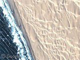
The Namib covers much of the Atlantic Ocean coast of Namibia, where the collision of the water-laden sea air and the bone-dry desert air causes immense fogs and strong currents, making this place as notorious for ending the lives of sailors as the more famous Skeleton Coast to the north. There are plenty of shipwrecks to be found in this imagery for those that care to find them!
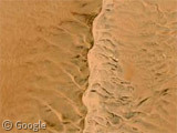
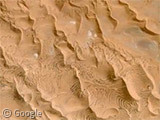
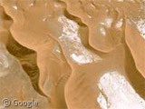
Away from the coast, this massive desert receives less than 10 mm of rain annually and is almost completely barren, apart from the spectacularly complex dune patterns.
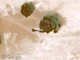
In the eastern part of the desert we find the famous Sossusvlei salt pan, which can sometimes be seen filled with water when a flash-flood fills the Tsauchab river. Note the tourist buses parked in the shade of a tree.
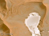
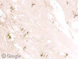
To the south is the Dead Vlei salt pan where even from up here we can spot the “skeletons” of trees which are believed to be about 900 years old - scorched black by the sun and unable to decompose due to lack of moisture.
Perhaps most impressive of all the sights here though, are the mammoth dunes which surround the salt pans. Some of them rise up to 340 metres, which makes them the highest sand dunes in the world.
Check out the photos on Flickr of giant dunes, tree skeletons, and the dunes as seen from in the Dead Vlei.
See Wikipedia for more info on the Namib Desert, the Namib-Naukluft National Park, the Tsauchab, Sossusvlei and the Dead Vlei.
You forgot to mention that if they select your “View in Google Earth” link they can turn on the “Geographic Web” layer and see some excellent pictures of the Namib desert from the Panoramio photo layer. The Panoramio photo layer is now also built in to Google Maps (found under the “More” tab).
The spice is life.
Namibia is an amazing country; check out my Namibia Honeymoon pics at
http://www.alkemii.co.uk/lisaandgareth/TheBestAlbum/index.html
This landscape is amazing!
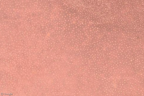
With some browsing around I found some very high resolution images in the middle of nowhere:
https://www.googlesightseeing.com/maps?p=&c=&t=h&hl=en&ll=-26.522216,15.141424&z=20 https://www.googlesightseeing.com/maps?p=&c=&t=h&hl=en&ll=-26.043464,15.000722&z=20 https://www.googlesightseeing.com/maps?p=&c=&t=h&hl=en&ll=-25.028203,15.300629&z=18 https://www.googlesightseeing.com/maps?p=&c=&t=h&hl=en&ll=-25.01132,15.354901&z=18 https://www.googlesightseeing.com/maps?p=&c=&t=h&hl=en&ll=-24.950913,15.466046&z=19 https://www.googlesightseeing.com/maps?p=&c=&t=h&hl=en&ll=-24.911318,15.522223&z=18 https://www.googlesightseeing.com/maps?p=&c=&t=h&hl=en&ll=-24.765333,15.740479&z=18
Does the river actually end there? In the middle of the desert?
@koen – yup, these salt pans are as far as the “river” ever gets! Apparently a torrential river can form in a matter of hours during the rare times when rain falls in the Naukluft Mountains and runs off.
we were lucky enough to see Dead Vlei with water in it….quite rare.
http://www.alkemii.co.uk/lisaandgareth/TheRestAlbum/slides/IMG_2659.html
Awesome posts. I have long dreamed of the Namib. It must be incredible to see such massive dunes so close to the sea.
Gareth just curious….how much did your Namibia trip cost you?
Well we went for a month and stayed at some very expensive places, but also camped en-route.
We hired a truck with a tent on the roof and drove approximately 5,500k.
Total cost was about £7000 but could have been done a LOT cheaper by camping more. Some of our accommodation was $300-500 a night per person. Some was $20-30.
@Dr.R: those very high resolution photos are part of the National Geographic Megaflyover imagery – photos taken by NG photographer Michael Fay. You can find the layer under the Gallery->National Geographic sub-layer in Google Earth which will show you most of the locations of the photos included in GE.
The earth has teeth!
https://www.googlesightseeing.com/maps?p=&c=&t=k&hl=en&ll=-24.700599,15.471411&z=14
A couple of corrections to misleading information in this thread. @Alex Dead Vlei and for that matter, Hidden Vlei and Sossusvlei are NOT SALT PANS, they are in fact mud clay pans which have been bleached white by the sun.
@geebee Your photo link is of water in Sossusvlei, NOT Dead Vlei. At Dead Vlei it’s not physically possible for the flood waters of the Tsauchab River to reach Dead Vlei. The only way that Dead Vlei can fill with water is if rain falls directly into Dead Vlei. If you have a photo of Dead Vlei with water in it I would like to see it.
@Joe: We did experience some rain directly in Dead Vlei this June, but definitely not enough to fill the pan with water. But we clearly saw heavy rains and even lightnings all around us on that day, so I guess having some water in Dead Vlei might be theoretically possible. http://www.pbase.com/nd/dunes
@geebee you were lucky to experience rain & lighting over Dead Vlei. the linked picture you have shows the ponding of flood waters from the Tsauchab River at Sossusvlei. This water will have fallen as rain many miles away in the Naukluft Mountains and collected in run offs and filled the dry river beds as flash floods which if sufficient rains have fallen in the mountains means these flood waters then terminate at Sossusvlei. As I said before the only way Dead Vlei can fill with water is if rain falls directly into it (as it is cut off from the Tsauchab and Sossusvlei by dunes). I know that rain does fall in Dead Vlei, but not in sufficient quantities to make large pools (as it is not connected to a large enough flood plain upon which rain water can converge to create dramatic ponds such as those seen periodically at Sossusvlei.
http://flickr.com/photos/82822788@N00/sets/72157600318475930/
@Joe It seems you misattributed my posting to geebee. I was not arguing with you, just wanted to point out that it does happen for rain to fall directly into Dead Vlei, so we seem to be in complete agreement.
@Marassa, Sorry I confused you with geebee. Indeed we are in complete agreement.
namibia is best country in the whorld… did you guys know that the namib desert were a tropical rainforest… we learnt about it in geography at the university…