The Donghai Bridge
Thursday, 31st July 2008 by Alex Turnbull
Such is the volume of new imagery that is added to Google Earth, that by the time we got around to posting the longest cross-sea bridge in the world, it had already been superseded.
Fortunately for us however, the current reigning champion was captured whilst still under construction, which means that we're able to bring you the longest cross-sea bridge on Google Earth, China's Donghai Bridge.
Measuring a whopping 32.5 kilometres (20.2 miles), the Donghai Bridge was completed in 2005, and connects Shanghai (above) to the Yangshan Islands in the East China Sea.
Most of the six lane bridge is low-level viaduct, but there are two cable-stayed sections which allow ships to pass, the larger of which has a span of 420 m.
Apparently the seemingly meandering path the bridge takes across the East China Sea was specifically designed to keep drivers more alert during their long crossing.
While questions have been raised over the financial logic of projects like the Donghai Bridge, China is rapidly emerging as the new Land of Long Bridges. China now has seven of the top twelve longest bridges in the world, all of which were completed in the last 5 years.
There's information about and a great picture of the Donghai Bridge available at Wikipedia. You can also read about the current longest cross-sea bridge, which will likely also have been superseded by the time we get to it.
Thanks to Lukas Nowacki and Tom.


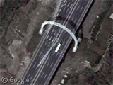

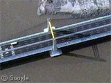

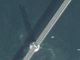
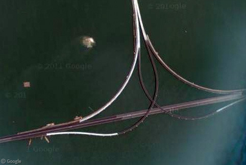

Well, no cars at all, so I guess it is before it was finished. Then, look at all the streets they built on the western side. I guess they are all only for the bridge? As there are no cars over there as well. Third point: Pretty bad image border as well on the western side.
@Michael – In our fifth thumbnail, is that not a bus?
Well yeah probably. I thought that are trucks or whatever… But Bus sounds reasonable as well. But then if there’s not more traffic then that… Why build such a huge bridge?…
A 32km bridge to connect to nothing but that rather piddly seaport? That’s indeed an impressive and ridiculous display of too much money at work…
@Flümo: This rather piddly seaport is already one of the most modern container ports in the world and once it’s construction is finished it will supersede Shanghai container port (which is the largest in the world when it comes to volume, I believe). The whole port is build on the artificial island – you can zoom out slightly in GMaps to see the old satellite photo of the natural island without the port
Also, the meandering path of the bridge was not designed with drivers in mind, but the ships passing under – so they don’t have to cross the bridge while sailing straight against current and wind but rather at the angle.
Something big is going on here as well, https://www.googlesightseeing.com/maps?p=&c=&t=h&hl=en&ll=30.899684,121.938672&z=15
@dr.R: That is the Luchao Harbour City, a purposebuilt development built around a 2.5km lake, which will (according to the developers, support 300,000 residents. (Source)
Something odd goes on when in google maps and you zoom out on the image that dr.r. posted…I think you get to see what it looks like now when you zoom in and see it before when you zoom out. You can see where they are starting the outline of the new area going out into the water.