The Sunken Island of Jordsand (Island Week 3)
Thursday, 4th September 2008 by Alex Turnbull
It's Island Week 3 here at GSS, which means we'll mostly be posting about Islands. It'll probably last about a week.
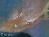
This is what used to be the island of Jordsand in the Wadden Sea, just off the coast of Denmark, and east of the German island of Sylt.
Once upon a time it may have connected to both the mainland and Sylt, but by 1873 it was down to just 18.4 hectares in size. Attempts to protect the island were made during the 1970s but recurring floods continued to reduce its area and, during the winter of 1998, the little island was finally submerged for good.
Interestingly, the low resolution image used on Google Maps for the more zoomed-out views still shows some small sections of land protruding from the water.
Thanks to Lars Dybdahl.
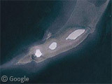

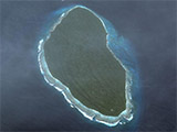
I can recognize one of the three “visible islands” as the last shape of Jordsand, before it submerged. My guess is, that they are all three just below the surface.
Last time I visited the island, we drove by tractor through the ocean to it during low tide, and the low resolution images may have been taken during low tide.
Here is a Wikipedia article on the topic:
http://en.wikipedia.org/wiki/Jordsand
It doesn’t mention, that due to plate tectonics, this area of Europe is sinking slowly. The plates simply tilt slowly.
You say it’s an island, but you reckon it was connected to the mainland… that means it’s not an island! How could my most trusted Googlesightseeing lie to me?! (also, if it’s sunken… it’s not an island!!! More lies =[)
Well, a place that has Ocean all around it is usually called an island. It was an island in the years 1231 and 1998 (and between those years). It may have been connected to mainland before that.
In that way, Jordsand is like Great Britain, which is also an Island today, but it was connected to Denmark, Germany etc. in pre-historic times.
Great comments/insight Lars!