Gateway to the Americas
Monday, 22nd September 2008 by Alex Turnbull
The Laredo International Bridge 1 is one of four road bridges that cross the Rio Grande to connect the cities of Laredo, USA and Nuevo Laredo, Mexico.
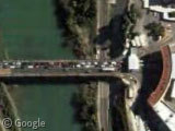
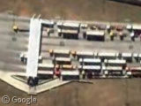
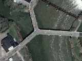
The 320 m long bridge is officially known as the Gateway to the Americas International Bridge (Wikipedia) and, as we can see from this satellite shot, the sheer volume of cars waiting to get into the states really help it to live up to its name - nearly a million cars cross this bridge each year, albeit slowly.
There's a webcam on the American side that shows a typical American street scene, while the webcam on the Mexican side seems to always show a scene very similar to what we can see in the satellite shot.
In the webcams you might also spot one of the 4 million pedestrians who cross the bridge on foot each year.
Laredo International Bridge 2, or officially the Juárez-Lincoln International Bridge (Wikipedia), was built in 1976 to alleviate traffic on the first bridge, and is only open to buses and non-commercial traffic.
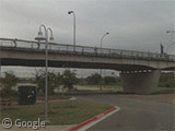
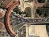
Slightly shorter at 307 m it has six lanes, four or which head north into the US. All four northbound lanes appear to be continually gridlocked, which is hardly surprising when you hear that over 4 million non-commercial vehicles cross here every year.
Google's Street View car never got close enough to see the bridge itself, but we can see the front of the border control building from a distance.
Next up is the Laredo International Bridge 3, or Colombia-Solidarity International Bridge (Wikipedia), which has eight lanes this time and of all the bridges so far carries the most commercial traffic - around 270,000 vehicles each year.
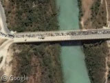
Our final road bridge is the Laredo International Bridge 4, or World Trade International Bridge (Wikipedia), which despite also having eight lanes, is only open to commercial vehicles - a LOT of them. In the past year this bridge has been crossed by nearly 1.2 million commercial vehicles.
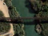
It's not only road bridges that connect the two countries here either - there's also the Laredo International Railway Bridge, or Texas-Mexican Railway International Bridge (Wikipedia) which connects the Texas Mexican Railway in the US with Mexico's Kansas City Railway.
Ironically, unlike the road bridges, the Google Street View car got close enough to the railway bridge for a photo opportunity.
As if that wasn't enough bridges, plans are already underway for the construction of yet another road bridge and two more railway bridges.
For the full breakdown of statistical data about these bridges, see this traffic distribution chart at cityoflaredo.com.
Congratulations to Fraser, who finally got a suggestion published.



I would have assumed that “Gateway to the Americas” meant “gateway to the rest of the american countries” not “Gateway to the US” as implied by the post. You also dont tell us how much traffic is in each direction, which would be interesting. The long queues may be due to stricter boarder controls in one direction as well as sheer volume. I have been through a number of boarders where one country is far stricter than the other and as a result creates long queues.
It’s a fair statement to say U.S. border controls are tighter than Mexico border controls.
But I think it’s also a fair statement to say that there’s more demand to enter the U.S. than there is to enter Mexico. Since satellite photos seem to be during daytime we would see the inbound traffic rather than the evening outbound traffic.
@Timothy – I agree, “Gateway to the Americas” is a misleading term, but hey – it wasn’t me that named it “The Gateway to the Americas International Bridge”!
As for how many cross in either direction, well it doesn’t seem that the City of Laredo publish that information, or I would have included it. One wonders if there might be a slight discrepancy in the tally of people returning back to Mexico of course…
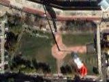
In case anyone else is having a feeling of déjà vu, the bridges haven’t been featured before as such, but the “monster flag” near one of them featured three years ago: https://www.googlesightseeing.com/2005/09/14/laredo-monster-flag/
Happily the flag is still visible on the Google map!
This wouldnt be some Mexicans trying to enter the US of A by another way would it?
https://www.googlesightseeing.com/maps?p=&c=&t=k&hl=en&ll=27.575091,-99.52277&z=18
My wife and I walked over the Gateway to the Americas bridge a few days ago. We were on vacation in San Antonio and decided to make a short side trip to see Mexico. We used one of the parking lots on the Laredo side and walked over the bridge. While it’s cool to be able to walk into another country, Nuevo Laredo wasn’t a very nice place, we’ll leave it at that.