Mystery Stone Arrow
Tuesday, 23rd September 2008 by James Turnbull
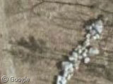
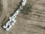
Near Sebago Lake in Cumberland County, Maine, we find a strange arrow arranged from piles of stones:
What makes the arrow really bizarre is that rather than your usual pointing-style arrow, this apears to be a representation of the sort of arrow you might shoot with a bow. But why?
Without any clues of what it could mean, I presumed it was still an arrow for pointing, and followed the path north-east to a quiet pertrol station, but the trail went dead.
Buried treasure? Terrorist targeting device? Innocent stone wall? What do you think?
Thanks to RFIDGuy.


Much more interesting: Who fired it?
Following the arrow backwards leads to the lake, so there must be a giant stone indian living in there. Scary.
Uhm, “terrorist targeting device”? I got news for you guys….that whole “war on terror” thing only exists in the minds of the Neo-Cons and the people who watch Fox “news”….there ain’t no terrorists. Especially in Maine of all places…..unless you count the old Nazis living in Kennebunkport.
I’m not sure what this is, but it doesn’t look much like an arrow to me. Check out the Live Maps bird’s eye view:
http://maps.live.com/default.aspx?v=2&FORM=LMLTCP&cp=r96dmh93w3wc&style=b&lvl=2&tilt=-90&dir=0&alt=-1000&scene=14404754&phx=0&phy=0&phscl=1&encType=1
There are more piles of stones along the same trail (?) a bit to the south:
https://www.googlesightseeing.com/maps?p=&c=&t=h&hl=en&ll=43.838782,-70.450445&z=20 https://www.googlesightseeing.com/maps?p=&c=&t=h&hl=en&ll=43.835593,-70.449291&z=20 https://www.googlesightseeing.com/maps?p=&c=&t=h&hl=en&ll=43.82431,-70.44511&z=20 https://www.googlesightseeing.com/maps?p=&c=&t=h&hl=en&ll=43.818978,-70.444671&z=20
For sure a sign that the proto-Turks have also been here
“there ain’t no terrorists”
Oh, that’s comforting to know. Thanks, genius.
It seems like the road beside the rock pile leads north to a quarry. Either random dropped loads, or possibly barriers designed to slow the run off of rainwater down the roadway.
Bill, you’re welcome. Anytime, glad to be of assistance. You need help with anything else just ask.
Oh, and I’m gonna go with barriers to slow the run off.
I’m going to have to be boring and go with road blocks.
If you follow the road to the south you see two more that have clearly been put in place to try and stop people driving through, or driving on the wrong part of the clearing. Have a look at Basin Rd near the piles of gravel to see what I mean.
I’m also leaning toward roadblocks, to discourage driving, biking, walking, fourwheeling, etc in those areas.
I think these are the roadblocks against terrorists 😐
It points to a secret FEMA camp run by the goverment… hehe… that’s why you can only see it from the sky… what color is your circle? Red, Blue, or yellow…. google it if you’re curious