Bridges to Nowhere
Tuesday, 21st October 2008 by Ian Brown
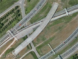
Drivers on the A10 ring road in Amsterdam can be forgiven for any confusion experienced when they see this incomplete section of highway bridge.
We’re not sure what happened - maybe the construction crew finished up early one Friday afternoon and by the following Monday had forgotten what they were supposed to be building?
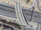
Meanwhile in Tehran, a similar situation seems to be coming to an end. We're told this bridge sat unconnected to anything for at least 8 years, but the construction currently visible at the north end of the bridge may mean that it will finally get put to use some day. Still a bit of a drop if you were to drive off the south end though...
Let us know if you find any more abandoned bridges.
Thanks to Asmir Babaca and Mazi.
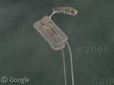
This end of the Higway in Buenos Aires remains unfinished by at least 25 years, and I think it will never be finished. There is a ground level photo in Panoramio’s links.
By the way ¿does anybody know why the labels all around the city are just plain wrong? A few months ago there where no labels for anything in Argentina, now they added the names of the neighbourhoods around the city, but almost none of them are in the right place….
Well, there was a construction mess here near Nantes, with some unfinished bridges and roads : View Placemark
There is one famous recent example in Germany, the “Itztalbrücke“.
Unfortunately, none of the map services seem to have up to date imagery – the bridge is right next to the motorway, where the marker sits.
The about 850m long bridge is meant for a high-speed railway line that is supposed to arrive there in about 2015-2017. The bridge was finished in 2005, at the same time as the A73 motorway passing there – thereby using the construction infrastructure in place at the time. Funding for the rest of the railway link is unclear by now though, so it might be bridge to nowhere for even longer than the planned 10 years.
(Ground level image)
Damn, GSS ate my map marker. Just look at the middle of the image… 🙂
View Placemark (34.28319,-117.74679) In the mountains north of Los Angeles is an abandoned bridge from a mid-1930s project to run a road across the mountains. After getting about halfway, they only then realized the road would be subject to frequent flooding, and so stopped the project at the north end of this bridge. Due to frequent flooding, the road to the south is now no longer usable either except by foot or horseback.
There are plenty of these in the USA as a result of the freeway revolts – after some interstates were built, residents of cities decided they didn’t want them running through their cities. Baltimore, in particular, has several examples where interstate construction was halted: I-70: View Placemark (39.30108,-76.710899) and I-95: View Placemark (39.268718,-76.660076) (these are harder to see – look closely).
We have this onehttp://maps.google.co.uk/maps?f=q&hl=en&geocode=&q=manchester&ie=UTF8&ll=53.472042,-2.236646&spn=0.002299,0.006866&t=k&z=18 in Manchester, UK.
I think what you meant to say was this wasnt it Jim? 🙂 View Placemark
Bridge to Nowhere, Bovoni, St. Thomas, US Virgin Islands
View Placemark
There was going to be an inner beltway built in boston, circling from just south of the city on what is now I-93, to just north of the city on I-93. (I-93 used to start just north of boston and now starts south of the city partway around the state route 128 beltway).
There was a freeway revolt before it was built, however. But some infrastructure had already been built for it.
To prepare for this, there were several bridges and offramps built. The one built south of the city was turned into a big offramp to a street and then rebuilt as part of the big dig project. The one north of the city can still be seen here: View Placemark
And there’s a bridge across the highway at the I-93/I-95 interchange south of boston that I think was built for the project and then abandoned and finally put into use for highway maintenance traffic. View Placemark
As mentioned in the Dutch Wikipedia (http://nl.wikipedia.org/wiki/Grands_travaux_inutiles), the flyover might be used for a seond tunnel underneath the Noordzeekanaal.
The M8 motorway between Glasgow and Edinburgh used to have two Bridges to Nowhere over it, both in Glasgow.
The Sauchiehall Street bridge had neither end connected for many years until an office block was built on top of it in the mid 90s (ground level pic).
The Anderston footbridge was built to connect into a shopping centre that was never built, and the bridge has ended abruptly 12 metres above a car park ever since.
I fondly remember these bridges from trips through to Glasgow in my youth!
More info at Wikipedia on M8 Bridges to Nowhere.
This one in Naples would’ve got straight through a house if it’d been finished
Google Maps / Live Maps Bird’s Eye
Two I’m familiar with… View Placemark (42.430441,-71.016011) Cutler Circle, Revere, Mass., USA, has two bridges, technically an unfinished freeway, that had been planned to extend Interstate 95 north from Boston north to Peabody, a stretch named Northeast Expressway (the complement of the existing Southeast Expressway), but environmental concerns about the planned route through marshlands and a major city park canceled the project. View Placemark (47.643808,-122.297165) Washington State Arboretum, Seattle, Wash., USA: These stubs were intended to form the R. H. Thompson Expressway, which would have served as an Interstate 5 bypass from Interstate 90 to State Rt. 520. Again, because it would have run over the west side of the Arboretum, environmental concerns canceled the project, though development in this area to alleviate heavy 520 traffic is still attractive to highway planners..
There are two unfinished highway bidges in Czech republic, built during the WWII as a part of first hiqhway between Prague and Brno: View Placemark (49.700371,15.099989) These bridges were abandoned because of creation of Prague’s water supply lake.
I just noticed that Regis’ subs are for the same project as mine, though it was for 95 not 93 — 93 already goes through downtown Boston (well, these days, mostly underneath it). 95 meanwhile now piggybacks on 128 from Peabody to Blue Hill. As a result this portion of 95 is west of 93, making it one of the oddities of the interstate system’s numbering order.
Just west of downtown Columbus OH is an abandoned street bridge over I-70/I-71. You can see the upper right end of the roadway doesn’t connect to anything anymore.
There is a really big project that came to a sudden halt in Cape Town, South Africa. Several sections of the infamous uncompleted bridge exist, with rumors of plans to finish the project creeping up every now and then. This highway in the sky is sorely needed to ease traffic in Cape Town. View Placemark (-33.919307,18.434533) View Placemark (-33.914375,18.425360) View Placemark (-33.914646,18.421417) The latest rumor is that the bridges will be completed for the Soccer World cup to be hosted by South Africa in 2010. But only time will tell…
35.15296,-90.053805
That bridge just inside of Memphis, TN has been that way as long as I can remember. We would always joke about accidentally going that way and falling off (at one point it had non-permanent concrete barriers rather than being completely blocked off with the guard rail like it is now)
oops: View Placemark (35.15296,-90.053805)
These are awesome! Who knew there were so many abandoned bridges and ramps out there?
It’s interesting to see many slowly being taken over by nature while others are turned into parking lots or storage areas.
Bonus Points for the nice bridge shadow just to the west of that one in Memphis, Jay K!
The old crossing for the freeway here was torn down.. the new was built and and something about the development of the land on the east side bridge caused it to be delayed for something like 4 years.. so the shiny new ped bridge lay there waiting. Until just this year when it was finished
Google Maps”
oops, thats in lynnwood, wa, usa
I don’t know if this really counts, it’s kind of an elevated offramp to nowhere: View Placemark
Most international thread ever? Its like a Benetton ad in here! 😀 Loving it!
Do stubs for planned but never built on/off ramps, like this one on the (elevated, so its technically a bridge, right?) Seattle Viaduct, count? View Placemark (47.593626,-122.335207)
All we need now is Keanu Reeves and a speeding bus LOL
Here’s a motorway junction in Belgium that is only half-used View Placemark (50.90168,4.434743)
There’s also a “Bridge to Nowhere” in New Zealand at View Placemark (-39.270919,174.972189) but the imagary isn’t great
In Belgium – Ypres, the highway just stops at one end…
View Placemark
Here’s an example of a bridge that’s unfinished according to google maps: View Placemark
But actually was finished later: http://www.panoramio.com/photo/8726903
I can’t imagine nobody mentioned the most famous bridge of all: https://www.googlesightseeing.com/maps?p=&c=&t=h&hl=en&ll=43.95363,4.80441&z=18
(famous because of this)
I also can’t imagine I have to pass a *** spam filter if I include two *** links in my *** comment… What is this?
😉
@dr R: Apologies, we’re getting hit really hard with the spam at the moment, and Akismet isn’t doing a very good job of stopping it, so I’ve had to tighten the security.
In Sao Paulo we have this bridge: View Placemark
but it’s already finished, so it’s funny to see the thing unfinished still 🙂
The Belgian motorways have their peculiarities, indeed – here’s one, not far south of Phil’s, where you do a u-turn across all lanes. A lot of bridges are to do with future constructions, but sometimes there’s so much affection for old ones they just shift them out of the way. Then again, there’s the old London Bridge which ended up here in Arizona, just about still in business, but how are the mighty fallen!
nandhp – I drove past that bridge in St. Thomas before and found it interesting that it wasn’t being used, when it was newer and wider than the current crossing.
Also, there is a bridge to nowhere in Louisville, KY. Construction on the bridge began in 1888 and finished in 1895. In 1969 the approaches were removed. Interestingly, the bridge has caught on fire several time since then. Current plans are the convert the bridge into a pedestrian walkway and work on the southern approach (which is the Louisville side) has begun. A design for the approach on the northern (Indiana) side has yet to be completed.
View Placemark
This one in midtown Omaha, NE was in use in my childhood, but has been decaying ever since new interchanges were built around it.
View Placemark
@ john in Louisville. Do you know what the area just to the east of the bridge you mention is used for? It looks like an interesting public space of some description with an open air arena and what not.
cookie monster – I assume you are talking about the eastern side of the bridge on the northern side of the river, right? I think that is called Terrace Lawn. From what I can find, it was built in 1999 but not really used until 2004 when they brought in a stage on a boat. You can see a little about that here:
http://www.jeffparks.org/riverstage/Index.html.
See these links for better pictures:
http://www.roundaboutmadison.com/Inside%20Pages/images/08%20August/08-05/Jeff%20Amphitheatre3.jpg
http://www.jeffplanning.com/images/curren2.jpg
http://www.jeffplanning.com/images/curren1.jpg
No – thanks for the reply john but ive worked out myself what it is. Its the area on the south side of the river. Its: http://www.louisvillewaterfront.com/ Very nice it is too
Here’s a pedestrian bridge to nowhere over Interstate 5 near Mill Creek, Washington, USA. The bridge was completed for over 9 months before approaches and a trail were finally added. Google Maps still shows it orphaned.
View Placemark
Along the north section of I-485 around Charlotte there are many bridges to no where. Here is an example: View Placemark
Here’s the Lichfield Aqueduct over the M6 – the aqueduct has been finished but the canal has yet to reach it.
http://en.wikipedia.org/wiki/Lichfield_Aqueduct
The Oresund bridge linking Sweden with Denmark consists of both bridge and tunnel – so from Google Earths point of view it looks like a somebody built the 10 km long bridge to nowhere.
This section of unfinished bridge from Albany to Rensselaer, NY was supposed to be a connector from I-787 to I-90, just off to the East. Budget and opposition prevented completion. It has been this way since the late 1960’s, I believe. Google Maps
The current Dunn Memorial Bridge that crosses the Hudson River, connecting Albany & Rensselaer NY was built in the 60’s ? It looks like the original design was to go striaght across into the city proper of Rensselaer NY, but work was halted and ramps were built to redirect traffic along the shoreline. View Placemark
Rex Handle, Weird ! I didn’t even see your entry until I completed mine and saw the post listed. Great minds think alike !
We’ve got something similar http://maps.google.com/maps/ms?hl=en&ie=UTF8&oe=UTF8&msa=0&msid=118321144244312355085.00045a001ff5a172583d0 (mark called Unfinished “Hitler’s” bridge”).
View Placemark
No history on it, but found in Toronto, Canada.
Here near ‘s-Hertogenbosch are two bridges that go nowhere. They seem to have been built to be part of the interchange of the A59 and N267. The extension of the N267 to the south is never built. Placemark: Google Maps
The second one, is not a bridge to nowhere, but more special: a Canal to nowhere! They planned to build a canal from Oelegem to Zandvliet so the boats could avoid trespassing the busy harbours of Antwerp. Therefore there’s a beginning of the canal near Oelegem. Near Sint-Job-in-‘t-Goor the canal was supposed to cross the new highway, so when they built the highway they first dug a <a href=http://maps.google.nl/maps?f=q&source=s_q&hl=nl&geocode=&q=&ie=UTF8&ll=51.300757,4.539456&spn=0.018782,0.072098&t=h&z=15.part of the canal, and build a bridge over it. Near Zandvliet you can see where the canal was supposed to end.