Rhoose Point, Wales
Thursday, 20th November 2008 by Ian Brown
Rhoose Point is the southernmost point of mainland Wales. The point is marked by a 4m standing stone monument surrounded by a stone circle.
The stone was erected in 2000 by the company reclaiming the quarry and surrounding land for housing. Some good pictures can be found at this Flickr set.
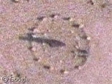
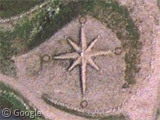
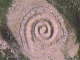
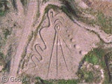
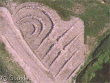
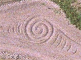
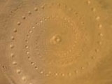
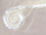
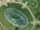
More mysterious are the several nearby shapes created from rocks, sand and gravel - a compass, a spiral and other assorted designs. Exhaustive research (i.e. trawling through Google while drinking my morning cup of tea) has failed to reveal any information about these features. Are they art? Very ambitious graffiti? Alien communications? Who made them? Can any locals enlighten us?
Thanks to AndrewAnorak.
Um, shouldn’t the southernmost point not be here? https://www.googlesightseeing.com/maps?p=&c=&t=k&hl=en&ll=51.381026,-3.342204&z=19
dr.R. – yes, I guess that is technically the southernmost point. I guess they put the stone & circle where it was most convenient, and most likely to last a while. Several places I read that the coast and cliffs are washed away by the sea at quite a rapid rate, so the southernmost point is travelling northward all the time!
Actually, isn’t this technically the southern most point? If you drag the map northward and put Dr. R’s point at the edge of the view window, this point is below the edge of the view window.
https://www.googlesightseeing.com/maps?p=&c=&t=k&hl=en&ll=51.380225,-3.405794&z=17
Breaksea Point is apparently what nova72’s point is called. And it does seem to me as well to be further south than the extremity of Rhoose Point.
I’m not sure – I think the pic was taken at low tide. The “permanent” dry land at Rhoose Point (i.e. above the cliffs) seems to be further south than at Breaksea Point, but Breaksea has a wider expanse of shoreline.