Complicated borders
Friday, 12th December 2008 by Alex Turnbull
Here's a fairly long train travelling through an icy Moldova, eastern Europe. A train is hardly an uncommon sight on Google Earth - but this particular train will travel from one side of Moldova all the way to the other in an incredible two minutes flat.
The train has just left neighbouring Romania and is passing through Moldova on its way to Ukraine... but as you may have guessed by now, this train passes through Moldova at the exact point where the three countries meet. If the train had been just a little longer, it could have actually straddled all three countries at the same time!
Elsewhere in Europe, we find the Belgian town of Baarle-Hertog - which is in the Netherlands.
Baarle-Hertog is made up of twenty separate Belgian exclaves in the Netherlands, and three other pieces on the Dutch-Belgian border. Even more confusingly, there are also seven Dutch exclaves within the Belgian exclaves!
The Dutch parts of the town are called Baarle-Nassau, and the border is so complicated that there are some houses that are divided between the two countries. Allegedly there was once a Dutch law which required restaurants to close earlier than those in Belgium, which for some restaurants simply meant that the clients had to move tables to the Belgian side.
Read more about Moldova, Baarle-Hertog and Baarle-Nassau at Wikipedia. BLDG blog also has an excellent article about Baarle-Hertog.
Thanks to Eric Hagerman and Nev Stokes.


This exclave-within-an-exclave issue somehow reminded me of the lake-island recursion.
In Switzerland, there is a German as well as an Italian exclave, but I admit they are not as spectacularly complicated as the two Baarles.
https://www.googlesightseeing.com/maps?p=&c=&t=h&hl=en&ll=47.696939,8.690529&z=14 https://www.googlesightseeing.com/maps?p=&c=&t=h&hl=en&ll=45.971853,8.974285&z=14
And then there is the Austrian town of Jungholz which is connected to the rest of the country by only one point: https://www.googlesightseeing.com/maps?p=&c=&t=h&hl=en&ll=47.570735,10.458126&z=14
Have you ever noticed this tiny bit of the USA tacked onto BC, Canada: View Placemark
Point Roberts – more info on wikipedia: http://en.wikipedia.org/wiki/Point_Roberts,_Washington
Ceuta is a tiny bit of Spain attached to Morocco – http://en.wikipedia.org/wiki/Ceuta
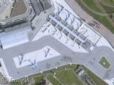
If you look at Coolangatta Airport in Australia, you will find it also straddles a state border. The border dissects the middle of the runway.
This state border is also a time-zone border in summer as NSW has Daylight Savings Time and Queensland doesn’t.
Legally, if you were to land from the north at 2pm, it would be 2pm when you touchdown, 3pm when you stop and taxi, and 2pm when you get to the terminal.
Since the Google Earth photo was taken, the southern part of the runway has been extended and the new Tugun Bypass (also not visible yet) has a tunnel which passes under the runway.
Evan :->
Oops! Here’s the co-ords:
153.504715,-28.164444,0
Evan :->
There’s a similar place in Germany with a very complex border between the german states of Hessen and Baden-Württemberg, including some enclaves/exclaves: https://www.googlesightseeing.com/maps?p=&c=&t=m&hl=en&ll=49.615826,8.681259&z=14
Actually, it seems as if google is even missing some border lines, wikipedia has a better map.
And the there is the route of the former Vennbahn, a belgian railway with quite a bit of track crossing german territory – but entirely on belgian ground according to the Treaty of Versailles. This has the weird effect that about a dozen persons in Germany do de jure live in Belgium. They even have belgian addresses and number plates for their cars.
The Vennbahn borders are completely unknown to google apparently. Pity.
I hope Moldova and Ukraine have a good border agreement; I followed the trainline back a while (bored? moi?), and I crossed the border quite a few times. From Moldava, into the Ukraine, to Moldova again then back into the Ukraine, to go through another short piece of Moldova and then it can go to Romania… Image being stopped at every crossing…
koen: Borders can be quite a bit off in google maps due to a low resolution of their border data in a lot of places. For example, I’m pretty sure all those straight lines and angles the border is shown to have aren’t the actual border.
And this: https://www.googlesightseeing.com/maps?p=&c=&t=h&hl=en&ll=45.266188,28.877563&z=11 is certainly wrong – I just verified it against my Times atlas: The border does infact follow the river here.
I believe the best post about Baarle is here
And here is the nice list of enclaves/exclaves with the maps.
This always strikes me as an odd one :
View Placemark
A random bit of the US stuck on the side of Canada
@dr. R. – Jungholz is brilliant! I love that it is only connected via a very steep peak, which apparently means that you can’t physically get from Austria to Jungholz without going into Germany.
It is, isn’t it? From this page:
“The existence of such artifacts as boundary crosses can give rise to all sorts of philosophical and mathematical ponderings. For example, is Jungholz really connected to the rest of Austria, the boundary cross being a point and thus infinitely small? For the same reason, does Germany completely surround Jungholz or not? Certainly, it is not possible to travel from Austria to Jungholz through the point.”
another nice site about enclaves, and also see the story of Cooch Behar at strangemaps
What about a countriy into another country? Like Vatican into Italia, or Lesoto into South Africa?
Whaat?? These are complicated borders for you guys? For really complicated borders check out the border between Uzbekistan and Kyrgizistan/Tajikistan. The whole outline of Uzbekistan is full of enclaves and crazy borders…
It is rumored that when the Russians drew the borders, during the Soviet era, they did this on purpose to create conflict between the nations….
If you want to see some really crazy borders, check out this spot on the Slovenian/Croatian border:
View Placemark
See also http://wikimapia.org/5519161/Brezovica-pri-Metliki-Gordian-Knot
and
http://sl.wikipedia.org/wiki/Slika:Interesting_part_of_the_border_between_Slovenia_and_Croatia_in_Zumberak_region.png