Tokyo’s Towers of Wind(s)
Friday, 1st May 2009 by Ian Brown
Tokyo has two structures, apparently unrelated, with very similar names - the Tower of Wind and the Tower of Winds.
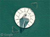
The Tower of Wind (singular, known locally as Kaze no Tō) is a spectacular structure in Tokyo Harbour consisting of a dazzling white circular base topped with blue and white striped 'sails'.
Google reveals a rather surprising number of blogs and other sites convinced that such a structure could only be the secret lair of Godzilla or an international super-villain. The reality is rather more mundane - the Tower of Wind is a ventilation shaft outlet for the Tokyo Bay Aqua-Line - the world's longest undersea tunnel for cars. The 9.6km tunnel is coupled with a 4.4km bridge to link the two sides of the Bay, saving up to 100km of driving.
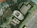
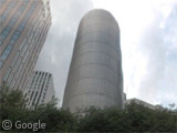
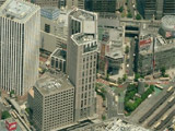
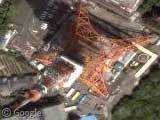
The Tower of Winds (plural) is a 21m tall building on the mainland designed by architect Toyo Ito.
Street View shows that it is rather unremarkable by day, while Live Maps shows that it is dwarfed by the surrounding skyscrapers.
By night, however, it comes alive, with ever-changing displays of interior and exterior illumination. More than 1000 LEDs, a dozen neon rings and 30-plus floodlights respond to the noise of the city and the motion of the wind. This movement of light is intended to represent "the visual complexity of Tokyo metaphorically in terms of a never-ceasing, ever-changing wind". Interesting details and good night-time pictures can be found at Ego magazine and Lighting Academy.

The Tower of Wind was shown here already back in 2005. 🙂
https://www.googlesightseeing.com/2005/06/28/tokyo-bay-offshore-platform/
Uh oh, I’ll be in trouble with James & Alex. Sorry guys, I tried searching for ‘tower’, ‘wind’, etc and didn’t come across it. Let me know if you want me to edit the post. I’ll be more thorough next time…
haha, good memory Daryl!
When I read this post, I thought to myself “we’ve featured a similar thing before” but was convinced it couldn’t be the same as I’d never heard the “longest undersea tunnel” fact.
No worries about editing the post Ian, it was worth looking at again for the updated imagery and additional facts!
Here’s a streetview of one end of the tunnel: https://www.googlesightseeing.com/maps?p=&c=&t=h&hl=en&ll=35.4624,139.875247&z=16&layer=c&cbll=35.464149,139.875382&cbp=12,287.04142011834347,,0,13.201183431952666
I only remember because I think it was one of my first suggestions, and it was accepted and published. 🙂
And here’s the Live Maps view of the other tower:
http://maps.live.com/default.aspx?v=2&FORM=LMLTCP&cp=pxfpzywnkkrz&style=b&lvl=1&tilt=-90&dir=0&alt=-1000&phx=0&phy=0&phscl=1&scene=34727846&encType=1
Am I mistaken or were the recently posted Bristol harbour and Upper Heyford car parks also featured before?
The Live maps view is amazing, I must admit! Thanks dr.R.
The car parks were only ever mentioned in the comments, and had never had their own post until now.
I too had recognised the Tower of Wind, but given that this is a far more interesting post than the original, I think we should let Ian off the hook!
Although… James did write this post about flying over RAF Thurleigh:
https://www.googlesightseeing.com/2007/10/08/spare-runways/