A Trio of Tripoints
Wednesday, 12th August 2009 by Ian Brown
A tripoint is a geographical location where three borders meet - most notably those of different countries, but also (to a lesser extent) counties, states, provinces, etc. While many of the world's 157 national tripoints are located in the middle of lakes, rivers, deserts or mountains, those that are in populated areas are often marked with monuments of some kind.
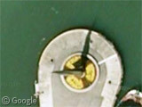
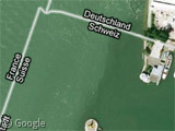
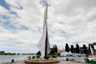
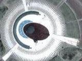
The Swiss city of Basel is home to one of the most spectacular tripoint monuments at the location where it borders Germany and France.
Basel's dreiländereck (literally "3 lands place") is home to a soaring metal three-sided spiral which bears the flags of the 3 countries. It is located on a quay in the river Rhine, near a restaurant of the same name. The actual tripoint is located just to the north-west, in the middle of the river.
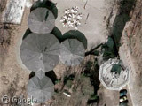
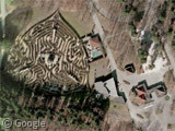
Germany also has a significant tripoint where it meets Belgium and the Netherlands. Vaalserberg features a number of tourist attractions including a viewing tower, cafes and a maze.
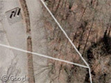
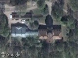
While Google Maps seems to show the tripoint in a tree, I believe the actual location is marked by the 3 small monuments visible by their shadows in the upper-left of this image.1
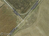
Not all tripoints are marked as cohesively. The one where Austria, Hungary and Slovakia meet has a number of monuments scattered across the different borders - all quite small, so check Panoramio to see them in detail.
Where is your favourite location with one foot in one country, one foot in a second, and ... perhaps your nose in a third?
For more like this, see our 2008 post about Complicated Borders. Thanks to AndrewAnorak and David Grenewetzki.
About the Tripoint from Netherlands/Belgium/Germany;
The point Google specifies is quite correct. It is indeed lying on the edge of that forrest. The three “monuments” are removed border stones placed there because it mainly symbolises the highest point in The Netherlands.
At the exact tripoint there is a pie-chart like mosaic made in the street with colours representing each country.
A nice trivia is that it used to be a quad-point (or whatever that is called), Between 1839 and 1919 there was a temporary state situated in a triangular shape called Neutral Moresnet. That had something to do with mining. That state is also representeted on the pie-chart I mentioned earlier.
Greetings from The Netherlands 😉 Frank
I obviously didn’t read that footnote! D’oh! So it is called a quadripoint!.
Cheers, Frank
No national quadripoints, but there is a state quadripoint in the US:
View Placemark
http://en.wikipedia.org/wiki/Four_Corners_Monument
Actually ‘Dreiländereck’ translates as ‘Three countries corner’ …
That was my bad Tammo actually, as I couldn’t reach our German translator today, so relied on her less-German fiancé 😉
I’ll update the post, cheers!
Right on the spot where the borders of Norway, Finland and Russia meet, 3 time zones meet too. UTC+1, UTC+2 and UTC+3.
Another intersting thing is the border between Norway and Russia. If you stand in Norway and step over on the other side to Russia you have to change the time of your clock by 2 hours. As far as I know nowhere else in the world this happens.
China has one time zone, so there are a few areas where bordering time zones are two hours and even three hours off.
Actually, on the border between Afghnaistan and China, the time zone difference is 3 hours 30 minutes.
Not a tripoint but related to the compicated borders topic… If you want to see some really crazy borders, check out this spot on the Slovenian/Croatian border:
View Placemark
See also http://wikimapia.org/5519161/Brezovica-pri-Metliki-Gordian-Knot
and
http://sl.wikipedia.org/wiki/Slika:Interesting_part_of_the_border_between_Slovenia_and_Croatia_in_Zumberak_region.png
On the African near-quadripoint issue… Google Maps has recently improved its depiction of the borders in this region but the Zimbabwe-Botswana border is still not quite right – I think it should go almost due south from the river, a little further to the east than shown on Google. View Placemark
Here’s my interpretation on an aerial photo… http://i25.tinypic.com/mae6ax.jpg
Either way there is a very short border between Botswana and Zambia.
here is the best available real map of the african near quadripoint area & it is based on much larger scale mapping too so it involves no errors of scale or slips of the pen etc but is quite deliberate & accurate
http://library.wur.nl/isric/kaart/origineel/afr_zw3002_3to.jpg
it looks like there is really a short nazw border rather than any bwzm border there
also with all due respect to wikipedias 157 national tripoints there are actually at least 176 recognized by the united nations & perhaps as many as 31 more
https://www.jiscmail.ac.uk/cgi-bin/webadmin?A2=ind0910&L=INT-BOUNDARIES&T=0&F=&S=&X=0A1F0F460F0A2FEE23&P=59
Tripoint between Bulgaria, Greece and Republic of Macedonia (aka FYROM) in Belasitsa Mountain
https://www.googlesightseeing.com/maps?p=11913&c=208071&t=h&ie=UTF8&ll=41.337928,22.942742&spn=0.002993,0.004812&z=18