Haiti Earthquake (Updated Imagery)
Wednesday, 20th January 2010 by Alex Turnbull
Last week's catastrophic 7.0 earthquake in Haiti is estimated to have killed 200,000 people, injured 250,000 and left 1.5 million people homeless.
Following the quake, Google quickly released a KML file that included imagery taken by the GeoEye satellite within hours of the occurrence of the disaster.
Today brings the news that Haiti has within the last few hours been hit by a second, 6.1 magnitude earthquake. The extent of the damage caused by this strong aftershock is not yet clear.
This sad news coincides with Google's addition of even more up to date imagery to Google Maps and Earth. The new imagery was gathered on January 17th (Sunday), and must be aerial imagery, as the resolution is extremely high - somewhere around 15cm per pixel.
Here we can see a makeshift camp set up for survivors - and the SOS message they have scrawled on the ground nearby.
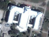
We saw the destruction of the presidential palace in our post last week, but this new imagery really hits home just how cataclysmic the quake was.
We can see a US plane at the airport which appears to be unloading supplies, but as is being reported widely, this aid isn't reaching the people fast enough. Aid group Partners in Health estimate that 20,000 people are dying each day who could have been saved with access to proper medical attention.
There are so many factors compounding Haiti's problems it's almost overwhelming. For example, Haiti's national prison was heavily damaged in the quake - allowing a reported 4,000 prisoners to escape. They're currently in the process of reclaiming old territory, starting gang wars, and attacking the police and UN forces.
A spokesperson for the UN called this "the worst disaster the UN has ever confronted", and reading through the continually updated Wikipedia page on the disaster gives some idea of what they're up against.
If you wish to donate to the efforts to provide aid to the people of Haiti, you may visit Google's Disaster Relief page.1
-
Additionally, if you're a Mac user, consider buying some independent software - all applications bought through Indie Relief will donate all proceeds to Haiti. Note that this only applies today, January 20th. ↩︎


This looks like the centre of aid operations at the airport:
View Placemark
Also I’ve been browsing around the new imagery, and those makeshift campes are everywhere. Every available open space has become home to displaced people
there is now news that US divers say the port could be be opened within a month.
But with this devestation, I hope so. https://www.googlesightseeing.com/maps?p=&c=&t=k&hl=en&ll=18.555996,-72.348447&z=19
fyi, the imagery comes from : http://www.wired.com/wiredscience/2010/01/haiti-3d-flyover http://www.rit.edu/news/?v=47281
I know the folks that are flying it…cool stuff.
Actually…. the stuff Google currently has up is their own imagery that they flew (somewhere along the line they bought an aerial imaging company). I’m currently down in Haiti flying the RIT sensor Glen mentioned – we’re uploading our data to Google and they should be posting the rough stuff relatively soon. Our visible images are at about 15 cm nominally (we captured a cloud free scene, and the details are pretty sharp… but it took 3 days worth of flying to capture it flying at 2600ft AGL) … and we’re also gathering Short/Mid/Long wave infrared along with a pretty high resolution topography with a Leica ALS-60 LIDAR. You can see what we’ve done so far going here: http://ipler.cis.rit.edu/projects/haiti (follow the telesciences link to get a first-cut mosaic at full resolution) We’ll continuously update that site with all the latest things as they are processed and refined
I was one of the rescuers of Rescue South Africa who search and rescue in Haiti,never in my 30 years of services i experience a disaster response as this Gods blessing to all in Haiti