The Pennine Way
Friday, 26th March 2010 by Ian Brown
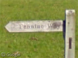
The recent expansion of Street View in the UK allows us to visit sections of the Pennine Way, Britain's most well known long distance walking path, where we can admire the scenery of three national parks without the inconvenience of walking hundreds of kilometers across challenging terrain in unpredictable weather.
While the 429km trail can be walked in either direction, the majority of hikers travel south-to-north to have the prevailing wind behind them, so that's the way we'll go too.
The Pennine Way starts in the Peak District village of Edale, at the Old Nag's Head pub where those preparing for the task ahead can enjoy a stiff drink to settle their nerves. Google seems to have censored the beer garden sign for some reason.
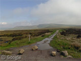
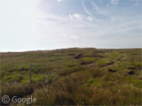
The path heads north through the country's oldest national park, over Kinder Scout, Bleaklow and other high moorland. In sections the path is so heavily used by both long-distance and day hikers that measures have been needed to repair damaged land and provide a permanent stone surface1, such as this section off the Snake Road.
Along the way, walkers have to pass over or through more than 700 gates and stiles which provide access to the public footpaths across farmland and moors.
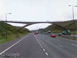
After a couple of days of walking on peaceful hillsides, it must be a bit of a shock to the system to take the footbridge across the busy M62.
While there are many markers and points of interest along the way, one of the most significant is Stoodley Pike, a tower first built in 1814 to commemorate Napoleon's defeat, though the current structure dates to 1889.
While the majority of the Way is on public footpaths, there are short distances on roads, particularly when passing through places such as Gargrave, a picturesque village on the edge of the Yorkshire Dales.
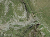
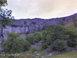
Further north in the Dales is one of the natural highlights of the walk - the limestone pavement and cliff at Malham Cove, which is one of the National Trust properties visited by the Street View trike. I've hiked the area many times and don't recall it being quite so purple as Google makes it appear!
The Pennine Way was conceived by Tom Stephenson in the mid-1930s, and completed 30 years later when a section of trail north of the Cove was declared open in an official ceremony. From there walkers head to Pen-y-ghent which is a famed and fairly stiff climb.
The fastest completion of the trail is 2 days 17 hours - a record set by Mike Hartley in 1989. This feat was accomplished with no sleep and only a couple of short breaks, including one for fish and chips!
As mentioned earlier, the Pennine weather is unpredictable much of the time, with snow on the higher moors not uncommon in winter.
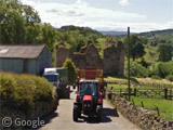
As we continue our intrepid journey north into Northumberland National Park, we come across the remains of Thirlwall Castle (and red tractor). Here the path also encounters Hadrian's Wall, stones from which were used to build the castle.
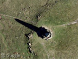
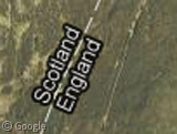
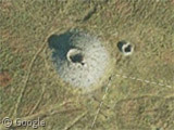
After a considerable distance crossing country with no roads, the Pennine Way reaches the Scotland-England border. The clearly visible path runs parallel to the border for a while, and crosses back-and-forth many times, including at Russell's Cairn, a bronze age stone memorial which can apparently shelter over a dozen people should bad weather strike.
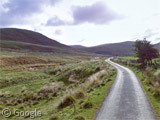
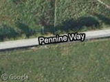
After entering Scotland for good, and descending from the high ground for the final time, walkers find themselves on a small road appropriately named Pennine Way.
Weary walkers doubtless enjoy this downhill stretch into Kirk Yetholm where, mirroring the start of the walk, a pub awaits - The Border Hotel.
Famous rambler and author A.W. Wainwright promised to cover the cost of a half pint of ale for anyone completing the walk - a generous move which cost an estimated £15,000 during his lifetime.
If you are now inspired to put on your hiking boots, throw some Kendal Mint Cake and a raincoat into a backpack, and head out on this long journey yourself2, you can start with the official site. I also recommend a seasoned walker's journal of the route, and a comprehensive description which is broken down into the 18 daily sections followed by most walkers.








Great, now you’ve given me itchy feet. Another great walk to add to my list.
Stoodley Pike is very interesting. I’ve walked there quite a few times (once in a blizzard) when growing up in Halifax.
IIRC it has collapsed a couple of times – around the outbreak of wars. Local legend says that the next time it falls will mark the end of the world.
Lots more snow on the Keld/Kirkby Stephen road. Looks like the Googlecar had a spectacular journey that day. View Placemark,,0,12.05 “Get your snow / on route B6270”
You should check out the great hand tree at Malham Cove
https://www.googlesightseeing.com/maps?p=&c=&t=h&hl=en&ll=54.072037,-2.158647&z=18&layer=c&cbll=54.072072,-2.158327&cbp=13,353.99,,0,-2.82
That’s awesome, thanks Stephen!