World’s Longest Bridge Over Ice-Covered Waters
Friday, 9th April 2010 by Ian Brown
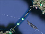
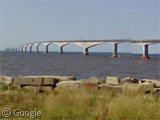
The world’s longest bridge over ice-covered waters is the 12.9 km Confederation Bridge which connects the Canadian provinces of New Brunswick and Prince Edward Island.
When PEI joined Canada in 1873, the federal government committed in its Constitution to providing ‘efficient steam service’ from the island to the mainland. For a number of years steamships provided service in the summer, while iceboats crossed the Abegweit Passage during the winter.
Over the years this evolved into a permanent ferry service between Cape Traverse, PEI and Cape Tormentine, NB.
Confederation Bridge from the New Brunswick shoreline
Discussions about a permanent fixed link took place numerous times from the late 1800s to the mid-1900s, though proposals for a rock causeway were generally dismissed as being too hazardous to shipping, and impractical due to the extreme tides in the area.
In the 1980s the federal government agreed to construct a bridge if the island would agree to cease operation of its deficit-laden ferry and railway services.
Confederation Bridge from the PEI shoreline
This proposal created considerable angst on the island, with many residents fearful of environmental damage and destruction of their quiet island lifestyle. However, after a vote in 1988 the bridge received almost 60% approval, though it took another 5 years for construction to commence, along with a modification to the Canadian Constitution to affirm that the bridge could replace the ferry service.
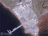
The bridge’s components were made of high-grade concrete and steel in a construction facility at Amherst Head. Ice shields were required on all 62 of its piers to protect them from the complex tides and crushing ice which builds up in the winter.
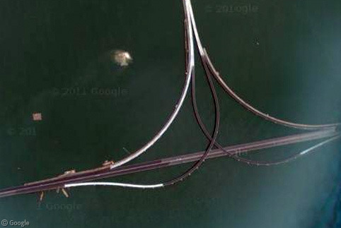
The bridge curves in a slight S-shape, supposedly to keep drivers from losing focus on an elevated bridge with no landmarks to distract the vision. For the most part the deck is 40m above the water, though the central spans rise to 60m to allow the largest ship traffic to pass beneath.
Confederation Bridge was officially opened on May 31, 1997, with the ferries ceasing operation the same day. An estimated 75,000 people took the opportunity to walk across the bridge before it was opened to traffic – with pedestrians and cyclists now forced to take a shuttle service.
While traffic to PEI has increased, the bridge may have actually reduced long-term tourist stays due to the ease with which people can now visit just for a day. It has, however significantly increased food exports to the rest of Canada.
Learn more at the Bridge's official site, which includes a webcam (requires Windows Media Player) and a photo gallery with good pictures of winter ice.
Thanks to Kris MacLellan, Pete, Alain Lamarre, Duncan, Daniel Pereira and James.





You write that the public decided to build the bridge in 1998 and that the bridge opened on May 31st 1997. I think you need to fix 1998 to 1988 unless they invented a time machine 🙂
Oops. Thanks for pointing out my typo, Rasmus. I’ve corrected the error!
We had that crater post earlier. Is this one of those impact regions? It looks very circular.