Airport Emergency Training Locations
Friday, 27th August 2010 by Ian Brown
As a moderately frequent flyer, I enjoy looking out for fire and emergency training locations at airports. It's fascinating because, for anybody who is even vaguely nervous about flying, the sight of a twisted and charred fuselage is probably the last thing they want to see as their plane accelerates down the runway! Here are a few of the best that I've been able to find on Google Maps.
Glasgow airport in Scotland have their fire training centre conveniently located next to a road, giving us a great look at it from Street View.
From this we can clearly see that, while some airports may use abandoned or decommissioned planes for training, in many cases it is merely a 'plane-shaped object' that can withstand repeatedly being set on fire - though convincing enough to upset a nervous flyer, particularly if it happened to be ablaze as you taxied past! Nearby is a small collection of old and wrecked cars - perhaps used to practice extractions?
At Zurich Airport there is an old DC-8 which looks to be in relatively good shape, so is probably used for evacuation exercises rather than fire training (which likely happens at the smaller object just to the east).
Another 'plane-shaped object', complete with a couple of fire trucks can be found at Leeds-Bradford Airport, a mere 150m from a runway!
The sprawling airport in Denver has 4 fire stations and the impressively titled Denver International Airport/Denver Fire Department Aircraft Rescue and Firefighting (ARFF) Training Academy, with a full-size plane mockup.
A similar training school can be found at Durham Tees Valley Airport which has a veritable array of old planes and 'plane-shaped objects'.
Recently, the trend has been for airports to invest in expensive training systems that can challenge firefighters with a range of different situations. At Schiphol Airport near Amsterdam there is a full-size mock up of a 747, in an area clearly marked Fire Training, which has 20 computer-controlled fire training settings. There is also a very similar system at London's Gatwick Airport.
Manchester Airport has a high-tech system from a different manufacturer, that also resembles the front two-thirds of a 747.
We previously covered some of these "Fat Planes" back in 2006, but let us know what other training locations you can find on Google Maps or Street View. Bonus points if you can find one that is actually on fire!
(I shall now sit quietly and wait to see if spending a couple of hours browsing maps and street views of airport security perimeters has attracted the attention of the government's online monitors).
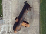
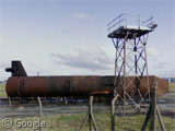
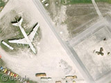
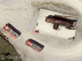
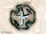
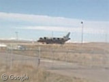
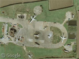
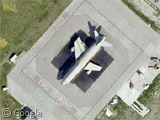
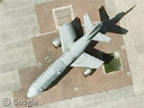
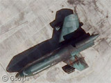
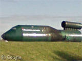
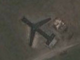
Here are 3 for you…
Sydney Airport – View Placemark
Our local Canberra Airport – View Placemark
Saw this one at Honolulu Airport whilst taxiing recently – View Placemark
some shots taken from the ground of the DC-8 in Zurich. It’s not in that great shape 🙂 http://jetphotos.net/showphotos.php?regsearch=TU-TCP&view=true
This one is probably used for anti-terrorism training / fire rescue training.
It looks like a combination of large and medium sized aircraft simulators welded together and painted red.
As seen on StreetView
View Larger Map
As seen on Maps
View Larger Map
Bristol International:
View Placemark
Unfortunately I couldn’t find any vantage point in Streetview …
Salt Lake City, Utah:
View Placemark,,1,-0.95
At Pittsburgh, PA airport. Always a heartening sight. No streetview. View Placemark
Here are a couple more from around Australia
Brisbane View Placemark
Gold Coast View Placemark
Melbourne View Placemark
Adelaide View Placemark
Perth View Placemark
This one at RAAF Pearce in Western Australia is for emergency and counter terrorism training View Placemark
The one at Darwin isn’t on fire but it has only recently been used by the look of the foam on the ground View Placemark
Alice Springs View Placemark
RAAF Amberly View Placemark
You didn’t leave gaps in the code –
View Larger Map
View Larger Map
View Larger Map
View Larger Map
View Larger Map
View Larger Map
View Larger Map
View Larger Map
View Larger Map
Sorry, don’t know what happened there.
Looks like the Singapore one comes closest to being on fire…
The image looks to have been taken after a fire training session – there is still foam on the surrounding grounds.
Or maybe they gave the simulator a wash? Haha
yym_c: thanks for posting with corrected links from Waterbucket’s post. I’ve also edited the original comment so we have the descriptions.
Thanks yym_c and Ian for fixing my post. It looks like the site doesn’t like it when you post too many links. It spat the dummy and unformatted the post.
Would it be easier (to spot mistakes) if there was a preview before posting option?
Something for the site moderators to look into?
Thanks yym_c – a fair point! I’ll look into our options. Cheers!
Hi yym_c,
We’ve added a comment preview option to the site – thanks for the feedback!
As a test, here’s a stone bear: View Placemark,,1,2.51&ie=UTF8&ll=51.481122,-3.182361&spn=0.001741,0.004061&z=18&panoid=kZ8xZ23ccrX9onatLQPjrQ
Fire and Emergency Services Training Institute at Toronto’s Pearson Airport
View Placemark
View Placemark (41.70686,-86.333343)
here a link to a mapped photo of the training site at the Incheon airport near Seoul, South Korea’s http://www.panoramio.com/photo/36457612
View Placemark
Jersey Airport,Jersey,Channel Islands – this is their training site for the Fire Team