The Russian Woodpecker
Monday, 30th August 2010 by Ian Brown
Last week a top-secret Russian shortwave radio station, UVB-76, began broadcasting a coded message for only the fourth time in 28 years. Today we're exploring another shortwave system within the radioactive zone surrounding Chernobyl, The Russian Woodpecker
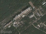
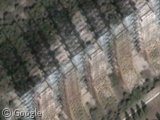
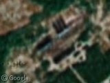
The Russian Woodpecker was an over-the-horizon (OTH) radar system used during the later years of the Cold War. Broadcast towers used for its shortwave signals are still in place near Chernobyl.
The Woodpecker nickname derived from the loud and repetitive signals being broadcast. They were so powerful that they interfered with radio signals and telecommunications around the world, from their beginning in 1976 to when they ceased at the end of 1989 when the Soviet Union started to collapse.
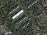
There were various conspiracy theories about the source of the sound, from the orthodox (radio jamming or submarine communications) to the bizarre (global mind control or aliens). However, NATO forces quickly realised that it was an OTH system, and were even able to photograph the massive arrays of 150m tall antennas, which they dubbed the Steel Yard, and nearby buildings, which look quite overgrown now.
The proximity to Chernobyl means this location is likely permanently abandoned, though local amateur radio enthusiasts have been known to rig their own systems up to the antennas!
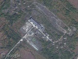
Officially named Duga-3, the system was completed by a receiving facility approximately 60km away from the transmitter. Unfortunately this area is only covered by very low-resolution imagery.
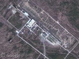
A second Duga-3 system was installed in Siberia - again a pair of facilities 60km apart, though most of the installations have been dismantled. However, if you zoom in, there appear to be large collections of military vehicles at both locations.
This system was intended to cover any gaps in the original system's OTH radar detection of incoming missiles from the USA.
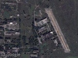
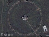
These systems followed on from prototypes Duga-1 and Duga-2 which were built and tested in southern Ukraine. Little evidence of these systems remains, but there is an interesting circular formation nearby.
Can anyone find any other top-secret shortwave systems elsewhere in the world?
Learn more about the Russian Woodpecker at Wikipedia and Passing Strangeness.
Thanks to Mada.
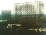


Here are pictures from somebody that actually climbed on that thing http://englishrussia.com/index.php/2008/04/28/duga-the-steel-giant-near-chernobyl/ I also saw a video of somebody doing ‘Plasma Radio’ on that thing.
The Duga-3 antennas were also immortalized in the computer game STALKER: Shadow of Chernobyl as the location of the Brain Scorcher, set up to protect the secrets at the heart of the Exclusion Zone…
View Placemark
I spent days trying to figure out what this facility was for (seems abandoned, but maybe not).
This site http://www.hawaiihighways.com/lanai_molokai.htm
Suggests that it is a “small Air Force space communications facility”
My guess would be part of the “Molokai HF Receiver Site, Molokai, Hawaii”
which Wikipedia lists as a minor active-duty installation.
That “circular formation” is almost certainly a Wullenweber-style array, known in the USSR as “Krug”, which was either used for navigation or for intelligence. The US and other nations built similar systems in the early Cold War era. Their circular shape allows for instant direction detection of signals; a signal detected at two of them are rapidly triangulated. I have a bunch of these posted up at VGT, look for the phrase “AN/FLR-9” for examples.
Well, there’s the Australian JORN OTH system, with three antennae pairs. These are the Alice Springs test antennae.
View Placemark (-22.967561,134.447937) View Placemark (-23.521497,133.677521)
High-power HF OTH systems are always going to be big – unless you’re looking for small installations like those run by oil rig operators used to monitor wave heights in the North Sea or Gulf of Mexico.
I’m not sure if this has been posted before, but here is the mysterious HAARP facility in Alaska. Well only part of it is in High Res.
https://www.googlesightseeing.com/maps?p=&c=&t=k&hl=en&ll=62.392458,-145.149779&z=15
Here’s the wiki page for it. http://en.wikipedia.org/wiki/High_Frequency_Active_Auroral_Research_Program
For what it’s worth this is also the inspiration for the multiplayer map Grid in Call of Duty: Black Ops