Which lake was that again?
Friday, 18th February 2011 by Chris Hannigan
Straddling the international border between Canada and the United States sits a region known as the Boundary Waters. Carved repeatedly by massive sheets of ice, this region has become home to over 1,000 protected and pristine lakes – so many in fact, that some rather creative nomenclature was required…
Firstly, there are bays (and sometimes lakes) named after days of the week; Wednesday Bay, Thursday Bay, Friday Bay, Saturday Bay, and Sunday Bay.
There are also lakes named after body parts; Finger Lake, Elbow Lake, Bone Lake, and Organ Lake to name a few.
One of my personal favorites is the series of lakes named after That Man and This Man. But then don't forget about the Other Man (Lake) or even No Man (Lake) at all!
Some lakes just sound similar like Rum Lake and Ram Lake.
There's even a Disappointment Lake for a good excuse when you have a bad fishing trip.
I think a Def Leppard fan got to name this one Rock of Ages Lake.
When the creative juices stop flowing sometimes it's best to resort to numbers, like Eagles Nest Number One Lake... and Two Lake, Three Lake, and Four Lake.
I think the best grouping however has to be the region named after vegetables - Kraut Lake, Parsnip Lake, Bean Lake, Carrot Lake, Potato Lake, Celery Lake, Squash Lake, Turnip Lake, Onion Lake, Cucumber Lake, Tomato Lake, Peanut Lake, Strawberry Lake to name a few.
Take a look around and see what you can find!
There is of course more information on Boundary Waters at Wikipedia.
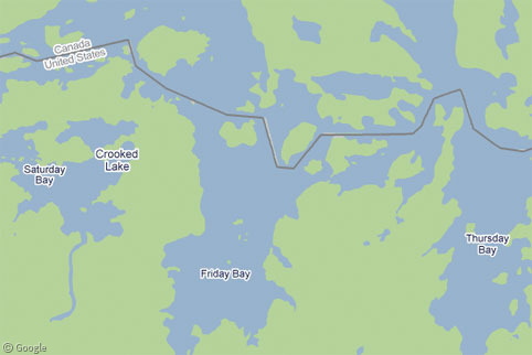
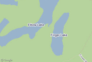
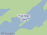
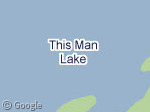
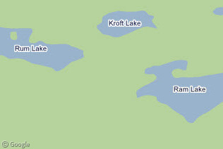
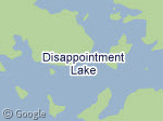
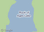
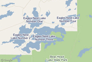
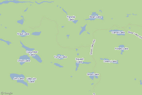
In case you’re not sure what you’re looking at 🙂 https://www.googlesightseeing.com/maps?p=&c=&t=h&hl=en&ll=48.017143,-91.275101&z=14
Sorry – my comment above should have map labels on or it doesn’t make sense! 🙁
Thanks Nic, I’ve edited your link to include the labels.
(Also – hoho!)
Ha, yeah I saw Ima Lake as well. I swore somewhere I saw Ura Lake too… but when it came time to take picture’s it magically disappeared!
I’ve been on Ima late. My dad had no end of fun when I pointed that out on the (paper!) map.
OMG! (wringing hands and stifling sobs) Looks like global warming to me! What are we going to DOOOO!
There is also name duplication (there are at least 3 Whitefish Lakes on the Ontario side, and at least two Whitefish Rivers, while many lakes are either not officially named or are known by multiple names, with the most commonly known name not necessarily being the official name.
There is a Contest Lake. Does the winner own the lake?
I love how there seems to be no Monday or Tuesday Lake.
There’s also a Disappointment Lake (or Lake Disappointment) in Western Australia. The fishing isn’t very good…
Lake Disappointment – Wikipedia
Many years ago, my Dad and I canoed on Lake One and Lake Two on the edge of the Boundary Waters.
Having grown up not far from here, I read a piece of trivia a few years back. The question was – How much of the Ontario/U.S. border is on land? The border length must measure in the thousands of kilometres. I think the answer was something less than 20 miles. Well – east of this area all of the border is on water as it passes down the Pigeon River through the Great Lakes, over Niagara Falls and down and out the St. Lawrence River. On the western boundary it goes through Lake of the Woods. The only piece over land is in this area and there’s very little of that. Most follows the lakes, rivers and creeks. I think the calculations were done adding up the lengths of the portages on a canoeing map.