B-Bomb!
Wednesday, 13th April 2005 by
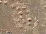
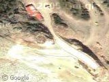
No, that's not the surface of the moon. It's where the US government has blown-up lots and lots of things at the "Nellis Air Force Bombing and Gunnery Range" in Nevada, just south-west of Area 51. Also, scroll north and check out that big bad-boy crater.
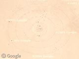
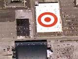
Thanks to "eugene" for pointing out even more crazy stuff further to the north. Including this massive target, I assume for practice bombing.
hey i found this big ass airport not to far off from the link im not sure its the “Nellis Air Force Bombing and Gunnery Range� or not if its not dose any one know what the hell it is it huge has to be govt or somthing View Placemark
Cheers eugene, added that 🙂
I think that’s part of the Nevada Test Site. The craters are from underground nuclear testing.
The area where they tested the first Atomic bomb in the 1945 was at the White Sands Missile Test Range. The craters where the bombs were set off (Trinity Test Site) have been filled in. This is the best image available: View Placemark
You can also visit the base for more info: http://www.wsmr.army.mil/
http://www.answers.com/topic/operation-plowshare
These craters are from operation plowshare, the idea to use nuclear weapons for peaceful construction purposes.
more crater
Topozone agrees that the second image is a “target”: http://www.topozone.com/map.asp?lat=37.487583&lon=-116.228313&datum=NAD83&u=5
Check out their view of the first image: http://www.topozone.com/map.asp?lat=37.144947&lon=-116.064892&datum=nad83&u=5 In case the satellite images don’t illustrate these holes enough, the contour lines on the topo map are 20 vertical feet apart.
Here’s a great one: this is the sink-hole created by an underground explosion, such as an underground nuke test or a fuel-air explosive in a deep bunker. There is a momentary lift from the concussion that leaves a ring like this one.
That’s definitely the Nevada Nuclear test range. Almost a thousand nuclear weapons have been detonated on the site since 1961. Most of them were not for operation plowshare (see above) although the largest, Sedan Crater, was. It is the largest manmade crater on earth. You can find it here: View Placemark
In the same area of Nellis, anyone know what these two circles are, and zooming in and scrolling below, a compound of buildings.
View Placemark
These are all in the Nevada Test Site, which covers a huge area (including the Area 51 site). It’s split up into differently numbered areas and is used by all sorts of goverment agencies – the craters are mainly clustered in the DOE areas and are the result of civil nuclear testing. Some of the “craters” are mounds, which house labs and storage facilities. There are military locations there too including the ultra secret Tonopah base. Several airbases have already been spotted by visitors here, I notice. I noticed one that seems to be abandoned, and features a long deserted aircraft on the runway that almost looks like it’s made of sand (I’ve submitted that using the suggestion form).
If you zoom into the “bullseye” as far as you can, you’ll see what look like oil drilling rigs and storage tanks.
Since I doubt there’s any oil under a dry lakebed in the Mojave desert, I bet I know what they were practicing for!
Also, If you look carefully at the “big @$$ airport”, you’ll see two rings of six dirt mounds, and several three sided berms, with taxiways leading to them.
The circular formations resemble SAM (Surface to Air Missile) sites, and the berms look like aircraft dispersal locations. The sort used in a formely independant country whose name starts ith an I and ends with a Q.
“Drive it like you stole it.”
Atomsk
Indeed the Air Force might use it for training exercises such as those conducted out of Nellis AFB – known as Red Flag…
Try counting the planes, I lost count at a hundred..perhaps just prior to some exercise….
more bomb holes by the runway that eugene found.. i folowed the road till i came across these View Placemark
check out the end of this video. i think the target in the video is the same as the one shown on google images. could be wrong…
http://www.undergroundfilm.org/films/viewer.tcl?oftype=lar&wid=1016781
This is a good view of the Sedan Shot crater… 1280 feet wide and 320 feet deep… http://en.wikipedia.org/wiki/Sedan_(nuclear_test)
View Placemark
Try to find old pieces of structural tests such as cement pillings used on bridges and such, if anyone can find the hypocenter for Shot Grabel then you can find alot of these things.
Anybody notice these green circles not too far away?
View Placemark
The link to White Sands Missile Range is not the trinity test site. The trinity site is very old and not as impressive from the air. View Placemark
the brown location at the base of the circle is the parking lot. It is opened to the public twice a year, so it is not a big secret. As impressive as the other circles are, they are not from atomic bomb blasts, they are graded for target evaluation and ease of recovery of test articles. So they are simply mowed desert areas, no more, no less.
what is this then? View Placemark
I think the circle ranges are meant to check certain types of damage at different distances. Like do sheep go blind at 200m or do mice get cancer being at a distance og 500m, or does a bunker collapse at 50m distance.
The even tested with soldiers as guinea pigs at other locations (great photo): http://www.yuccamountain.org/julie.htm
That is a BIG bang! View Placemark
That is the sedan crater. planned to use them to drill a new panama canal thru nicaragua. fell flat however http://nuclearweaponarchive.org/Usa/Tests/ here is link of most of the shots. Bikini and enowitok are the larges mike shot 15 mgton poor view on earth now. there is a huge crater and one filled in by the army with a large concree dome at eniwetok
Mmm.. I just followed the road from that weird airport north and found this View Placemark When you zoom in on each end of the triangle you can see some kind of radio towers.. WHAT IS THIS!!! I guess big brother is watching you!
Kieth, the second image that topozone said was a target, isn’t. It does, however have the markings of one, but there are radio towers within the rings that do not appear to be damaged at all, as would be the case if bombs were dropped on them
the green circles are just farm land. likely producing 300lb heads of lettuce.
View Placemark
Looks like those weird green circles again
That big bad-boy crater is the sedan crater
The circles as noticed by warren Says: June 11th, 2005 at 1:39 am
Anybody notice these green circles not too far away?
View Placemark
and Gayle O Says: April 15th, 2005 at 5:43 pm
In the same area of Nellis, anyone know what these two circles are, and zooming in and scrolling below, a compound of buildings.
View Placemark
Are crops. If you saw the movie Andromeda Strain you could safetly assume that the gov’t is growing wheat in those circular patters. Is the wheat being grown as a cover for underground facilities or activities? Who knows but it could be something as simple as the USGS or USDA growing genetically engineered crops.
The Yucca Flats area (Area 6) which is southwest of Area 51 (Groom Lake) as previously stated has been used for DOE nuclear tests and Nellis AFB artillery. Im not going to discuss what the “Target” was used for because I cannot say for certain. I assume it’s for bomb/missile practice but I’m not certain.
I am very intrigued by the “abandoned” airfield.. it looks more like it’s artificial and kind of just rag tag put together. The Berms are interesting to look at (as is the abandoned aircraft). The small cluster of “foundations” to the south and east of the runway and taxiways is also interesting but I have no idea what they are.
I am -really- intrigued about the sand colored (camouflaged) runways in the Groom Lake lakebed. Runways 27/9 R and L and Runways 21/3 R and L appear to be still maintained and the long seashell taxiway is very interesting as well.
I’ve noticed that a lengthy section of Runway 32/14 has been closed (big yellow Xs and the numbers are blacked out) it appears that the closed parts have undergone extensive weathering by not being maintained, I’d even venture to say that the Air Force has turned those sections of runway into collapsable concrete or just neglected to maintain them; the grid pattern makes me think collapsable concrete.
Inbetween Rwys 32 and 30 there appears to be some sort of catapult launch system that has also gone under substantial weathering (again by the grid pattern on the concrete). I assume that’s used as a catapult system similar to that found on Navy aircraft carriers. Of course it could be some sort of advanced magnetic launch catapult which wouldn’t surprise me as talks of such a system being tested have been going around for a while. NASA was toying with the idea of using such a system to launch reusable craft into space.
I’m not much into conspiracy theories anymore surrounding Area 51 or the Nevada desert. I feel what I’ve said here is rather sensible and not too far fetched.
Some more goodies in the Nellis Complex: Tenopah Test Range (TNX) View Placemark You can see closed taxiways (yellow Xs) and what appear to be buildings that are no longer used. link to info about the Tenopah Test Range: http://www.serve.com/mahood/nellis/ttr/ttrmain.htm
Indian Springs AF Aux (KINS) View Placemark http://www.globalsecurity.org/military/facility/indian-springs.htm
Pahute Mesa Airstrip (L23) View Placemark Pahute Mesa Airstrip is owned by the Nevada Dep’t of Energy and no flights are permitted to land without permission from the NVDOE. The “owner” of the airfield wishes it not be on flight charts.
Yucca Airstrip (NV11) View Placemark
You can see that one of the mounds has been blacked out. Weapons of somes sort that the Gov’t doesn’t want computer nerds to see obviously. The Yucca Airstrip is also owned by the DOE and requires permits to land.
All of the airstrips listed above are in restricted airspace from 0 to 100,000ft (so basically, well into the stratosphere) The only exception is KINS which is right on the border of the airspace. Anyway Enjoy 🙂
These are subsidence craters, a common feature in the Nevada Test Site, wherein untold numbers of nuclear bombs were detonated underground.
«daveB»
I am very disappointed… The green circles are farmland. They are circular because of the watering device which is fixed at the center and goes around and around like a hand of the clock. its the most efficient way to grow from the area given
Now you can add your own bombs to Google Maps. The bombs are not nuclear (only MOABs – Mother Of All Bombs), but they will still do some damage. Everyone has something they would like to blow up, and this slightly controversial site is the place to do it. Drop your bomb here.