Shipwreck, Key Largo
Friday, 27th May 2005 by James Turnbull
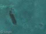
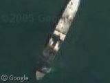
Amongst the Coral Reefs of the John Pennekamp State Park we can see an intentionally sunk 329 foot long military ship. Apparently two such ships, the Coast Guard Cutters DUANE and BIBB, were sunk here in 1987 with open hatchways and rooms for divers to freely explore. Scanning around the area I can only see this one ship - can anyone find the other?


I found this http://www.duikschooladvancedscubadiving.nl/islamorada.htm but, I don’t know how to convert the locations for google…
View Placemark
Tim, that’s the same ship as the original post!
Do boats damage the sea floor? I’ll let you decide….
View Placemark
This is to the NE of the sunken ship.
According to here. The Bibb is 135 feet of water, whereas the topo map for the area shows the Duane in shallow water. Butch posted a page with coordinates. Converting those coordingates from Degrees/Minutes to Degrees and putting them into Google Maps gives.
I’m starting to think that this ship is neither the Bibb nor the Duane, but I can’t find anything saying what else it might be :-/
my bad. Ignore my earlier post.
View Placemark
But I no longer think this is it.
This isn’t the USCG Duane, it’s the USS Spiegel Grove:
http://www.floridakeys.org/spiegelgrove.htm
But then again I think I’m wrong…
definitely not USS Spiegel Grove, taht one is more to the south maybe this will help http://www.keylargocondo.cc/pages/MapsTables/WreckMap.html and http://www.keylargocondo.com/pages/MapsTables/TableWrecks.html
the closes wreck is probably ‘Capt. Tom’s Wreck’, if you transform its location and put it in google then ist View Placemark … not exactly on the point … but scroll about 1/2 screen west and 3 screens north and its there (screens measured at 1400×1050 resolution browser) dont know about the aligning of google maps to real coordinates, it could some miles off , or maybe its just some unodcumented wreck, but looking on its size it would be hard to miss something like this 😉
even if we presume that its ‘capt. tom’s wreck’ it is still a mystery, not much information about this one except a book Histories and Mysteries: The Shipwrecks of Key Largo (http://www.bestpub.com/bookdetail.asp?BookID=1168&Category=) which links it to name Charles W. Baird, for which there isn’t much information 🙁 anyway … this book could probably solve it, or better a nice trip to Key Largo with some scuba diving 😉
so … upon checking the offset on Carysfort reef lighthouse, yi seem that google is precise, direct hit on the offical coordinates View Placemark nice place 🙂 maybe worth have an article to itself
maybe that above mentioned diving page is little off, whoul be good to get a normal diving chart 🙂
It’s not the Speigel and it’s not the Duane or Bibb. The Speigel is further south. Check this site to see wrecks in that area. http://www.divespots.com/scuba/site-key-largo/destination-spots.info Click the View Map button to see all dive sites pinpointed in the area.
I believe its tom’s wreck
this is close up pic of it
http://www.floridakeystravel.info/photo-info-13.html
… So what ship’s wreck is at View Placemark (25.209450,-80.246667) Clearly it is a wreck in there but no information about it.
George, that’s the Speigel Grove Battleship. It’s in the Google Earth Shipwreck collection:
http://bbs.keyhole.com/ubb/ubbthreads.php?ubb=showflat&Number=468469&site_id=1#import