Hawaiian Volcanoes
Monday, 20th June 2005 by Alex Turnbull
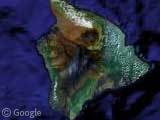
The Hawaiian Islands are at the end of a chain of volcanoes that began to form more than 70 million years ago. Each Hawaiian island is made of at least one volcano, and the island of Hawai`i, the southernmost of the Hawaiian islands, consists of five volcanoes, and is the location of the Hawaii Volcanoes National Park.
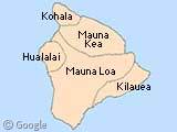
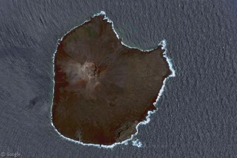
Here's a look at three of the most interesting volcanoes on the island. I didn't bother doing them all as unfortunately none of the island is in high-resolution yet 🙁
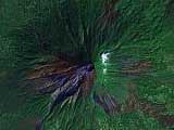
Mauna Kea is Hawaii's tallest volcano at 4,205 meters. It's so tall, that snow forms on it's upper reaches each winter (several meters deep!) and the name itself means 'White Mountain'. It hasn't erupted for around 4,500 years however.
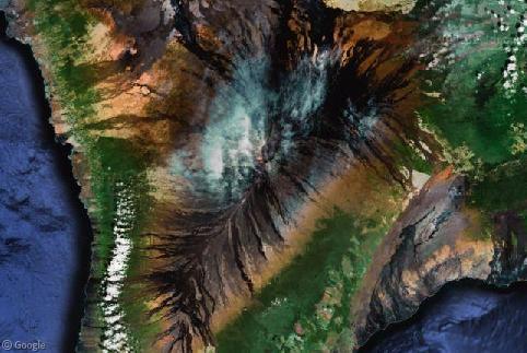
Mauna Loa is Earth's largest volcano, and fittingly it's name means 'Long Mountain'. It covers more than half of Hawai`i and accounts for 85 percent of the land-mass of all the Hawaiian islands combined. It is also considered one of the world's most active volcanoes having erupted 33 times since 1843, most recently in 1984. Mauna Loa is certain to erupt again, and is carefully monitored for signs of volcanic activity.
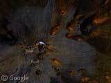
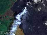
Kilauea is perhaps the most active volcano in the world, it's been erupting continually since 1983! Perhaps this is where it gets it's name, which translates to 'spewing' or 'much spreading'. Shown in our thumbnail is the cinder-and-spatter cone of Pu‘u‘Ō‘ō, which looks fantastic from up here with a plume of steam stretching southwards, and even huge areas of glowing orange lava!
There's lots more fascinating information about all volcanoes on the island available at the Hawaiian Volcano Observatory website.
Many thanks to Alex, Gayle Olson, Fernando Gilbert, Mark Hardman, Luke Gibson, neil, Dakota, SlantyOD, Layla, Keith, Adam, Kirk, Jim McKeeth, JP, RPirolli, Kyoji, Jason, Eric, Clinton Neville, Nelson, Tony Tabor, Sam, Charles Sieg and Adam Crownoble.

The island is so big, it’s also known as the “Big Island.” So big, if placed together all of the other Hawaiian islands combined can fit inside the island and still have room left.
Some are cautious that the volcano will erupt again, they’ve assigned numbers when you buy land: 1 – 10. The lower numbers mean that there’s a higher chance your property will get in the path of the lava… but people still buy land there!
Volcanoes National Park
Hawai’i aloha! I visited Kilauea twice this March — the first time, while on Chain of Craters road, I was able to see steam spewing out the ocean where the lava had entered it. I also saw patches of lava glowing on the side of the mountain. Huaka’i aloha ‘aina.
E Hawai’i aloha e…
I live about 25 miles from the Kilauea caldera. Sure wish we’d get high res! It’s a lot of fun zooming in to places I’ve hiked and backpacked, and checking out the lava flows from above. Aloha au ia Hawai’i. 🙂
i wish i could go to hawai”i someday to see the volcanes, that would be awesome! i have a question for you. do you know anyone that works with the volcanoes? my daughter needs to do an interview on that job from someone. Being a geologist because she picked her research paper on hawaiian volcanoes and the actice ones i could use some help and much appreciated too
I sure wish Google Maps would get some higher-resolution data, not just for the Big Island, but for Maui too! They just did a huge Google Earth–>Google Maps update, and still no hi-res for Hawaii. Then again, I think it’s missing from Google Earth too. How hard could it be? 🙂
I have a feeling that someone is paying to keep Hawaii low-res..
looks like napali coast on n. shore of kauai is hi res. only the coast area..