Hybrid
Friday, 22nd July 2005 by
Google have added yet more features to Google Maps :). There is now a new 'Hybrid' button on the maps interface that gives you the satellite imagery with the roads and place names overlaid. Pretty neat! Of course, as we now use the Maps API this all Just Works over on our map page.
Thanks to Ryan, Andrew, Kjfitz & Justin for spotting the change.


I think they also just added road maps in Japan and its islands.
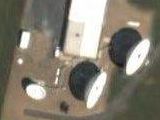
Another update is that vertical scaling is corrected. Round features are now round.
Is there any updating that Google is doing of the out-of-date low-res sattelite images to high-res? If so, is there any directory of what is updated?
Theres also an update to google earth…ver 3.0.0.395.0..cool!
Wow! This is great, makes Google maps ten times better than it was before!
Many of the roads are labelled in the wrong spot, but Google will probably fix that.
Wow.. every time I check google maps while on vacation they have added something new. Amazing!
Microsoft has just debuted an online map/aerial photo site to compete with Google Maps.
http://virtualearth.msn.com/
Their UI isn’t nearly as intuitive, and there are all sorts of little annoying features (hey, it’s Microsoft), but the aerial photos are much (MUCH) higher resolution. I can even identify the umbrella over the table in my back yard, and my father’s car parked outside his house.
MSN’s version has many areas that are grey’d out, such as military bases and such. Whereas Google doesn’t. This is half the fun, touring around areas where it’s quite illegal to do in person…..
MSN’s version also doesn’t work in Safari. Have to use Firefox.
Microsoft’s Earth deletes Apple HQ and they don’t have Canada.
Ryan: MSN’s version has many areas that are grey’d out, such as military bases and such.
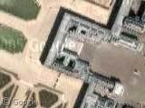
Really? Which bases are you referring to? I just pulled up high-resolution photos of the Pentagon, Andrews Air Force Base (home of Air Force One), Whiteman Air Force Base (where you can see a B-2 stealth bomber on the tarmac), and Norfolk Naval Shipyard (where you can see the USS Coral Sea before she was scrapped.
They may not have as much good-resolution coverage within the U.S., and they don’t cover anything outside the U.S., but some of their stuff is insanely hi-res (like the Pentagon).
Oh, and MSN has super-hi-res imaging of CIA headquarters in Langley, Virginia.
Microsoft hasn’t “deleted” Apple HQ, it’s just an older photo. Lots of new houses to the north of the freeway are also missing. In fact I think you can make out the vague shape of the buildings to come, almost as if the land was aleady bein cleared for building.