Winter Olympics 2006
Sunday, 12th February 2006 by James Turnbull
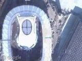
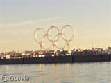
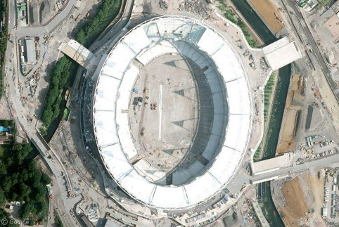
The 2006 Winter Olympics kicked off the day before yesterday in Torino, Italy and the over-the-top ceremony was held in the Olympic Stadium.
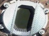
Some of the other places available for satellite spotting include the Palaghiaccio Arena (next to the Olympic Stadium, where ice hockey is played), the Athlete's Village, the Torino Esposizioni (where female hockey is played), the Speedskating Oval, the Palavela (where short track speedskating and figure skating will take place) and the Pragelato Ski Jump.
There's a few Winter Olympic Google Maps Mashups over at Google Maps Mania and the Google Blog has a KMZ file of all the Olympic locations with details of what's going on at each.
Thanks: Jayson Gabler, Patrick Gordon, Christophe Roudet, Andrea Pancotti, Daryl, Matt Witmer & Tim
You didn’t mention that the map view works in this area. Although it does mention it in the Google Maps Mania link you provided. Also, I wonder if this > View Placemark is where Fiat stores their vehicles, that I assume are made here > View Placemark This is a beautiful part of the world, even from above. and, Go Canada! 😀
And I now believe, after watching the weekend coverage on TV, that this is the large bridge that is on the cross country ski course (View Placemark) and this would then be the finish grandstands (View Placemark).
It is pretty cool that pretty much the entire course (only 3.75km long loops though) can be seen from the finish area. Makes for much better TV coverage.
And would this be the finish line to the downhill?
View Placemark
Daryl: that’s the Slalom track, the downhill arrives here View Placemark
main fiat factory, called “mirafiori”: http://www.peverada.it/mtb/percorsi/ciclopiste/foto/mirafiori1h.JPG View Placemark
also there is “Lingotto”, but just some offices, now is a shopping mall: View Placemark there is a vehicle test loop on the top
and the IVECO factory: View Placemark
interesting is the testing track: View Placemark there are four lanes, with different slopes
The “Lingotto” building with the test track on top was used as a filom location in The Italian Job, remember the Mini Cooper chase