Image updates
Sunday, 23rd April 2006 by James Turnbull
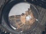
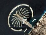
The recently announced Google Maps imagery updates are now online!
These new images once again bring Google Maps up to date with the images available in Google Earth, where the new imagery was added a couple of weeks ago. The Google Earth Blog has some details of what was added.
So, get submitting those new sights!

They have added some new strips of satellile images to England, including one that goes right from the south coast to Manchester, and just happens to go through Stonehenge! In the meantime, they have added aerial photos of Lancashire. And I noticed Tyne & Wear is also covered.
Can someone with Google Earth tell me: are these aerial photos (as opposed to satellie images) included with Google Earth?
Today I noticed much of Europe is now covered by road maps, so it should be much easier to find things!
Yeah, me too- did they just add that? It’s incredible! I wonder how long they’ve been working on it, eh?
how to find the new image of google earth? or the real image of google earth