Autumn
Wednesday, 21st February 2007 by Alex Turnbull
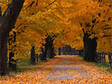
There's a nice story on Vanity Fair about how the author, Nick Tosches, spent more than a year attempting to track down the shot location of a desktop picture called Autumn that came with his copy of WIndows.
Eventually Nick managed to track the image back to the Corbis library, and in turn to the photographer, Peter Burian. With a little coaxing, Peter eventually remembered that he took the photo in the village of Kilbride, near his home in Milton, Ontario.
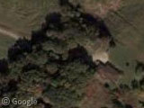
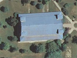
Of course once we had the address, we managed to find the exact tree-lined path and barn in a couple of minutes - thanks to Google Maps 😀
And although these particular trees are still green, there's thousands in this area that have started to turn a fantastic shade of orange!
Via Kottke.org.
What a great article that is. Pointless obsession and ultimate success — I love it!
If you want to see great autumn color with Google Map, take a look here : https://www.googlesightseeing.com/maps?p=&c=&t=k&hl=en&ll=47.083916,-70.924129&z=14
This is Mont-Sainte-Anne, a ski resort near Quebec City, Canada. They have every year in October the “Color Festival”.
Meanwhile, in the land of the Mac, the built in wallpaper Aqua:
http://desta.jp/desta/img/Aqua_blue.jpg
was easily tracked to:
View Placemark
Is this area known for its horse breeding? There seems to loads and loads of oval tracks all over the place and can only presume they are for running horses out.
https://www.googlesightseeing.com/maps?p=&c=&t=k&hl=en&ll=43.5015,-80.016603&z=14
Anyone know?
Well spotted CM.
There’s a mention in the Vanity Fair article that this is an area with lots of horses – apparently the fence visible in the wallpaper is a tell-tale sign.
They seem to be Anglophobes in these parts aswell. Along with Trafalgar and Wellington Boulevards there is a nice long, straight road named after a rotund, cigar smoking ex Prime Minister. How odd!
https://www.googlesightseeing.com/maps?p=&c=&t=k&hl=en&ll=43.685998,-79.895754&z=14
Here’s your link again CM, but I replaced the “t=k” with “t=h” making it link to hybrid mode!
https://www.googlesightseeing.com/maps?p=1317&c=122402&t=h&hl=en&ll=43.685998,-79.895754&z=14
(it’s on the list to fix the “show link” button so that it includes this preference by default)
theres clearly been lots of scots round these parts too – hamilton, north dumfries, perth east, kincardine…
Cookie monster, did you mean “Anglophiles” rather than “Anglophobes?”
Any chance of finding where the red desert XP wallpaper was taken? I mean this one.
The red desert image is pretty, but looks to be a photo montage. The two dunes portions are lit from different directions, and the transition between them looks like the good old “feather selection” trick. The moon is a telephoto shot, and the front dune, a wide angle. The color looks to be really pumped up as well.
Anyway, so it’s not a question of where it was taken, but where were all the parts taken.
Timhogs – ha ha – i think thats what is a called a Freudian slip! I think i had just been reading a story about the war in Iraq and was in a ‘phobe’ frame of mind as apposed to a ‘phile’ one! Thanks for pointing out my stupidity (not hard i might add!)
Roll on the day when the GSS boys put in an edit function!
Well it’s easy to see where one portion of the shot was taken:
http://moon.google.com/
I read the article on wednesday.. and i remember seeing the address or something like one, but now I look back to the article and it’s gone. No address there that would lead you to the coordinates above so easily. And there’s no google cache. in fact, google won’t turn up a link to the article at all anymore, when it would so readily on wednesday.
Was it modified? does anyone have a cached copy from a few days ago?
By golly Jeff you’re right – the text has indeed been edited!
I don’t have a copy of the original article, but I managed to find the location because it used to say that the lane was leading south from the “Side Road 8” – which is clearly marked on the map.
It’s a conspiracy!
Luckily, the city of Burlington has passed “A By-law to designate property known as 2270 No. 8 Side Road, in the City of Burlington, in the Regional Municipality of Halton, as a property having historical and architectural value and interest pursuant to the Ontario Heritage Act.”
http://www.burlington.ca/clerks/by-laws/html/92-2001.htm
Reasons of Designation (from the link): This original house was built in 1840 by brothers James and John Harris as a one-and-a-half storey end-gabled frame structure on 150 acres of farmland bought by them in 1834. The Harris farm was to the east of what was to become the village of Cumminsville and to the south east of what was to become the village of Kilbride. In 1848 one-half acre of this property was purchased from James Harris for the Kilbride Presbyterian cemetery. John Harris was a local magistrate for many years, and also operated a general store in the village.
A saltbox-style rear addition was built circa 1860, when the roof of the original structure may have been raised, and brick veneer was added. The three windows at the second level of the front elevation are set just below the eaves. The other windows have segmented headers with radiating brick voussoirs, which have been picked out in black paint.
The farmhouse remained in the Harris family until 1901. There is a large frame barn on the property. Now set on a two-acre lot, with scenic views of Mount Nemo and Rattlesnake Point, the house is an historic landmark on the No. 8 Side Road.
Yes, it was edited to take the actual address out of it. This is what the original sentence said:
“My best guess, based on the fence and the glimpse of an old gray barn at the end, is that it’s the lane leading south to the old Harris homestead at 2270 8th Sideroad.”
Hello 🙂 I live about 20 mins from Milton… I’ve driven down that road a few times i make my bf drive me there just to see it in the fall because its so beautiful I call it the Coverd Canopy Rd lol I didnt know that picture on windows was of the same place thou i always thought it looked familiar but didnt think it was from ontario lol Pretty neat… Althou that road isnt very nice to drive on its a little bumpy and whatnot and yes there is alot of horses out that way its more country and farms then anything.
aww crap my comment didnt work lol so i said ….
Hello everyone lol 🙂 I live about 20 mins from Milton… Im in Guelph Ont. I have driven down that road a few times my bf showed it to me its really beautiful in the fall. I always call it the Coverd Canopy Rd lol the trees totally cover the road u cant see the sky its all tree lol its beautiful.. and yes there are many horses in this area.. its mostly farm area agriculture… But yea I didnt know that the windows background was the same place i always thought it looked familiar!!! lol crazy… it is very pretty thou even thou the road isnt that nice to drive down because its not maintained that well since its a country rd 🙂 cheers everyone and thanks for the info 🙂
Hmm well i guess it did work didnt see there was 2 pages of comments…. so sorry for the double post… But does anyone know how you would back track a pic to find out where it is ?? how did the autumn one get back tracked ??
answer to pb..go to [Nick Tosches:Autumn and the plot against me: on the web:vanity fair.com.] it is a fantastic read???i spent 2 days couple weeks ago in my search.as it is autumn here in austalia i put in on my desktop,and that sent me on a journey myself.i am 81 yrs old loved what i found .thank you to Nick for his wonderful story and a TRUE ONE.i give a print out to all visitors that come ..they just love it!!! THANK YOU NICK..
Guys, the link you give above “exact tree-lined path and barn” can’t be right, the photo in Windows is of a sraight road or driveway, with an open grass area on the right behind the fence. The angles are all wrong to line up with either the house or seperate garage/barn in the link…
Put the two images side by side on your desktop if you don’t believe me.
Carl (Well done to Nick for finding the general area though!)
I think it might be this drive… https://www.googlesightseeing.com/maps?p=&c=&t=h&hl=en&ll=43.426876,-79.924534&z=18
Seeing that the Old Harris Homestead had been made a heritage site (see Mikael’s post above), I fired up the Burlington Interactive Map and activated the ‘heritage’ layer. The only place that shows up along Side Road 8 is this property: View Placemark
But in truth, I’m not entirely convinced that the photographer DID find the same spot. The fence in the winter picture taken now is completely different from the autumn one in the wallpaper…
Well, I am sure I found the right spot. In the winter photo that I took, check out the barn.
The trees and fence have changed; it’s five years later.
Trees have died, the fence is gone, etc.
Peter Burian
P.S. And I corresponded with the current owners of the property and they agree that I did find the right spot.
I love posting on old posts 🙂
I myself live in Milton, ON and never new that 🙂
To answer the question about horse breeding above, I’m not sure how much breeding goes on anymore because of the expansion imposed from the “Places to grow act” in Ontario, but there are a lot of stables in the area, and quite a few on the other side of town running down Ontario(Highway 25) south into Oakville. Funny though how I never knew that picture existed in windows until today. Guess I should pay more attention to the BGs that come with it
That autumn scene is not available in Vista, as far as I know.
btw, I was back to it in early November and it looked very nice this year.
Anyone who wants a small JPEG of the scene – as it looked this year – just send me a note : pkburian at gmail com