Planes in Formation?
Tuesday, 13th March 2007 by Alex Turnbull
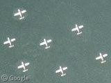
Initially we thought this was possibly the coolest find ever, but sadly this is not 9 small planes flying in formation over Denmark. No, even better than that, when you look closer it becomes obvious that someone has taken a single plane, and has been cloning it in Photoshop!
This is of course a complete scandal... I mean, it's all very well blurring out Government buildings, which is just hiding the truth... but this? This is out and out fantasy! Where will it all end? (Probably Alien Civilizations and UFOs no doubt...)
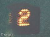
The company that provides this particular aerial image is called Scankort, but as yet we've been unable to prove whether the image was manipulated by them, or by Google themselves. However, there is one other possibility... No, I'm not talking about aliens, I'm talking about BBC 2!
They get everywhere those little 2s...
Via gearthhacks and virtualglobetrotting.
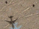
Haha classic! Everyone digg it! :p
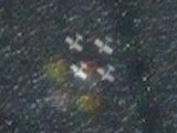
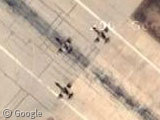
For what appears to be a real group of planes in formation, check out this location off the coast of Normandy, France. A historical remake of D-Day, maybe?
WHat is the deal with the #2? And Beb what are YOU talking about? Your link is the same as the OP.
W i C ke d
Beb meant here I think, and the giant 2 is most likely a leftover remnant of the film used to take these photos, as also seen in our Giant Alien Writing post.
Thanks, Alex, I had noticed my mistake but only after I had posted my response. The pb was that I navigated from within the original GSS view to where I remembered seeing those 4 planes and then pasted the link (which hadn’t changed) from the address bar. I’ll be more careful next time. I thought I would be given a chance to preview the post like on the GE Community. Is it something that can be done?
It makes you wonder how much more cloning goes on doesnt it? I wonder if the good people at Google have a filing cabinet with drawers marked “Generic Village”, “Suburban Sprawl” , “Featureless Desert”, “Sea” etc etc and if they want to save a bit of money they just pull something from file and drop it in hoping no one will notice. I like to think they also have a locked drawer marked “GSS” which is full of interesting stuff that they just clone in for our benefit!
I expect this is a actually a form of copy protection. Some maps have fake streets, some encyclopedias have fake biographies, etc. Satellite imagery needs to be similarly watermarked, and this is a dead simple way of doing it.
I hope that’s why, because that’s a bloody horrible photshop job.
i agree with phillip, a bloody beginners work 🙂 but a nice sight.
And there they were gone!
Hmm… they seem to have fixed it now, supposedly.
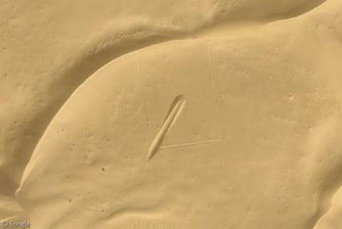
Now, instead of 7 planes, there is just one, and an odd, off-colour rectangle around it, which is clearly copied from around 900m south and 45m east of it (except for the plane peculiarly). A texture seems to have been overlayed on the lower one, and it is of worse quality, but when you look at the individual glimmers of the sun’s reflection in the water you can see that they match up perfectly.
Clicky
Although, actually, when you zoom out, it becomes clear that pretty much all of that sea water fake anyway.
Well who does that and how do they get away with it? I thought Google would provide all info “as-is” without any doctoring whatsoever. That makes me mad.
What about Greenland? From the whole earth view, it looks like the whole middle part has been photoshopped. Can someone explain that?
Hey, they’re not there anymore. Looks like GSS’s expose on Danish aerial coverups worked!