Hurricane Katrina and New Orleans – 5 Years Later
Tuesday, 14th September 2010 by Chris Hannigan
On August 29th 2005, Hurricane Katrina ripped through Louisiana and Mississippi en route to becoming the deadliest US hurricane since 1928. It's been five years since the disaster, but looking through Google's satellite and Street View services it's clear the scars remain deep in the region.
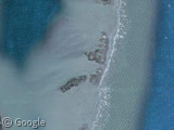
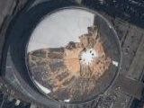
Hurricane Katrina made landfall from the Gulf of Mexico, crossing and nearly obliterating the Chandeleur Islands as it surged water towards Lake Pontchartrain. The US Geological Survey estimated that 217 square miles (560 km2) of the islands eroded away into the sea during the hurricane season of 2005. Today, Chandeluer is said to only be a few years away from eroding completely, and its easy to see there is not much left by looking at Google's most recent imagery.
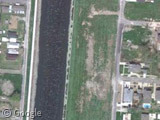
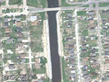
Satellite views show some new construction where the levees breached of many of New Orleans canals. Here we can see the new wall on the 17th ST Canal and the London Ave Canal. Both sites were determined to have collapsed below their design thresholds leading in part to the massive flooding within the city.
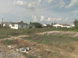
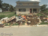
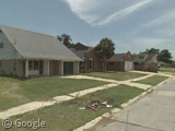
Switching down to Street View it’s easy to see that the effects of Katrina are still clearly very visible. Keep in mind it's hard to put an exact date for when the street view car visited New Orleans, but my best estimates narrow it down to late 2007/early 2008, so that would put these images somewhere between 2 and 3 years after the hurricane.
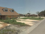
It's quite humbling because you can really just drop the "Google Pegman" anywhere in the heart of New Orleans and see Katrina's devastation. Some sites have been levelled to empty lots, and others appear to have remained untouched and have been reclaimed by nature.

A sharp contrast can be seen between places where trash and debris are still lining the streets, and other sites that look to have fully recovered with new construction and homes.
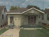
Many homes remain abandoned with the spray-painted "X sign" that emergency workers put after checking the property. The number on the bottom of the X indicated how many bodies were found inside the house. Fortunately, this home reads zero.
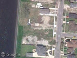
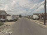
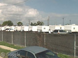
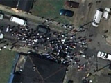
When Google visited New Orleans, many homeowners were still living in FEMA trailers that can be seen lining the streets. Some were fortunate enough to remain on their property, while others were moved to "trailer parks" scattered throughout the city.
It will be interesting to compare these images with Google's next Street View update of New Orleans. When that happens, we will revisit some of these sites and see the progress of rebuilding this city.
For more information, check out Wikipedia's article on Hurricane Katrina as well as GSS's previous visits to the city.
About the author
Chris is on twitter! @djtripp20

My blog, the Twelve Mile Circle, usually deals with geography topics. Recently however I posted some of our family memories and photos of Katrina along the Mississippi Gulf Coast. There is still plenty of evidence of the disaster even with the passage of time.
http://www.howderfamily.com/blog/?p=5761
The ‘trailer parks’ in New Orleans are gone. The one depicted here is back to being an open space. Both Orleans and Jefferson Parishes have leaned hard on trailer owners, and most have been removed.